How to get to Ritchie Street by bus?
Click on the bus route to see step by step directions with maps, line arrival times and updated time schedules.
From VR Chennai, Perambur Purasavakam
47 minFrom Sri Ramachandra Convention Center in Thiruvanmiyur, Mylapore Tiruvallikk
50 minFrom A. C. S. Medical College & Hospital, Saidapet
50 minFrom Meenakshi College Of Engineering, Egmore Nungabakkam
48 minFrom Stella Matutina College of Education, Egmore Nungabakkam
47 minFrom Dr. Irene Williams (dermico Skin Clinic) in Mogappair, Saidapet
52 minFrom HCL Technologies, AMB-6, Saidapet
52 minFrom Le Royal Méridien Chennai (LE ROYAL MERIDIEN-GST ROAD), Mambalam Gundy
42 minFrom Shankar IAS Academy, Egmore Nungabakkam
45 min
How to get to Ritchie Street by train?
Click on the train route to see step by step directions with maps, line arrival times and updated time schedules.
How to get to Ritchie Street by metro?
Click on the metro route to see step by step directions with maps, line arrival times and updated time schedules.
Bus stops near Ritchie Street in Fort Tondiarpet
Train stations near Ritchie Street in Fort Tondiarpet
Metro station near Ritchie Street in Fort Tondiarpet
- LIC, 13 min walk,VIEW
Bus lines to Ritchie Street in Fort Tondiarpet
- 1, Thiruvotriyur ⬌ Thiruvanmiyur,VIEW
- 1, Thiruvanmiyur Depot - Central R.S. (M.G.R.Central),VIEW
- 21, Broadway - Mandaveli,VIEW
- 51, Velachery - Tambaram West,VIEW
- 54, Broadway - Poonamallee,VIEW
- 221, CENTRAL R.S.(M.G.R.CENTRAL) - THIRUPORUR VIA KELAMBAKKAM,VIEW
- 3A, Broadway - Mandaveli,VIEW
- A18, Vandalur Zoo - High court,VIEW
- 155A, Thirumudivakkam - Broadway,VIEW
- A51 DLX, Tambaram East - High court,VIEW
- 18A HR, BROADWAY - TAMBARAM,VIEW
- AC-E18, Broadway - Guduvanchery,VIEW
- A1ET, Central R.S. (M.G.R.Central) - Okkiyam Thoraipakkam Sector Colony,VIEW
- 1B, Thiruvotriyur - Tambaram,VIEW
- 18B, BROADWAY - KOTTURPURAM,VIEW
- 21C, M.G.R Central - Kannagi Nagar S.C.Board,VIEW
- 88C, Broadway - Thandalam Village,VIEW
- 88C, Broadway - Kundrathur,VIEW
- 188C, Broadway - Kundrathur,VIEW
- 221CT, BROADWAY - PERUMPAKKAM S.C.B.,VIEW
What are the closest stations to Ritchie Street?
The closest stations to Ritchie Street are:
- Shanthi Theatre is 334 meters away, 5 min walk.
- Simson is 360 meters away, 5 min walk.
- Triplicane Police Station is 379 meters away, 5 min walk.
- Simpsons / Periyar Bridge is 485 meters away, 7 min walk.
- Mount Road Post Office is 543 meters away, 7 min walk.
- Mount Road, 826 is 571 meters away, 8 min walk.
- Chintadripet is 591 meters away, 8 min walk.
- Chennai Park Railway Station is 922 meters away, 12 min walk.
- LIC is 970 meters away, 13 min walk.
Which bus lines stop near Ritchie Street?
These bus lines stop near Ritchie Street: 1, 11G, 23C#, 26, 27B, 54, T29.
Which train line stops near Ritchie Street?
MRTS-1 (Chennai Beach)
Which metro line stops near Ritchie Street?
BLUE LINE (Alandur)
What’s the nearest metro station to Ritchie Street in Fort Tondiarpet?
The nearest metro station to Ritchie Street in Fort Tondiarpet is LIC. It’s a 13 min walk away.
What’s the nearest train station to Ritchie Street in Fort Tondiarpet?
The nearest train station to Ritchie Street in Fort Tondiarpet is Chintadripet. It’s a 8 min walk away.
What’s the nearest bus station to Ritchie Street in Fort Tondiarpet?
The nearest bus stations to Ritchie Street in Fort Tondiarpet are Shanthi Theatre, Simson and Triplicane Police Station. The closest one is a 5 min walk away.
What time is the first metro to Ritchie Street in Fort Tondiarpet?
The BLUE LINE is the first metro that goes to Ritchie Street in Fort Tondiarpet. It stops nearby at 5:39 AM.
What time is the last metro to Ritchie Street in Fort Tondiarpet?
The BLUE LINE is the last metro that goes to Ritchie Street in Fort Tondiarpet. It stops nearby at 11:55 PM.
What time is the first train to Ritchie Street in Fort Tondiarpet?
The EMU is the first train that goes to Ritchie Street in Fort Tondiarpet. It stops nearby at 4:03 AM.
What time is the last train to Ritchie Street in Fort Tondiarpet?
The EMU is the last train that goes to Ritchie Street in Fort Tondiarpet. It stops nearby at 12:50 AM.
What time is the first bus to Ritchie Street in Fort Tondiarpet?
The 27B is the first bus that goes to Ritchie Street in Fort Tondiarpet. It stops nearby at 3:00 AM.
What time is the last bus to Ritchie Street in Fort Tondiarpet?
The 21 is the last bus that goes to Ritchie Street in Fort Tondiarpet. It stops nearby at 3:18 AM.
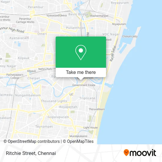
See Ritchie Street, Fort Tondiarpet, on the map
Public Transit to Ritchie Street in Fort Tondiarpet
Wondering how to get to Ritchie Street in Fort Tondiarpet? Moovit helps you find the best way to get to Ritchie Street with step-by-step directions from the nearest public transit station.
Moovit provides free maps and live directions to help you navigate through your city. View schedules, routes, timetables, and find out how long does it take to get to Ritchie Street in real time.
Looking for the nearest stop or station to Ritchie Street? Check out this list of stops closest to your destination: Shanthi Theatre; Simson; Triplicane Police Station; Simpsons / Periyar Bridge; Mount Road Post Office; Mount Road; Chintadripet; Chennai Park Railway Station; LIC.
Bus: 1, 11G, 23C#, 26, 27B, 54, T29, 21, 51, 11, 22, 60, 254, 2A, 2A, S96.Train: MRTS-1, EMU, MRTS-2, EMU, EMU, EMU, EMU, MEMU.Metro: BLUE LINE.
Want to see if there’s another route that gets you there at an earlier time? Moovit helps you find alternative routes or times. Get directions from and directions to Ritchie Street easily from the Moovit App or Website.
We make riding to Ritchie Street easy, which is why over 1.5 million users, including users in Fort Tondiarpet, trust Moovit as the best app for public transit. You don’t need to download an individual bus app or train app, Moovit is your all-in-one transit app that helps you find the best bus time or train time available.
For information on prices of bus, metro and train, costs and ride fares to Ritchie Street, please check the Moovit app.
Use the app to navigate to popular places including to the airport, hospital, stadium, grocery store, mall, coffee shop, school, college, and university.
Ritchie Street Address: Chennai 600002 TN street in Fort Tondiarpet
- Chintadripet,
- Nexus Communications,
- Don Bosco Primary School Vellore,
- Bagoda Jalore Rajasthan,
- Richie Street (Chennai),
- Mobile Accessories, Mount Road,
- Government Estate Metro Station,
- Chennai Flea Market,
- The LOTUS Hotel Sameera,
- Chennai Woodlands,
- The Hindu Kasturi Building,
- No. 9, Athipattan Street, Mount Road Chintadripet,
- The Hindu (Hindu Office),
- Annamalai Dr R N in Mount Road,
- P. Orr & Sons,
- Madras Gun House,
- Tamil Nadu,
- No. 9, City Centre plaza, Mount Road, Anna Salai Anna Salai,
- Multi Speciality Hospital-ER,
- Casino
Places Near Ritchie Street (Fort Tondiarpet)
- Singaperumal Koil - Sriperumbudur Road, Sriperumbudur,
- Marina Beach,
- Phoenix Market City (Phoenix Marketcity Mall), Mambalam Gundy,
- Omandurar Multi-Speciality Hospital-ER, Fort Tondiarpet,
- Marina Beach,
- Kapaleeswarar Temple, Mylapore Tiruvallikk,
- Phoenix Mall, Mambalam Gundy,
- The Marina Mall, Chengalpattu,
- Kotturpuram Anna University bus (Anna Centenary Library Bus Stop), Mylapore Tiruvallikk,
- ECR Beach,
- Mamallapuram, Chengalpattu,
- Siruvapuri Bala Murugan Temple, Ponneri,
- Thiruporur, Chengalpattu,
- Nithya Kalyana Perumal Koil - Thiruvidanthai, Chengalpattu,
- Cognizant Kits Campus- CKC, Sholinganallur,Chennai, Chengalpattu,
- Kovilambakkam, Chengalpattu,
- Thiruvalidhayam, Padi Sivan Temple- Guru Stalam, Perambur Purasavakam,
- Saravana Stores (Saravana Stores the Legend Padi), Perambur Purasavakam,
- Kapaleeshwarar Temple, Mylapore Tiruvallikk,
- Kovalam Beach
How to get to popular places in Chennai with public transit
Get around Fort Tondiarpet by public transit!
Traveling around Fort Tondiarpet has never been so easy. See step by step directions as you travel to any attraction, street or major public transit station. View bus and train schedules, arrival times, service alerts and detailed routes on a map, so you know exactly how to get to anywhere in Fort Tondiarpet.
When traveling to any destination around Fort Tondiarpet use Moovit's Live Directions with Get Off Notifications to know exactly where and how far to walk, how long to wait for your line, and how many stops are left. Moovit will alert you when it's time to get off — no need to constantly re-check whether yours is the next stop.
Wondering how to use public transit in Fort Tondiarpet or how to pay for public transit in Fort Tondiarpet? Moovit public transit app can help you navigate your way with public transit easily, and at minimum cost. It includes public transit fees, ticket prices, and costs. Looking for a map of Fort Tondiarpet public transit lines? Moovit public transit app shows all public transit maps in Fort Tondiarpet with all Bus, Train and Metro routes and stops on an interactive map.
Chennai has 3 transit type(s), including: Bus, Train and Metro, operated by several transit agencies, including Chennai Metro Rail Limited (CMRL), CMRL Metro Feeder Buses, MTC (Metropolitan Transport Corporation), MTC Small Bus Service, MTC Deluxe Service, MTC Express Service, MTC A/C Service, Chennai Local Trains (Southern Railways), MTC Bus Inactive bus lines and MRTS Rail Chennai