Directions to Rite Aid (Hartford) with public transportation
The following transit lines have routes that pass near Rite Aid
 Bus: 54, 56, 76, FLIXBUS 2610, GREYHOUND US0230.
- Train: AMTRAK HARTFORD LINE, HARTFORD LINE, VALLEY FLYER, VERMONTER, NORTHEAST REGIONAL.
How to get to Rite Aid by bus?
Click on the bus route to see step by step directions with maps, line arrival times and updated time schedules.
How to get to Rite Aid by train?
Click on the train route to see step by step directions with maps, line arrival times and updated time schedules.
Bus stops near Rite Aid in Hartford
Train station near Rite Aid in Hartford
- Hartford Union Station, 27 min walk,VIEW
Bus lines to Rite Aid in Hartford
- 56, 56f - Bloomfield Ave-Bloomfield Ctr-Federation Home,VIEW
- 58, 58 - Albany Av-Bishops Corner,VIEW
- 74, 74 - Granby St-St Francis Hosp-Copaco-Wedgewood Dr,VIEW
- 50, 50a - Blue Hills Ave-Copaco-Cigna,VIEW
- 52, 52w - Blue Hills Ave-Wedgewood Dr,VIEW
- 54, 54 - Blue Hills Av-Blue Hills Ext-Amazon,VIEW
- 76, 76 - Ashley St-Downtown Hartford,VIEW
What are the closest stations to Rite Aid?
The closest stations to Rite Aid are:
- Albany Ave @ Kent St is 65 yards away, 1 min walk.
- Albany Ave @ Woodland St is 209 yards away, 3 min walk.
- Homestead Ave @ Woodland Sr is 359 yards away, 5 min walk.
- Hartford Union Station is 2234 yards away, 27 min walk.
Which bus lines stop near Rite Aid?
These bus lines stop near Rite Aid: 54, 56, 76, FLIXBUS 2610, GREYHOUND US0230, GREYHOUND US0235, GREYHOUND US0255S.
Which train lines stop near Rite Aid?
These train lines stop near Rite Aid: AMTRAK HARTFORD LINE, HARTFORD LINE, VALLEY FLYER, VERMONTER.
What’s the nearest train station to Rite Aid in Hartford?
The nearest train station to Rite Aid in Hartford is Hartford Union Station. It’s a 27 min walk away.
What’s the nearest bus station to Rite Aid in Hartford?
The nearest bus station to Rite Aid in Hartford is Albany Ave @ Kent St. It’s a 1 min walk away.
What time is the first train to Rite Aid in Hartford?
The NORTHEAST REGIONAL is the first train that goes to Rite Aid in Hartford. It stops nearby at 4:51 AM.
What time is the last train to Rite Aid in Hartford?
The NORTHEAST REGIONAL is the last train that goes to Rite Aid in Hartford. It stops nearby at 11:59 PM.
What time is the first bus to Rite Aid in Hartford?
The 54 is the first bus that goes to Rite Aid in Hartford. It stops nearby at 4:28 AM.
What time is the last bus to Rite Aid in Hartford?
The 50 is the last bus that goes to Rite Aid in Hartford. It stops nearby at 1:30 AM.
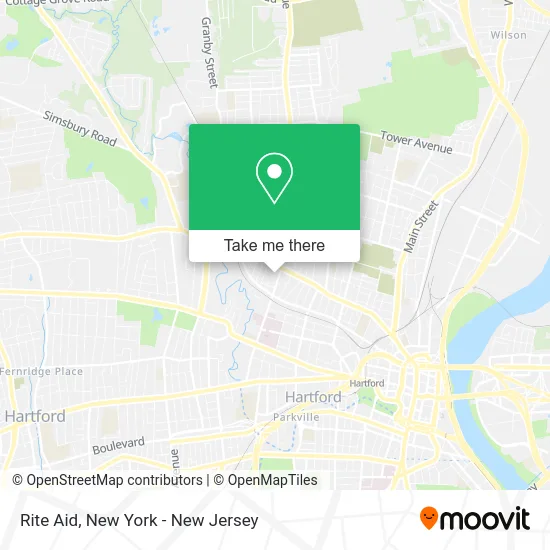
See Rite Aid, Hartford, on the map
Public Transit to Rite Aid in Hartford
Wondering how to get to Rite Aid in Hartford? Moovit helps you find the best way to get to Rite Aid with step-by-step directions from the nearest public transit station.
Moovit provides free maps and live directions to help you navigate through your city. View schedules, routes, timetables, and find out how long does it take to get to Rite Aid in real time.
Looking for the nearest stop or station to Rite Aid? Check out this list of stops closest to your destination: Albany Ave @ Kent St; Albany Ave @ Woodland St; Homestead Ave @ Woodland Sr; Hartford Union Station.
Bus: 54, 56, 76, FLIXBUS 2610, GREYHOUND US0230, GREYHOUND US0235, GREYHOUND US0255S, 58, 74, 50, 52.Train: AMTRAK HARTFORD LINE, HARTFORD LINE, VALLEY FLYER, VERMONTER, NORTHEAST REGIONAL.
Want to see if there’s another route that gets you there at an earlier time? Moovit helps you find alternative routes or times. Get directions from and directions to Rite Aid easily from the Moovit App or Website.
We make riding to Rite Aid easy, which is why over 1.5 million users, including users in Hartford, trust Moovit as the best app for public transit. You don’t need to download an individual bus app or train app, Moovit is your all-in-one transit app that helps you find the best bus time or train time available.
For information on prices of train and bus, costs and ride fares to Rite Aid, please check the Moovit app.
Use the app to navigate to popular places including to the airport, hospital, stadium, grocery store, mall, coffee shop, school, college, and university.
Rite Aid Address: 1291 Albany Ave Hartford, CT 06112 street in Hartford
- Connecticut State Check Cashing,
- Walgreens Pharmacy,
- Jahm Ske's,
- Total Wireless,
- Libertyx Bitcoin Atm,
- Post Office Blue Hills,
- United States Postal Service,
- Blue Hills,
- Ridium Commercial Funding,
- Us Post Office,
- Tizeda Spices Llc,
- Walgreens #18969,
- Total Wireless,
- Legacy Foundation Of Hartford,
- The Life Changer Center,
- Jtjohnsonlaw,
- Access Healthcare,
- Kings Musalla Church of God,
- Greater Hartford Harm Reduction Coalition,
- Blue Hills Civic Association
Places Near Rite Aid (Hartford)
- Wall Street, Manhattan,
- Bellevue Hospital, Manhattan,
- Queens Center Mall, Queens,
- 111 Centre New York City Supreme Court, Manhattan,
- Chinatown, Manhattan,
- 3 Stone St, Manhattan,
- 26 Federal Plaza, Manhattan,
- 1 Police Plaza, Manhattan,
- 911 Memorial, Manhattan,
- Katz's Deli, Manhattan,
- Times Square, Manhattan,
- Pier 83, Manhattan,
- Rockefeller Center, Manhattan,
- 66 John Street, Manhattan,
- Hudson Yards, Manhattan,
- qqqq, Manhattan,
- Mountainside Hospital, Glen Ridge,
- SoHo, Manhattan,
- 376 Hudson Street, Manhattan,
- San Gennaro Feast, Manhattan
How to get to popular places in New York - New Jersey with public transit
Get around Hartford by public transit!
Traveling around Hartford has never been so easy. See step by step directions as you travel to any attraction, street or major public transit station. View bus and train schedules, arrival times, service alerts and detailed routes on a map, so you know exactly how to get to anywhere in Hartford.
When traveling to any destination around Hartford use Moovit's Live Directions with Get Off Notifications to know exactly where and how far to walk, how long to wait for your line, and how many stops are left. Moovit will alert you when it's time to get off — no need to constantly re-check whether yours is the next stop.
Wondering how to use public transit in Hartford or how to pay for public transit in Hartford? Moovit public transit app can help you navigate your way with public transit easily, and at minimum cost. It includes public transit fees, ticket prices, and costs. Looking for a map of Hartford public transit lines? Moovit public transit app shows all public transit maps in Hartford with all Bus, Train, Subway, Light Rail, Ferry and Cable Car routes and stops on an interactive map.
New York - New Jersey has 6 transit type(s), including: Bus, Train, Subway, Light Rail, Ferry and Cable Car, operated by several transit agencies, including MTA Subway, Metro-North Railroad, LIRR, PATH, MTA New York City Transit - Express routes, MTA Bus, NJ Transit, NYC Ferry, NICE bus, Bee-Line Bus, NJ Transit Rail, Norwalk Transit District, Hartford Line, River Valley Transit and HART