How to get to Ritsi-Drew Caters 4 U by bus?
Click on the bus route to see step by step directions with maps, line arrival times and updated time schedules.
From Bayonne, NJ, Bayonne
34 minFrom Staten Island, NY, Staten Island
46 minFrom Staten Island Mall, Staten Island
42 minFrom NJ 440, Jersey City
72 minFrom Prudential Center, Newark
159 minFrom Immigration Court-Newark, Newark
170 minFrom Hudson Mall, Jersey City
85 minFrom HUUHHHH??, Woodbridge
166 minFrom IKEA Elizabeth Shuttle Bus To Manhattan, Elizabeth
146 min
Bus stops near Ritsi-Drew Caters 4 U in Staten Island
Bus lines to Ritsi-Drew Caters 4 U in Staten Island
- S46, West Shore Plz Via Castleton,VIEW
- S96, Limited St George Via Castleton,VIEW
- S48, St George Ferry Via Forest,VIEW
- S98, Limited St George Via Forest,VIEW
- SIM33, Mariners Harbor Via N Gannon Av,VIEW
- SIM33C, Mariners Harbor Via N Gannon Av,VIEW
- SIM34, Mariners Harbor Via Watchogue Rd,VIEW
- S40, St George Ferry Via Richmond Terr,VIEW
- S90, Limited St George Ferry Via Rchmond Terr,VIEW
What are the closest stations to Ritsi-Drew Caters 4 U?
The closest stations to Ritsi-Drew Caters 4 U are:
- Brabant St/Lockman Av is 294 yards away, 4 min walk.
- Forest Av/Harbor Rd is 573 yards away, 7 min walk.
- South Av/Brabant St is 783 yards away, 10 min walk.
Which bus lines stop near Ritsi-Drew Caters 4 U?
These bus lines stop near Ritsi-Drew Caters 4 U: S46, S89, SIM33C.
What’s the nearest bus station to Ritsi-Drew Caters 4 U in Staten Island?
The nearest bus station to Ritsi-Drew Caters 4 U in Staten Island is Brabant St/Lockman Av. It’s a 4 min walk away.
What time is the first bus to Ritsi-Drew Caters 4 U in Staten Island?
The S48 is the first bus that goes to Ritsi-Drew Caters 4 U in Staten Island. It stops nearby at 3:17 AM.
What time is the last bus to Ritsi-Drew Caters 4 U in Staten Island?
The S40 is the last bus that goes to Ritsi-Drew Caters 4 U in Staten Island. It stops nearby at 2:58 AM.
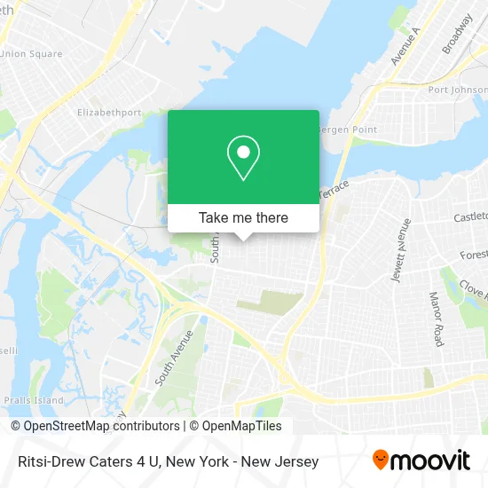
See Ritsi-Drew Caters 4 U, Staten Island, on the map
Public Transit to Ritsi-Drew Caters 4 U in Staten Island
Wondering how to get to Ritsi-Drew Caters 4 U in Staten Island? Moovit helps you find the best way to get to Ritsi-Drew Caters 4 U with step-by-step directions from the nearest public transit station.
Moovit provides free maps and live directions to help you navigate through your city. View schedules, routes, timetables, and find out how long does it take to get to Ritsi-Drew Caters 4 U in real time.
Looking for the nearest stop or station to Ritsi-Drew Caters 4 U? Check out this list of stops closest to your destination: Brabant St/Lockman Av; Forest Av/Harbor Rd; South Av/Brabant St.
Bus: S46, S89, SIM33C, S96, S48, S98, SIM33, SIM34, S40, S90.
Want to see if there’s another route that gets you there at an earlier time? Moovit helps you find alternative routes or times. Get directions from and directions to Ritsi-Drew Caters 4 U easily from the Moovit App or Website.
We make riding to Ritsi-Drew Caters 4 U easy, which is why over 1.5 million users, including users in Staten Island, trust Moovit as the best app for public transit. You don’t need to download an individual bus app or train app, Moovit is your all-in-one transit app that helps you find the best bus time or train time available.
For information on prices of bus, train, subway and light rail, costs and ride fares to Ritsi-Drew Caters 4 U, please check the Moovit app.
Use the app to navigate to popular places including to the airport, hospital, stadium, grocery store, mall, coffee shop, school, college, and university.
Ritsi-Drew Caters 4 U Address: 21 Destiny Ct street in Staten Island
- H&R Block,
- Amazon Locker - Wilsonblvd,
- The Parish Of St. Clement & St. Michael - Mariners Harbor, Staten Island,
- Amazon Locker - Weasel,
- Amazon Locker - Samaher,
- Amazon Locker-Drever,
- Fernandez & Fernandez Deli Grocery,
- Amazon Locker - Amy,
- Amazon Locker - Saigin,
- Amazon Locker-Glastonbury,
- Amazon Locker-Partridge,
- God All Mighty,
- Amazon Locker - Masroor,
- Moove Lubricants,
- Amazon Locker-Carpeting,
- Amazon Locker-Ewing,
- Amazon Locker-Apparatus,
- Elegant Concepts Salon,
- God's Little Angels by Faith,
- Amazon Locker-Chambersbay
Places Near Ritsi-Drew Caters 4 U (Staten Island)
- Mountainside Hospital, Glen Ridge,
- 66 John Street, Manhattan,
- Pier 83, Manhattan,
- Times Square, Manhattan,
- 376 Hudson Street, Manhattan,
- Rockefeller Center, Manhattan,
- Queens Center Mall, Queens,
- San Gennaro Feast, Manhattan,
- SoHo, Manhattan,
- qqqq, Manhattan,
- Katz's Deli, Manhattan,
- Bellevue Hospital, Manhattan,
- 26 Federal Plaza, Manhattan,
- Wall Street, Manhattan,
- 111 Centre New York City Supreme Court, Manhattan,
- 911 Memorial, Manhattan,
- Chinatown, Manhattan,
- 1 Police Plaza, Manhattan,
- 3 Stone St, Manhattan,
- Hudson Yards, Manhattan
How to get to popular places in New York - New Jersey with public transit
Get around Staten Island by public transit!
Traveling around Staten Island has never been so easy. See step by step directions as you travel to any attraction, street or major public transit station. View bus and train schedules, arrival times, service alerts and detailed routes on a map, so you know exactly how to get to anywhere in Staten Island.
When traveling to any destination around Staten Island use Moovit's Live Directions with Get Off Notifications to know exactly where and how far to walk, how long to wait for your line, and how many stops are left. Moovit will alert you when it's time to get off — no need to constantly re-check whether yours is the next stop.
Wondering how to use public transit in Staten Island or how to pay for public transit in Staten Island? Moovit public transit app can help you navigate your way with public transit easily, and at minimum cost. It includes public transit fees, ticket prices, and costs. Looking for a map of Staten Island public transit lines? Moovit public transit app shows all public transit maps in Staten Island with all Bus, Train, Subway, Light Rail, Ferry and Cable Car routes and stops on an interactive map.
New York - New Jersey has 6 transit type(s), including: Bus, Train, Subway, Light Rail, Ferry and Cable Car, operated by several transit agencies, including MTA Subway, Metro-North Railroad, LIRR, PATH, MTA New York City Transit - Express routes, MTA Bus, NJ Transit, NYC Ferry, NICE bus, Bee-Line Bus, NJ Transit Rail, Norwalk Transit District, Hartford Line, River Valley Transit and HART