How to get to Ritter by bus?
Click on the bus route to see step by step directions with maps, line arrival times and updated time schedules.
How to get to Ritter by train?
Click on the train route to see step by step directions with maps, line arrival times and updated time schedules.
From Epplesee, Rheinstetten
39 minFrom Waldbronn Eistreff, Waldbronn
84 minFrom Karlsruher Straße, Pforzheim
103 minFrom Hopfenschlingel, Vereinbarte Verwaltungsgemeinschaft Rastatt
66 minFrom Schloss Neuenbürg, Verwaltungsgemeinschaft Neuenbürg
103 minFrom POCO Einrichtungsmärkte, Pforzheim
104 minFrom Rkh Kliniken, Verwaltungsgemeinschaft Bretten
67 min
Bus stops near Ritter in Stuttgart
Light Rail stations near Ritter in Stuttgart
- Karlsruhe Entenfang, 4 min walk,VIEW
Train stations near Ritter in Stuttgart
- Karlsruhe Entenfang, 5 min walk,VIEW
Bus lines to Ritter in Stuttgart
- 70, Karlsruhe Heidehof - Karlsruhe Entenfang Bstg A,VIEW
- ALT70, Karlsruhe Heidehof Bstg A - Karlsruhe Entenfang Bstg A,VIEW
- NL17, Karlsruhe Entenfang Bstg B - Karlsruhe Entenfang Bstg B,VIEW
- 60, Karlsruhe Entenfang Bstg A - Karlsruhe Staufenbergweg Bstg A,VIEW
- 62, Karlsruhe Hauptbahnhof (Vorplatz) Bstg B - Karlsruhe Entenfang Bstg E,VIEW
- NL15, Karlsruhe Entenfang Bstg B - Karlsruhe Entenfang Bstg B,VIEW
- 60, Karlsruhe Entenfang - Karlsruhe Staufenbergweg,VIEW
- 62, Karlsruhe Entenfang - KA Hauptbahnhof (Vorplatz),VIEW
- NL15, Karlsruhe Entenfang - Karlsruhe Entenfang,VIEW
- 70, Karlsruhe Heidehof,VIEW
- ALT70, Karlsruhe Entenfang,VIEW
- SEV 14, Karlsruhe Entenfang,VIEW
- SEV 15, Knielingen Rheinbergstraße,VIEW
- 222, Rastatt Bahnhof - Karlsruhe Entenfang,VIEW
- ALT62, Karlsruhe St. Josef Kirche - KA Hauptbahnhof (Vorplatz),VIEW
- ALT64, Karlsruhe Rheinhafen Nord - Karlsruhe Entenfang,VIEW
- NL16, Karlsruhe Stadtwerke - Karlsruhe Entenfang,VIEW
- NL17, Karlsruhe Entenfang - Karlsruhe Entenfang,VIEW
What are the closest stations to Ritter?
The closest stations to Ritter are:
- Karlsruhe Kärcherstraße Bstg A is 218 meters away, 3 min walk.
- Karlsruhe Vogesenbrücke Bstg A is 268 meters away, 4 min walk.
- Karlsruhe Vogesenbrücke is 268 meters away, 4 min walk.
- Karlsruhe Entenfang is 290 meters away, 4 min walk.
Which train lines stop near Ritter?
These train lines stop near Ritter: S12, S2, S53.
Which light rail lines stop near Ritter?
These light rail lines stop near Ritter: 3, S2, S5, S51.
Which bus lines stop near Ritter?
These bus lines stop near Ritter: 222, 62, 70.
What’s the nearest light rail station to Ritter in Stuttgart?
The nearest light rail station to Ritter in Stuttgart is Karlsruhe Entenfang. It’s a 4 min walk away.
What’s the nearest train station to Ritter in Stuttgart?
The nearest train station to Ritter in Stuttgart is Karlsruhe Entenfang. It’s a 5 min walk away.
What’s the nearest bus station to Ritter in Stuttgart?
The nearest bus station to Ritter in Stuttgart is Karlsruhe Kärcherstraße Bstg A. It’s a 3 min walk away.
What time is the first light rail to Ritter in Stuttgart?
The E is the first light rail that goes to Ritter in Stuttgart. It stops nearby at 3:38 AM.
What time is the last light rail to Ritter in Stuttgart?
The E is the last light rail that goes to Ritter in Stuttgart. It stops nearby at 2:12 AM.
What time is the first train to Ritter in Stuttgart?
The S5 is the first train that goes to Ritter in Stuttgart. It stops nearby at 3:56 AM.
What time is the last train to Ritter in Stuttgart?
The S5 is the last train that goes to Ritter in Stuttgart. It stops nearby at 1:06 AM.
What time is the first bus to Ritter in Stuttgart?
The ALT70 is the first bus that goes to Ritter in Stuttgart. It stops nearby at 4:10 AM.
What time is the last bus to Ritter in Stuttgart?
The 70 is the last bus that goes to Ritter in Stuttgart. It stops nearby at 1:07 AM.
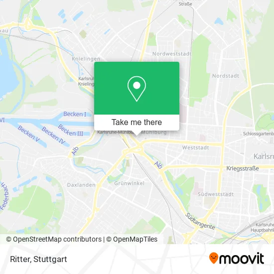
See Ritter, Stuttgart, on the map
Public Transit to Ritter in Stuttgart
Wondering how to get to Ritter in Stuttgart? Moovit helps you find the best way to get to Ritter with step-by-step directions from the nearest public transit station.
Moovit provides free maps and live directions to help you navigate through your city. View schedules, routes, timetables, and find out how long does it take to get to Ritter in real time.
Looking for the nearest stop or station to Ritter? Check out this list of stops closest to your destination: Karlsruhe Kärcherstraße Bstg A; Karlsruhe Vogesenbrücke Bstg A; Karlsruhe Vogesenbrücke; Karlsruhe Entenfang.
Train: S12, S2, S53, E, S1, 3, S5, 5.Light Rail: 3, S2, S5, S51.Bus: 222, 62, 70, ALT70, NL17, 60, NL15, 60, NL15, ALT70.
Want to see if there’s another route that gets you there at an earlier time? Moovit helps you find alternative routes or times. Get directions from and directions to Ritter easily from the Moovit App or Website.
We make riding to Ritter easy, which is why over 1.5 million users, including users in Stuttgart, trust Moovit as the best app for public transit. You don’t need to download an individual bus app or train app, Moovit is your all-in-one transit app that helps you find the best bus time or train time available.
For information on prices of train, bus and light rail, costs and ride fares to Ritter, please check the Moovit app.
Use the app to navigate to popular places including to the airport, hospital, stadium, grocery store, mall, coffee shop, school, college, and university.
Ritter Address: Hardtstraße 25 Mühlburg, 76185 Karlsruhe street in Stuttgart
- Trompeter von Säckingen,
- Di Sario Gaststätten Betriebs,
- Zum Biergarten,
- Gasthaus Zum Ritter,
- Erotic Treff,
- Ipk Beauty Academy,
- Beauty Salon Lia.Nails,
- Ysis Verwaltungs,
- Nähbar,
- Erotic King,
- Peter Wünsch,
- Jumper das Tanz und Event-Haus,
- Dotzauer,
- 48 American Sports Bar,
- Jumper & Tanztee,
- Cafe & Bar,
- Die Pvs,
- Pro Via Steuerberatungsgesellschaft,
- Asz Abrechnungs- und Servicezentrum,
- Thomas Knaus
Places Near Ritter (Stuttgart)
- Gleis 101/102 (tief), Stuttgart-Mitte,
- Im Wizemann (Halle), Bad Cannstatt,
- Pariser Platz Stuttgart, Stuttgart-Mitte,
- Waldfriedhof, Degerloch,
- Hauptbahnhof Stuttgart, Stuttgart-Mitte,
- Gasometer Pforzheim, Pforzheim,
- Porsche Museum, Zuffenhausen,
- Schleyerhalle, Bad Cannstatt,
- FlixBus Haltestelle, Stuttgart,
- Wilhelma (U-Bahn Wilhelma), Bad Cannstatt,
- Klinikum Stuttgart - Katharinenhospital, Stuttgart-Mitte,
- Marmorsaal Im Weissenburgpark, Stuttgart-Süd,
- Mercedes-Benz Museum (Mercedes Museum Stuttgart), Bad Cannstatt,
- SI-Centrum, Möhringen,
- Porsche-Arena, Bad Cannstatt,
- Hanns-Martin-Schleyer-Halle, Bad Cannstatt,
- Mettingen Eros-Center Puff Laufhaus, Esslingen Am Neckar,
- Geilhaus Haus 33a, Reutlingen-Betzingen,
- Mercedes-Benz Museum, Bad Cannstatt,
- Hanns-Martin-Schleyer-Halle (Stuttgart Hans-Martin-Schleyerhalle), Bad Cannstatt
How to get to popular places in Stuttgart with public transit
Get around Stuttgart by public transit!
Traveling around Stuttgart has never been so easy. See step by step directions as you travel to any attraction, street or major public transit station. View bus and train schedules, arrival times, service alerts and detailed routes on a map, so you know exactly how to get to anywhere in Stuttgart.
When traveling to any destination around Stuttgart use Moovit's Live Directions with Get Off Notifications to know exactly where and how far to walk, how long to wait for your line, and how many stops are left. Moovit will alert you when it's time to get off — no need to constantly re-check whether yours is the next stop.
Wondering how to use public transit in Stuttgart or how to pay for public transit in Stuttgart? Moovit public transit app can help you navigate your way with public transit easily, and at minimum cost. It includes public transit fees, ticket prices, and costs. Looking for a map of Stuttgart public transit lines? Moovit public transit app shows all public transit maps in Stuttgart with all Bus, Train, Subway, Light Rail, Ferry, S-Bahn and Funicular routes and stops on an interactive map.
Stuttgart has 7 transit type(s), including: Bus, Train, Subway, Light Rail, Ferry, S-Bahn and Funicular, operated by several transit agencies, including SSB - Stadtbahn, SSB, SSB - Seilbahn / Zacke, S-Bahn Stuttgart, Rhein-Neckar-Verkehr GmbH (rnv), Karlsruher Verkehrsverbund, DB AG, DB Regiobus BW, Arverio Baden-Württemberg GmbH, DB RegioNetz Verkehrs GmbH Westfrankenbahn, DB Regio AG Baden-Württemberg, Südwestdeutsche Verkehrs-AG, DB Regio AG Mitte Region Hessen, DB and Bodensee-Oberschwaben-Bahn