How to get to Ritter Petroleum Inc. by bus?
Click on the bus route to see step by step directions with maps, line arrival times and updated time schedules.
From Andry Alphabiotic Center, Indianapolis City (Balance)
63 minFrom Certasite - HPP/VT, Indianapolis City (Balance)
36 minFrom Marion County Assessor's Office (South), Beech Grove
74 minFrom Darbar Sri Guru Granth Sahib Ji, Indianapolis City (Balance)
60 minFrom Gregg Robert Dodd LCSW, Indianapolis City (Balance)
50 minFrom Michael A Carroll Track & Soccer Stadium, Indianapolis City (Balance)
59 minFrom Selzer J Don, MD, Indianapolis City (Balance)
59 minFrom IUPUI, Indianapolis City (Balance)
60 minFrom 1152 North White River Parkway West Drive, Indianapolis
55 minFrom Scott's Candy Shop, Indianapolis City (Balance)
64 min
Bus stops near Ritter Petroleum Inc. in Indianapolis City (Balance)
Bus lines to Ritter Petroleum Inc. in Indianapolis City (Balance)
What are the closest stations to Ritter Petroleum Inc.?
The closest stations to Ritter Petroleum Inc. are:
- 21st St & Layman Ave is 19 yards away, 1 min walk.
- 16th St & Ritter Ave is 436 yards away, 6 min walk.
Which bus line stops near Ritter Petroleum Inc.?
21 (Meijer E. Wash)
What’s the nearest bus station to Ritter Petroleum Inc. in Indianapolis City (Balance)?
The nearest bus station to Ritter Petroleum Inc. in Indianapolis City (Balance) is 21st St & Layman Ave. It’s a 1 min walk away.
What time is the first bus to Ritter Petroleum Inc. in Indianapolis City (Balance)?
The 21 is the first bus that goes to Ritter Petroleum Inc. in Indianapolis City (Balance). It stops nearby at 5:06 AM.
What time is the last bus to Ritter Petroleum Inc. in Indianapolis City (Balance)?
The 21 is the last bus that goes to Ritter Petroleum Inc. in Indianapolis City (Balance). It stops nearby at 9:55 PM.
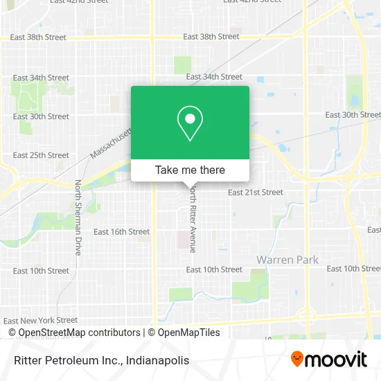
See Ritter Petroleum Inc., Indianapolis City (Balance), on the map
Public Transit to Ritter Petroleum Inc. in Indianapolis City (Balance)
Wondering how to get to Ritter Petroleum Inc. in Indianapolis City (Balance)? Moovit helps you find the best way to get to Ritter Petroleum Inc. with step-by-step directions from the nearest public transit station.
Moovit provides free maps and live directions to help you navigate through your city. View schedules, routes, timetables, and find out how long does it take to get to Ritter Petroleum Inc. in real time.
Looking for the nearest stop or station to Ritter Petroleum Inc.? Check out this list of stops closest to your destination: 21st St & Layman Ave; 16th St & Ritter Ave.
Bus: 21, 11.
Want to see if there’s another route that gets you there at an earlier time? Moovit helps you find alternative routes or times. Get directions from and directions to Ritter Petroleum Inc. easily from the Moovit App or Website.
We make riding to Ritter Petroleum Inc. easy, which is why over 1.5 million users, including users in Indianapolis City (Balance), trust Moovit as the best app for public transit. You don’t need to download an individual bus app or train app, Moovit is your all-in-one transit app that helps you find the best bus time or train time available.
For information on prices of bus, costs and ride fares to Ritter Petroleum Inc., please check the Moovit app.
Use the app to navigate to popular places including to the airport, hospital, stadium, grocery store, mall, coffee shop, school, college, and university.
Ritter Petroleum Inc. Address: 5460 E 21ST STREET street in Indianapolis City (Balance)
- Iglesia Tierra Prometida,
- Melanin Magic Llc,
- Clark Gasstation,
- Seafood World,
- Jerusalem Center Christian Church,
- Melanin Magic,
- American Crypto Bitcoin ATM,
- Krispy Krunchy Chicken,
- Rolland Manor Apartments,
- The Big Learning Tree 1,
- Philadelphia Missionary Baptist Church,
- Iglesia Cristiana Alfa Y Omega en Indiana,
- Sinai Outreach Ministry,
- Mt Sinai,
- Greenway Apartments,
- Latasha's Little Angels,
- Four Seasons at Hawthorne,
- Ridek Construction,
- Transformation Church Upci,
- First Friends Playschool
Places Near Ritter Petroleum Inc. (Indianapolis City (Balance))
- I-465 / I-65 Interchange, Indianapolis City (Balance),
- Lilly Corporate Center (Eli Lilly & Co), Indianapolis City (Balance),
- Methodist Hospital of Indianapolis, Indianapolis City (Balance),
- Eskenazi Hospital, Indianapolis City (Balance),
- Indianapolis Motor Speedway, Speedway,
- Train Ride At Castleton Mall, Indianapolis City (Balance),
- Indianapolis Airport Zone 2, Indianapolis City (Balance),
- I U Health Methodist Hospital, Indianapolis City (Balance),
- Gainbridge Fieldhouse, Indianapolis City (Balance),
- Cotter's Massage Parlor With Happy Endings, Indianapolis City (Balance),
- Indiana, Indianapolis City (Balance),
- St. Vincent entrance #1, Indianapolis City (Balance),
- Jersey Barn, Indianapolis City (Balance),
- Indiana Convention Center, Indianapolis City (Balance),
- THE BALT, Indianapolis City (Balance),
- Plainfield, IN, Plainfield,
- St. Vincent Hospital - Indianapolis, Indianapolis City (Balance),
- Lucas Oil Stadium, Indianapolis City (Balance),
- Castleton Square Mall, Indianapolis,
- 119 W 19th St Parking, Indianapolis City (Balance)
How to get to popular places in Indianapolis with public transit
Get around Indianapolis City (Balance) by public transit!
Traveling around Indianapolis City (Balance) has never been so easy. See step by step directions as you travel to any attraction, street or major public transit station. View bus and train schedules, arrival times, service alerts and detailed routes on a map, so you know exactly how to get to anywhere in Indianapolis City (Balance).
When traveling to any destination around Indianapolis City (Balance) use Moovit's Live Directions with Get Off Notifications to know exactly where and how far to walk, how long to wait for your line, and how many stops are left. Moovit will alert you when it's time to get off — no need to constantly re-check whether yours is the next stop.
Wondering how to use public transit in Indianapolis City (Balance) or how to pay for public transit in Indianapolis City (Balance)? Moovit public transit app can help you navigate your way with public transit easily, and at minimum cost. It includes public transit fees, ticket prices, and costs. Looking for a map of Indianapolis City (Balance) public transit lines? Moovit public transit app shows all public transit maps in Indianapolis City (Balance) with all bus routes and stops on an interactive map.
Indianapolis has 1 transit type(s), including: bus, operated by several transit agencies, including IndyGo, FlixBus-us and Greyhound-us