How to get to Rivadeneira by bus?
Click on the bus route to see step by step directions with maps, line arrival times and updated time schedules.
From Miami Springs, FL, Miami
42 minFrom Bayside Marketplace Parking, Miami
37 minFrom NW 95th St / NW 17th Ave, Miami
78 minFrom The Salvation Army, Miami
45 minFrom Virginia Key Beach Park, Key Biscayne
84 minFrom Trump National Doral Miami, North Westside
62 minFrom Flagler Monument Island, Miami Beach
81 minFrom Bang Bros., North Westside
62 min
How to get to Rivadeneira by train?
Click on the train route to see step by step directions with maps, line arrival times and updated time schedules.
Bus stops near Rivadeneira in Miami
Light Rail stations near Rivadeneira in Miami
- Mia@Lower Level Ramp, 28 min walk,VIEW
Train station near Rivadeneira in Miami
- Douglas Road, 39 min walk,VIEW
Bus lines to Rivadeneira in Miami
What are the closest stations to Rivadeneira?
The closest stations to Rivadeneira are:
- W Flagler St & Sw 38 Av is 89 yards away, 2 min walk.
- Sw 37 Av & W Flagler St is 206 yards away, 3 min walk.
- W Flagler St & Nw 37 Av is 237 yards away, 4 min walk.
- W Flagler St & Sw 38 Ct is 340 yards away, 5 min walk.
- Mia@Lower Level Ramp is 2376 yards away, 28 min walk.
- Douglas Road is 3301 yards away, 39 min walk.
Which bus lines stop near Rivadeneira?
These bus lines stop near Rivadeneira: 11, 37, MIAHAVA.
Which train line stops near Rivadeneira?
ORANGE (Dadeland South Stat.rail Northbound→MIA Northbound)
What’s the nearest light rail station to Rivadeneira in Miami?
The nearest light rail station to Rivadeneira in Miami is Mia@Lower Level Ramp. It’s a 28 min walk away.
What’s the nearest bus station to Rivadeneira in Miami?
The nearest bus station to Rivadeneira in Miami is W Flagler St & Sw 38 Av. It’s a 2 min walk away.
What time is the first light rail to Rivadeneira in Miami?
The MIA is the first light rail that goes to Rivadeneira in Miami. It stops nearby at 3:03 AM.
What time is the last light rail to Rivadeneira in Miami?
The MIA is the last light rail that goes to Rivadeneira in Miami. It stops nearby at 2:59 AM.
What time is the first train to Rivadeneira in Miami?
The GREEN is the first train that goes to Rivadeneira in Miami. It stops nearby at 5:09 AM.
What time is the last train to Rivadeneira in Miami?
The GREEN is the last train that goes to Rivadeneira in Miami. It stops nearby at 12:55 AM.
What time is the first bus to Rivadeneira in Miami?
The 11 is the first bus that goes to Rivadeneira in Miami. It stops nearby at 3:17 AM.
What time is the last bus to Rivadeneira in Miami?
The 11 is the last bus that goes to Rivadeneira in Miami. It stops nearby at 2:30 AM.
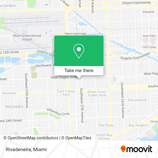
See Rivadeneira, Miami, on the map
Public Transit to Rivadeneira in Miami
Wondering how to get to Rivadeneira in Miami? Moovit helps you find the best way to get to Rivadeneira with step-by-step directions from the nearest public transit station.
Moovit provides free maps and live directions to help you navigate through your city. View schedules, routes, timetables, and find out how long does it take to get to Rivadeneira in real time.
Looking for the nearest stop or station to Rivadeneira? Check out this list of stops closest to your destination: W Flagler St & Sw 38 Av; Sw 37 Av & W Flagler St; W Flagler St & Nw 37 Av; W Flagler St & Sw 38 Ct; Mia@Lower Level Ramp; Douglas Road.
Bus: 11, 37, MIAHAVA, CGABLE, 211, MIAFLAG.Train: ORANGE, GREEN.
Want to see if there’s another route that gets you there at an earlier time? Moovit helps you find alternative routes or times. Get directions from and directions to Rivadeneira easily from the Moovit App or Website.
We make riding to Rivadeneira easy, which is why over 1.5 million users, including users in Miami, trust Moovit as the best app for public transit. You don’t need to download an individual bus app or train app, Moovit is your all-in-one transit app that helps you find the best bus time or train time available.
For information on prices of bus, train and light rail, costs and ride fares to Rivadeneira, please check the Moovit app.
Use the app to navigate to popular places including to the airport, hospital, stadium, grocery store, mall, coffee shop, school, college, and university.
Rivadeneira Address: 3800 SW 1st St Miami, FL 33134 street in Miami
- Miami Tile & Installation,
- Gusto Casero by MDQ Sweets,
- Dermal Era Holistic Med Spa,
- Univista Insurance,
- Wells Fargo,
- Smile Central,
- Sedano's (Sedanos Supermarket),
- Key West In Miami,
- Eye-MD Optics,
- Luany Jewelry,
- Sedano's Supermarket,
- Dime Immigration,
- Ponce De Leon Boulevard & Southwest 37th Avenue,
- 37th Ave & West Flagler St,
- Shred Nations,
- Dr. Maribel Santa Cruz,
- West Flagler Street & Southwest 37th Avenue,
- NW 37th Ave / S Douglas Rd,
- Plaza de Leon,
- Sunflower Academy Preschool
Places Near Rivadeneira (Miami)
- Aventura Mall, Miami Beach,
- Richard E. Gerstein Justice Building, Miami,
- Keiser University Flagship Campus, West Palm Beach,
- Miami Design District, Miami,
- Brickell City Centre, Miami,
- Dolphin Mall Bus, Miami,
- Port of Miami Cruise Terminal, Miami,
- Sawgrass Mall, Miami,
- Hard Rock Stadium, Miami Gardens,
- Miami-Dade County Courthouse, Miami,
- Little Havana, Miami,
- Miami VA Hospital, Miami,
- Wynwood, Miami,
- Aventura Mall, Miami,
- Marlins Park, Miami,
- Zoo Miami, Miami,
- Sawgrass mall ( FL ), Miami Beach,
- Bayside Marketplace, Miami,
- Dolphin Mall, Miami,
- Miami Freedom Park, Miami
How to get to popular places in Miami with public transit
Get around Miami by public transit!
Traveling around Miami has never been so easy. See step by step directions as you travel to any attraction, street or major public transit station. View bus and train schedules, arrival times, service alerts and detailed routes on a map, so you know exactly how to get to anywhere in Miami.
When traveling to any destination around Miami use Moovit's Live Directions with Get Off Notifications to know exactly where and how far to walk, how long to wait for your line, and how many stops are left. Moovit will alert you when it's time to get off — no need to constantly re-check whether yours is the next stop.
Wondering how to use public transit in Miami or how to pay for public transit in Miami? Moovit public transit app can help you navigate your way with public transit easily, and at minimum cost. It includes public transit fees, ticket prices, and costs. Looking for a map of Miami public transit lines? Moovit public transit app shows all public transit maps in Miami with all Bus, Train, Light Rail and Ferry routes and stops on an interactive map.
Miami has 4 transit type(s), including: Bus, Train, Light Rail and Ferry, operated by several transit agencies, including Broward County Transit, Miami-Dade Transit, Metrorail, Palm Tran, Tri-Rail, Brightline, MARTY, City of Homestead Trolley, Key West Transit, Treasure Coast Connector, GoLine IRT, Amtrak, Greyhound-us, FlixBus-us and Aventura Express Shuttle Bus