Directions to River Mill Hydroelectric Project (Portland, OR) with public transportation
The following transit lines have routes that pass near River Mill Hydroelectric Project
 Bus: 30.
How to get to River Mill Hydroelectric Project by bus?
Click on the bus route to see step by step directions with maps, line arrival times and updated time schedules.
Bus stop near River Mill Hydroelectric Project in Portland, OR
- SE Eagle Creek Rd & Hinman, 19 min walk,
Bus lines to River Mill Hydroelectric Project in Portland, OR
- 30, Clackamas Town Center Transit Center,
What are the closest stations to River Mill Hydroelectric Project?
The closest stations to River Mill Hydroelectric Project are:
- SE Eagle Creek Rd & Hinman is 1543 yards away, 19 min walk.
Which bus line stops near River Mill Hydroelectric Project?
30 (400 Block SE Main (Estacada City Hall))
What time is the first bus to River Mill Hydroelectric Project in Portland, OR?
The 30 is the first bus that goes to River Mill Hydroelectric Project in Portland, OR. It stops nearby at 8:27 AM.
What time is the last bus to River Mill Hydroelectric Project in Portland, OR?
The 30 is the last bus that goes to River Mill Hydroelectric Project in Portland, OR. It stops nearby at 7:20 PM.
See River Mill Hydroelectric Project, Portland, OR, on the map
Public Transit to River Mill Hydroelectric Project in Portland, OR
Wondering how to get to River Mill Hydroelectric Project in Portland, OR? Moovit helps you find the best way to get to River Mill Hydroelectric Project with step-by-step directions from the nearest public transit station.
Moovit provides free maps and live directions to help you navigate through your city. View schedules, routes, timetables, and find out how long does it take to get to River Mill Hydroelectric Project in real time.
Looking for the nearest stop or station to River Mill Hydroelectric Project? Check out this list of stops closest to your destination: SE Eagle Creek Rd & Hinman.
Bus: 30.
Want to see if there’s another route that gets you there at an earlier time? Moovit helps you find alternative routes or times. Get directions from and directions to River Mill Hydroelectric Project easily from the Moovit App or Website.
We make riding to River Mill Hydroelectric Project easy, which is why over 1.5 million users, including users in Portland, OR, trust Moovit as the best app for public transit. You don’t need to download an individual bus app or train app, Moovit is your all-in-one transit app that helps you find the best bus time or train time available.
For information on prices of bus, costs and ride fares to River Mill Hydroelectric Project, please check the Moovit app.
Use the app to navigate to popular places including to the airport, hospital, stadium, grocery store, mall, coffee shop, school, college, and university.
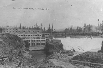
River Mill Hydroelectric Project Address: SE Kilowat Ln Estacada, OR 97023 street in Portland, OR
- Estacada Lake Boat Ramp,
- Estacada Lake,
- Timber Park,
- Estacada Secure Storage,
- McKenzie CNC, Inc.,
- Estacada Mini Storage,
- Eagle Bargain Outlet,
- NWT,
- Cascade Automotive Repair and Services,
- Jehovah's Witnesses (Kingdom Hall of Jehovahs Witnesses),
- Defy Drug Free Estacada Families & Youth,
- Julie Cooper Designs,
- Wade Creek Vintage Marketplace,
- Jeep West,
- First Rate Chimney,
- Salt and Light Counseling,
- Nicole Danielson,
- Lavern's Rock Works,
- G&N Homecare,
- T's Notary
Places Near River Mill Hydroelectric Project (Portland, OR)
- Pearl District, Portland,
- Portland Art Museum, Portland,
- Portland VA Medical Center, Portland,
- The Woodburn Premium Outlet Stores,
- Oregon Zoo, Portland,
- Multnomah County Courthouse, Portland,
- Ilani Casino,
- Washington Square Mall, Tigard,
- OHSU, Portland,
- Portland Japanese Garden, Portland,
- Oregon Convention Center, Portland,
- OHSU, Portland,
- Gov. Tom McCall Waterfront Park, Portland,
- Keller Auditorium, Portland,
- Crystal Ballroom, Portland,
- Intel Shuttle - Orenco MAX, Hillsboro,
- Spirit Mountain Casino,
- Moda Center, Portland,
- Powell's City of Books (Powell's Books), Portland,
- Powell's City of Books, Portland
How to get to popular places in Portland, OR with public transit
Get around Portland, OR by public transit!
Traveling around Portland, OR has never been so easy. See step by step directions as you travel to any attraction, street or major public transit station. View bus and train schedules, arrival times, service alerts and detailed routes on a map, so you know exactly how to get to anywhere in Portland, OR.
When traveling to any destination around Portland, OR use Moovit's Live Directions with Get Off Notifications to know exactly where and how far to walk, how long to wait for your line, and how many stops are left. Moovit will alert you when it's time to get off — no need to constantly re-check whether yours is the next stop.
Wondering how to use public transit in Portland, OR or how to pay for public transit in Portland, OR? Moovit public transit app can help you navigate your way with public transit easily, and at minimum cost. It includes public transit fees, ticket prices, and costs. Looking for a map of Portland, OR public transit lines? Moovit public transit app shows all public transit maps in Portland, OR with all Bus, Train, Light Rail, Ferry, Streetcar and Gondola routes and stops on an interactive map.
Portland, OR has 6 transit type(s), including: Bus, Train, Light Rail, Ferry, Streetcar and Gondola, operated by several transit agencies, including Mount Adams Transportation Service, RiverCities Transit, TriMet , TriMet , TriMet, Portland Streetcar, Portland Aerial Tram, C-TRAN, Multnomah County Transit, Washington Park, SMART, Canby Area Transit, South Clackamas Transportation District, The Wave and Lincoln County Transit