How to get to Riverbend Colorfast by bus?
Click on the bus route to see step by step directions with maps, line arrival times and updated time schedules.
From Western Drug Distribution Center (WDDC), Edmonton
72 minFrom Rundle Inn and Suites, Edmonton
60 minFrom CCIS L1-140, Edmonton
70 minFrom J. Percy Page High School, Edmonton
41 minFrom Vivid Vision Studio, Edmonton
62 minFrom Al Mustafa Academy, Edmonton
87 minFrom Royal Canadian Military Base, Edmonton
53 minFrom Blessed Hands Massage, Edmonton
53 minFrom 10086 Macdonald Drive Northwest, Edmonton
53 minFrom Buff N Bling Auto Spa, Edmonton
43 min
Bus stops near Riverbend Colorfast in Edmonton
Bus lines to Riverbend Colorfast in Edmonton
What are the closest stations to Riverbend Colorfast?
The closest stations to Riverbend Colorfast are:
- Riverbend Square & Rabbit Hill Road is 192 meters away, 3 min walk.
- Terwillegar Drive & Rabbit Hill Road is 454 meters away, 7 min walk.
- Falconer Gate & Riverbend Road is 787 meters away, 11 min walk.
Which bus lines stop near Riverbend Colorfast?
These bus lines stop near Riverbend Colorfast: 056, 706.
What’s the nearest bus station to Riverbend Colorfast in Edmonton?
The nearest bus station to Riverbend Colorfast in Edmonton is Riverbend Square & Rabbit Hill Road. It’s a 3 min walk away.
What time is the first bus to Riverbend Colorfast in Edmonton?
The 056 is the first bus that goes to Riverbend Colorfast in Edmonton. It stops nearby at 5:27 AM.
What time is the last bus to Riverbend Colorfast in Edmonton?
The 056 is the last bus that goes to Riverbend Colorfast in Edmonton. It stops nearby at 12:36 AM.
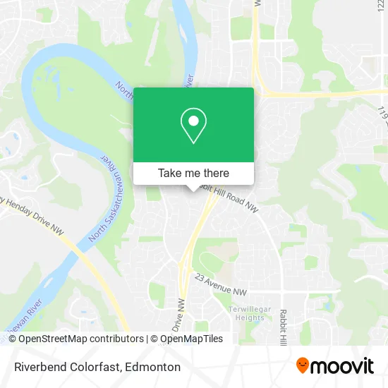
See Riverbend Colorfast, Edmonton, on the map
Public Transit to Riverbend Colorfast in Edmonton
Wondering how to get to Riverbend Colorfast in Edmonton? Moovit helps you find the best way to get to Riverbend Colorfast with step-by-step directions from the nearest public transit station.
Moovit provides free maps and live directions to help you navigate through your city. View schedules, routes, timetables, and find out how long does it take to get to Riverbend Colorfast in real time.
Looking for the nearest stop or station to Riverbend Colorfast? Check out this list of stops closest to your destination: Riverbend Square & Rabbit Hill Road; Terwillegar Drive & Rabbit Hill Road; Falconer Gate & Riverbend Road.
Bus: 056, 706, 703, 031, 657, 682.
Want to see if there’s another route that gets you there at an earlier time? Moovit helps you find alternative routes or times. Get directions from and directions to Riverbend Colorfast easily from the Moovit App or Website.
We make riding to Riverbend Colorfast easy, which is why over 1.5 million users, including users in Edmonton, trust Moovit as the best app for public transit. You don’t need to download an individual bus app or train app, Moovit is your all-in-one transit app that helps you find the best bus time or train time available.
For information on prices of bus and light rail, costs and ride fares to Riverbend Colorfast, please check the Moovit app.
Use the app to navigate to popular places including to the airport, hospital, stadium, grocery store, mall, coffee shop, school, college, and university.
Riverbend Colorfast Address: 536 Riverbend Sq NW Edmonton, AB T6R street in Edmonton
- Riverbend Square,
- SWTCH,
- STARBUCKS,
- Fresh Start Bakery,
- Musicworks Canada,
- Terrence Leung - TD Financial Planner,
- Donna Ko - TD Account Manager Small Business,
- Mamta Talwar - TD Investment Specialist,
- Alta Life Care Housing Foundation,
- Lifestyle Options Retirement Communities,
- Green Garden Palace Restaurant,
- Goodwill,
- S Squared Innovations,
- Trek Bicycle Store,
- Provita Health Food Store,
- Benefit,
- Amplifon - Riverbend S,
- Miracle-Ear,
- Riverbend Montessori Child Development Centre,
- Aveda
Places Near Riverbend Colorfast (Edmonton)
- Rogers Place, Edmonton,
- Royal Alexandra Hospital, Edmonton,
- University of Alberta, Edmonton,
- Edmonton Commonwealth Stadium, Edmonton,
- Northgate Centre, Edmonton,
- Edmonton EXPO Centre, Edmonton,
- Borden Park, Edmonton,
- Fort Edmonton Park, Edmonton,
- Kaye Edmonton Clinic, Edmonton,
- MacEwan University, Edmonton,
- Kingsway Mall, Edmonton,
- Alberta Legislature Building, Edmonton,
- Whyte Avenue, Edmonton,
- Edmonton Valley Zoo, Edmonton,
- West Edmonton Mall, Edmonton,
- Londonderry Mall, Edmonton,
- Cross Cancer Institute, Edmonton,
- Grey Nuns Community Hospital, Edmonton,
- Edmonton VIA Rail Station, Edmonton,
- Canada Place Service Canada Centre, Edmonton
How to get to popular places in Edmonton with public transit
Get around Edmonton by public transit!
Traveling around Edmonton has never been so easy. See step by step directions as you travel to any attraction, street or major public transit station. View bus and train schedules, arrival times, service alerts and detailed routes on a map, so you know exactly how to get to anywhere in Edmonton.
When traveling to any destination around Edmonton use Moovit's Live Directions with Get Off Notifications to know exactly where and how far to walk, how long to wait for your line, and how many stops are left. Moovit will alert you when it's time to get off — no need to constantly re-check whether yours is the next stop.
Wondering how to use public transit in Edmonton or how to pay for public transit in Edmonton? Moovit public transit app can help you navigate your way with public transit easily, and at minimum cost. It includes public transit fees, ticket prices, and costs. Looking for a map of Edmonton public transit lines? Moovit public transit app shows all public transit maps in Edmonton with all Bus and Light Rail routes and stops on an interactive map.
Edmonton has 2 transit type(s), including: Bus and Light Rail, operated by several transit agencies, including ETS LRT, ETS, Strathcona County Transit, St. Albert Transit, Spruce Grove Transit, Fort Saskatchewan Transit, Beaumont Transit and Leduc Transit