Directions to Rivers Edge Park (Roanoke) with public transportation
The following transit lines have routes that pass near Rivers Edge Park
 Bus: GREYHOUND US0600, TROLLEY, 26, 65, 11.
- Train: NORTHEAST REGIONAL.
How to get to Rivers Edge Park by bus?
Click on the bus route to see step by step directions with maps, line arrival times and updated time schedules.
How to get to Rivers Edge Park by train?
Click on the train route to see step by step directions with maps, line arrival times and updated time schedules.
Bus stops near Rivers Edge Park in Roanoke
- 3rd St Station Star Line, 4 min walk,VIEW
- 3rd St Station Slip A, 5 min walk,VIEW
- 3rd St Station Slip B, 5 min walk,VIEW
- 3rd St Station Slip Q, 5 min walk,VIEW
- 3rd St Station Slip F, 5 min walk,VIEW
- 3rd St Station Slip P, 5 min walk,VIEW
- 3rd St Station Slip C, 5 min walk,VIEW
- 3rd St Station Slip O, 5 min walk,VIEW
- 3rd St Station Slip G, 5 min walk,VIEW
- 3rd St Station Slip D, 5 min walk,VIEW
- 3rd St Station Slip N, 5 min walk,VIEW
- 3rd St Station Slip H, 6 min walk,VIEW
- 3rd St Station Slip I, 6 min walk,VIEW
- 3rd St at Church Ave, 6 min walk,VIEW
Train station near Rivers Edge Park in Roanoke
- Roanoke, 51 min walk,VIEW
Bus lines to Rivers Edge Park in Roanoke
- TROLLEY, Downtown Market,VIEW
- 26, 3rd St Station Slip A,VIEW
- 65, 65 - Third Street Station To Carlton & Grandin,VIEW
- 75, 75 - Third Street Station To Veterans Hospital,VIEW
- 76, 76 - Veterans Hospital To Third Street Station,VIEW
- 11, 11-Third Street Station To Valley View Mall,VIEW
- 52, 3rd St Station Slip Q,VIEW
- 85, 85 - Third Street Station To Peters Creek Road,VIEW
- 86, 86 - Peters Creek Road To Third Street Station,VIEW
- 15, 15 - Third Street Station To Valley View Mall,VIEW
- 56, 3rd St Station Slip P,VIEW
- 91, Apperson Eb at Riverview,VIEW
- 92, 3rd St Station Slip C,VIEW
- 21, 21 - Third Street Station To Valley Court,VIEW
- 62, 3rd St Station Slip O,VIEW
- 71, Lewis Gale Medical Center,VIEW
- 72, 72 - Lewis Gale Hospital To Third Street Station,VIEW
- SWB, 3rd St Station Slip D,VIEW
- 25, 25 - Third Street Station To Airport,VIEW
- 66, 66 - Carlton & Grandin To Third Street Station,VIEW
What are the closest stations to Rivers Edge Park?
The closest stations to Rivers Edge Park are:
- 3rd St Station Star Line is 258 yards away, 4 min walk.
- 3rd St Station Slip A is 350 yards away, 5 min walk.
- 3rd St Station Slip B is 352 yards away, 5 min walk.
- 3rd St Station Slip Q is 353 yards away, 5 min walk.
- 3rd St Station Slip F is 372 yards away, 5 min walk.
- 3rd St Station Slip P is 374 yards away, 5 min walk.
- 3rd St Station Slip C is 378 yards away, 5 min walk.
- 3rd St Station Slip O is 398 yards away, 5 min walk.
- 3rd St Station Slip G is 399 yards away, 5 min walk.
- 3rd St Station Slip D is 401 yards away, 5 min walk.
- 3rd St Station Slip N is 405 yards away, 5 min walk.
- 3rd St Station Slip H is 429 yards away, 6 min walk.
- 3rd St Station Slip I is 431 yards away, 6 min walk.
- 3rd St at Church Ave is 441 yards away, 6 min walk.
- Roanoke is 4320 yards away, 51 min walk.
Which bus line stops near Rivers Edge Park?
GREYHOUND US0600 (Nashville Bus Station)
Which train line stops near Rivers Edge Park?
NORTHEAST REGIONAL (Roanoke)
What’s the nearest bus station to Rivers Edge Park in Roanoke?
The nearest bus station to Rivers Edge Park in Roanoke is 3rd St Station Star Line. It’s a 4 min walk away.
What time is the first train to Rivers Edge Park in Roanoke?
The NORTHEAST REGIONAL is the first train that goes to Rivers Edge Park in Roanoke. It stops nearby at 9:35 AM.
What time is the last train to Rivers Edge Park in Roanoke?
The NORTHEAST REGIONAL is the last train that goes to Rivers Edge Park in Roanoke. It stops nearby at 10:13 PM.
What time is the first bus to Rivers Edge Park in Roanoke?
The SWB is the first bus that goes to Rivers Edge Park in Roanoke. It stops nearby at 5:15 AM.
What time is the last bus to Rivers Edge Park in Roanoke?
The SWB is the last bus that goes to Rivers Edge Park in Roanoke. It stops nearby at 10:21 PM.
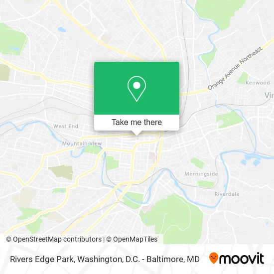
See Rivers Edge Park, Roanoke, on the map
Public Transit to Rivers Edge Park in Roanoke
Wondering how to get to Rivers Edge Park in Roanoke? Moovit helps you find the best way to get to Rivers Edge Park with step-by-step directions from the nearest public transit station.
Moovit provides free maps and live directions to help you navigate through your city. View schedules, routes, timetables, and find out how long does it take to get to Rivers Edge Park in real time.
Looking for the nearest stop or station to Rivers Edge Park? Check out this list of stops closest to your destination: 3rd St Station Star Line; 3rd St Station Slip A; 3rd St Station Slip B; 3rd St Station Slip Q; 3rd St Station Slip F; 3rd St Station Slip P; 3rd St Station Slip C; 3rd St Station Slip O; 3rd St Station Slip G; 3rd St Station Slip D; 3rd St Station Slip N; 3rd St Station Slip H; 3rd St Station Slip I; 3rd St at Church Ave; Roanoke.
Bus: GREYHOUND US0600, TROLLEY, 26, 65, 11, 52, 75, 76, 15, 56.Train: NORTHEAST REGIONAL.
Want to see if there’s another route that gets you there at an earlier time? Moovit helps you find alternative routes or times. Get directions from and directions to Rivers Edge Park easily from the Moovit App or Website.
We make riding to Rivers Edge Park easy, which is why over 1.5 million users, including users in Roanoke, trust Moovit as the best app for public transit. You don’t need to download an individual bus app or train app, Moovit is your all-in-one transit app that helps you find the best bus time or train time available.
For information on prices of bus and train, costs and ride fares to Rivers Edge Park, please check the Moovit app.
Use the app to navigate to popular places including to the airport, hospital, stadium, grocery store, mall, coffee shop, school, college, and university.
Rivers Edge Park Address: 215 Church Ave SW Roanoke, VA 24011 street in Roanoke
- Roanoke Department of Planning Building & Development,
- Roanoke Valley War Memorial,
- Government Offices City Libraries,
- Juice do It,
- City of Roanoke Purchasing Division,
- Roanoke City Permit Center,
- 220 Church LLC,
- Roanoke Code Enforcement,
- Office of Neighborhood Services - Roanoke VA,
- Breakfast Tiffaney's Restaurant,
- Play Roanoke,
- Roanoke Human Resources Department,
- 3142 Preston Park Elementary School,
- Virginia Government Finance,
- Electoral Board,
- City of Roanoke,
- Star City Cafe,
- Two Guys and A Truck,
- ATM,
- Roanoke City Police Department
Places Near Rivers Edge Park (Roanoke)
- The Anthem, Washington,
- Marriott Marquis Washington, DC, Washington,
- Georgetown, Washington,
- Capital One Arena, Washington,
- National Theatre, Washington,
- Warner Theatre, Washington,
- Sibley Memorial Hospital, Washington,
- PG Mall, Prince George's County,
- Basilica of the National Shrine, Washington,
- Camden Yards, Baltimore,
- Washington DC VA Medical Center, Washington,
- National Museum of African American History and Culture, Washington,
- Washington National Cathedral, Washington,
- Pennsylvania Ave NW (3rd st and pennsylvania), Washington,
- Westfield Montgomery Mall, Montgomery County,
- Museum Of The Bible, Washington,
- Rock Creek Tennis Center, Washington,
- National Zoo, Washington,
- Amazon Hq2, Arlington County,
- M&T Bank Stadium, Baltimore
How to get to popular places in Washington, D.C. - Baltimore, MD with public transit
Get around Roanoke by public transit!
Traveling around Roanoke has never been so easy. See step by step directions as you travel to any attraction, street or major public transit station. View bus and train schedules, arrival times, service alerts and detailed routes on a map, so you know exactly how to get to anywhere in Roanoke.
When traveling to any destination around Roanoke use Moovit's Live Directions with Get Off Notifications to know exactly where and how far to walk, how long to wait for your line, and how many stops are left. Moovit will alert you when it's time to get off — no need to constantly re-check whether yours is the next stop.
Wondering how to use public transit in Roanoke or how to pay for public transit in Roanoke? Moovit public transit app can help you navigate your way with public transit easily, and at minimum cost. It includes public transit fees, ticket prices, and costs. Looking for a map of Roanoke public transit lines? Moovit public transit app shows all public transit maps in Roanoke with all Bus, Train, Metro, Light Rail and Ferry routes and stops on an interactive map.
Washington, D.C. - Baltimore, MD has 5 transit type(s), including: Bus, Train, Metro, Light Rail and Ferry, operated by several transit agencies, including WMATA, Montgomery County Ride On, Fairfax Connector, TheBus, PRTC, DASH - Alexandria, Arlington Transit (ART), RTA of Central Maryland, MDOT MTA, MDOT MTA Light RailLink, MDOT MTA Commuter Bus, MDOT MTA Local Bus, FXBGO!, Virginia Railway Express (VRE) and MARC