Bus stops near Riverside Family Support in Harrisonburg
Bus lines to Riverside Family Support in Harrisonburg
- 1, Route 1,VIEW
- 1-B, Route 1-B,VIEW
- EXT 1, Extended Route 1,VIEW
- 4, Route 4,VIEW
- 4-B, Route 4-B,VIEW
- EXT 4, Extended Route 4,VIEW
- 5, Route 5,VIEW
- 5-B, Route 5-B,VIEW
- EXT 5, Extended Route 5,VIEW
- 6, Route 6,VIEW
- 6-B, Route 6-B,VIEW
- EXT 6, Extended Route 6,VIEW
- 2, Route 2,VIEW
- 2-B, Route 2-B,VIEW
- EXT 2, Extended Route 2,VIEW
- 3, Route 3,VIEW
- 3-B, Route 3-B,VIEW
- EXT 3, Extended Route 3,VIEW
- Mountain Valley Management,
- E Market St & Myrtle St E,
- Trophy Shop & Shirt Shack,
- Hess Financial,
- Corder Law,
- Harrisonburg Criminal Defense Attorney,
- Graves Aaron W Attorney at Law,
- Laura A Thornton,
- Graveswhetzel Law,
- Beauty Spa,
- Permanent Makeup by Ellen,
- The Beauty Spa,
- Woodbine Cemetery,
- Gary's Pianos,
- Integrity Custom Builders,
- Muhlenberg Lutheran Church,
- Harrisonburg-Rockingham Child Day Care Center,
- Second Home Childcare Center,
- Friendly City Inn,
- Stonewall Jackson Inn B&B
Places Near Riverside Family Support (Harrisonburg)
- Amazon Hq2, Arlington County,
- Museum Of The Bible, Washington,
- Marriott Marquis Washington, DC, Washington,
- Rock Creek Tennis Center, Washington,
- Basilica of the National Shrine, Washington,
- Washington DC VA Medical Center, Washington,
- M&T Bank Stadium, Baltimore,
- Capital One Arena, Washington,
- PG Mall, Prince George's County,
- Westfield Montgomery Mall, Montgomery County,
- Georgetown, Washington,
- Washington National Cathedral, Washington,
- Camden Yards, Baltimore,
- National Theatre, Washington,
- National Zoo, Washington,
- Warner Theatre, Washington,
- The Anthem, Washington,
- Sibley Memorial Hospital, Washington,
- National Museum of African American History and Culture, Washington,
- Pennsylvania Ave NW (3rd st and pennsylvania), Washington
How to get to popular places in Washington, D.C. - Baltimore, MD with public transit
What are the closest stations to Riverside Family Support?
The closest stations to Riverside Family Support are:
- South Main St. @ Court Square is 56 yards away, 1 min walk.
- East Market St. @ Mason St. (West) is 208 yards away, 3 min walk.
- East Market St. @ Urban Exchange is 241 yards away, 4 min walk.
- East Gay St. @ Transit Hub is 793 yards away, 10 min walk.
Which bus line stops near Riverside Family Support?
6 (East Gay St. @ Transit Hub)
What’s the nearest bus station to Riverside Family Support in Harrisonburg?
The nearest bus station to Riverside Family Support in Harrisonburg is South Main St. @ Court Square. It’s a 1 min walk away.
What time is the first bus to Riverside Family Support in Harrisonburg?
The 3 is the first bus that goes to Riverside Family Support in Harrisonburg. It stops nearby at 6:30 AM.
What time is the last bus to Riverside Family Support in Harrisonburg?
The 2-B is the last bus that goes to Riverside Family Support in Harrisonburg. It stops nearby at 10:46 PM.
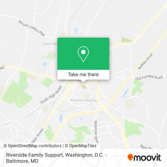
See Riverside Family Support, Harrisonburg, on the map
Public Transit to Riverside Family Support in Harrisonburg
Wondering how to get to Riverside Family Support in Harrisonburg? Moovit helps you find the best way to get to Riverside Family Support with step-by-step directions from the nearest public transit station.
Moovit provides free maps and live directions to help you navigate through your city. View schedules, routes, timetables, and find out how long does it take to get to Riverside Family Support in real time.
Looking for the nearest stop or station to Riverside Family Support? Check out this list of stops closest to your destination: South Main St. @ Court Square; East Market St. @ Mason St. (West); East Market St. @ Urban Exchange; East Gay St. @ Transit Hub.
Bus: 6, 1, 1-B, EXT 1, 4, 4-B, 5, 5-B, EXT 5, 6-B, 2, 2-B, EXT 2, 3, 3-B, EXT 3.
Want to see if there’s another route that gets you there at an earlier time? Moovit helps you find alternative routes or times. Get directions from and directions to Riverside Family Support easily from the Moovit App or Website.
We make riding to Riverside Family Support easy, which is why over 1.5 million users, including users in Harrisonburg, trust Moovit as the best app for public transit. You don’t need to download an individual bus app or train app, Moovit is your all-in-one transit app that helps you find the best bus time or train time available.
For information on prices of bus and train, costs and ride fares to Riverside Family Support, please check the Moovit app.
Use the app to navigate to popular places including to the airport, hospital, stadium, grocery store, mall, coffee shop, school, college, and university.
Riverside Family Support Address: 420 E Market St Harrisonburg, VA 22801 street in Harrisonburg
Get around Harrisonburg by public transit!
Traveling around Harrisonburg has never been so easy. See step by step directions as you travel to any attraction, street or major public transit station. View bus and train schedules, arrival times, service alerts and detailed routes on a map, so you know exactly how to get to anywhere in Harrisonburg.
When traveling to any destination around Harrisonburg use Moovit's Live Directions with Get Off Notifications to know exactly where and how far to walk, how long to wait for your line, and how many stops are left. Moovit will alert you when it's time to get off — no need to constantly re-check whether yours is the next stop.
Wondering how to use public transit in Harrisonburg or how to pay for public transit in Harrisonburg? Moovit public transit app can help you navigate your way with public transit easily, and at minimum cost. It includes public transit fees, ticket prices, and costs. Looking for a map of Harrisonburg public transit lines? Moovit public transit app shows all public transit maps in Harrisonburg with all Bus, Train, Metro, Light Rail and Ferry routes and stops on an interactive map.
Washington, D.C. - Baltimore, MD has 5 transit type(s), including: Bus, Train, Metro, Light Rail and Ferry, operated by several transit agencies, including WMATA, Montgomery County Ride On, Fairfax Connector, TheBus, PRTC, DASH - Alexandria, Arlington Transit (ART), RTA of Central Maryland, MDOT MTA, MDOT MTA Light RailLink, MDOT MTA Commuter Bus, MDOT MTA Local Bus, FXBGO!, Virginia Railway Express (VRE) and MARC