How to get to Riverside High School by bus?
Click on the bus route to see step by step directions with maps, line arrival times and updated time schedules.
From CROWNE PLAZA HOTEL, Indianapolis City (Balance)
42 minFrom Imilestones, Indianapolis City (Balance)
62 minFrom United States Government, Indianapolis City (Balance)
36 minFrom Rimstidt L David, Indianapolis City (Balance)
29 minFrom S Keystone Ave / E Pleasant Run Parkway South Dr, Indianapolis City (Balance)
55 minFrom Grove at Harcourt, Indianapolis City (Balance)
58 minFrom LD 136 (Science Building), Indianapolis City (Balance)
28 minFrom Tienda Mexicana Dos Amigos, Indianapolis City (Balance)
55 minFrom Christiii Boutique, Indianapolis City (Balance)
43 minFrom Social Security, Indianapolis City (Balance)
43 min
Bus stops near Riverside High School in Indianapolis City (Balance)
Bus lines to Riverside High School in Indianapolis City (Balance)
What are the closest stations to Riverside High School?
The closest stations to Riverside High School are:
- 30th St & Kessler Blvd N Dr is 145 yards away, 2 min walk.
- 30th St & Warman Ave is 312 yards away, 4 min walk.
- Lafayette Rd & Merchants Dr is 1182 yards away, 14 min walk.
Which bus lines stop near Riverside High School?
These bus lines stop near Riverside High School: 15, 30.
What’s the nearest bus station to Riverside High School in Indianapolis City (Balance)?
The nearest bus station to Riverside High School in Indianapolis City (Balance) is 30th St & Kessler Blvd N Dr. It’s a 2 min walk away.
What time is the first bus to Riverside High School in Indianapolis City (Balance)?
The 15 is the first bus that goes to Riverside High School in Indianapolis City (Balance). It stops nearby at 4:48 AM.
What time is the last bus to Riverside High School in Indianapolis City (Balance)?
The 30 is the last bus that goes to Riverside High School in Indianapolis City (Balance). It stops nearby at 11:51 PM.
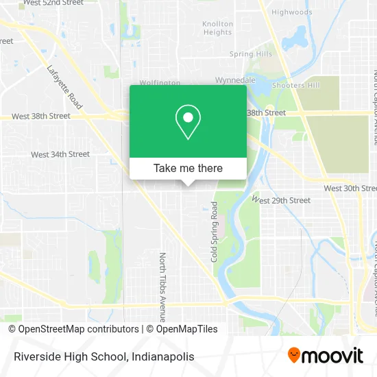
See Riverside High School, Indianapolis City (Balance), on the map
Public Transit to Riverside High School in Indianapolis City (Balance)
Wondering how to get to Riverside High School in Indianapolis City (Balance)? Moovit helps you find the best way to get to Riverside High School with step-by-step directions from the nearest public transit station.
Moovit provides free maps and live directions to help you navigate through your city. View schedules, routes, timetables, and find out how long does it take to get to Riverside High School in real time.
Looking for the nearest stop or station to Riverside High School? Check out this list of stops closest to your destination: 30th St & Kessler Blvd N Dr; 30th St & Warman Ave; Lafayette Rd & Merchants Dr.
Bus: 15, 30, 37.
Want to see if there’s another route that gets you there at an earlier time? Moovit helps you find alternative routes or times. Get directions from and directions to Riverside High School easily from the Moovit App or Website.
We make riding to Riverside High School easy, which is why over 1.5 million users, including users in Indianapolis City (Balance), trust Moovit as the best app for public transit. You don’t need to download an individual bus app or train app, Moovit is your all-in-one transit app that helps you find the best bus time or train time available.
For information on prices of bus, costs and ride fares to Riverside High School, please check the Moovit app.
Use the app to navigate to popular places including to the airport, hospital, stadium, grocery store, mall, coffee shop, school, college, and university.
Riverside High School Address: 2916 W 30th St Indianapolis, IN 46222 street in Indianapolis City (Balance)
- American Garage Door,
- Providence Locksmith & Key,
- D&C Pizza,
- True Vision Childcare,
- Mashaweena,
- Marian University Softball Field,
- Steps Ahead Drug Rehabilitation Indiana,
- St Michael Church (Saint Michael the Archangel),
- Catholic Archdiocese of Indianapolis Churches,
- Cheap Lock Repair of Indianapolis,
- bp,
- Rockitcoin,
- Alfajr Mosque,
- Hfo Properties,
- Cardinal Ritter High School,
- All Friends,
- Marian University: Oldenburg Hall,
- Marian University,
- First Karen Baptist Church,
- First Karen Baptist Church Of Indianapolis
Places Near Riverside High School (Indianapolis City (Balance))
- Eskenazi Hospital, Indianapolis City (Balance),
- St. Vincent Hospital - Indianapolis, Indianapolis City (Balance),
- I-465 / I-65 Interchange, Indianapolis City (Balance),
- Gainbridge Fieldhouse, Indianapolis City (Balance),
- Indiana Convention Center, Indianapolis City (Balance),
- Indiana, Indianapolis City (Balance),
- Jersey Barn, Indianapolis City (Balance),
- Train Ride At Castleton Mall, Indianapolis City (Balance),
- Lilly Corporate Center (Eli Lilly & Co), Indianapolis City (Balance),
- Castleton Square Mall, Indianapolis,
- Cotter's Massage Parlor With Happy Endings, Indianapolis City (Balance),
- 119 W 19th St Parking, Indianapolis City (Balance),
- Methodist Hospital of Indianapolis, Indianapolis City (Balance),
- Indianapolis Motor Speedway, Speedway,
- St. Vincent entrance #1, Indianapolis City (Balance),
- Plainfield, IN, Plainfield,
- Indianapolis Airport Zone 2, Indianapolis City (Balance),
- THE BALT, Indianapolis City (Balance),
- Lucas Oil Stadium, Indianapolis City (Balance),
- I U Health Methodist Hospital, Indianapolis City (Balance)
How to get to popular places in Indianapolis with public transit
Get around Indianapolis City (Balance) by public transit!
Traveling around Indianapolis City (Balance) has never been so easy. See step by step directions as you travel to any attraction, street or major public transit station. View bus and train schedules, arrival times, service alerts and detailed routes on a map, so you know exactly how to get to anywhere in Indianapolis City (Balance).
When traveling to any destination around Indianapolis City (Balance) use Moovit's Live Directions with Get Off Notifications to know exactly where and how far to walk, how long to wait for your line, and how many stops are left. Moovit will alert you when it's time to get off — no need to constantly re-check whether yours is the next stop.
Wondering how to use public transit in Indianapolis City (Balance) or how to pay for public transit in Indianapolis City (Balance)? Moovit public transit app can help you navigate your way with public transit easily, and at minimum cost. It includes public transit fees, ticket prices, and costs. Looking for a map of Indianapolis City (Balance) public transit lines? Moovit public transit app shows all public transit maps in Indianapolis City (Balance) with all bus routes and stops on an interactive map.
Indianapolis has 1 transit type(s), including: bus, operated by several transit agencies, including IndyGo, FlixBus-us and Greyhound-us