How to get to Riverside Park Brooklyn by bus?
Click on the bus route to see step by step directions with maps, line arrival times and updated time schedules.
Bus stop near Riverside Park Brooklyn
- Qvsc/Nddh/Salem Village, 7 min walk,VIEW
Bus lines to Riverside Park Brooklyn
- GREEN, Commerce Ave Commuter Lot,VIEW
What are the closest stations to Riverside Park Brooklyn?
The closest stations to Riverside Park Brooklyn are:
- Qvsc/Nddh/Salem Village is 536 yards away, 7 min walk.
Which bus lines stop near Riverside Park Brooklyn?
These bus lines stop near Riverside Park Brooklyn: 993, PPB.
What’s the nearest bus station to Riverside Park Brooklyn?
The nearest bus station to Riverside Park Brooklyn is Qvsc/Nddh/Salem Village. It’s a 7 min walk away.
What time is the first bus to Riverside Park Brooklyn?
The GREEN is the first bus that goes to Riverside Park Brooklyn. It stops nearby at 7:35 AM.
What time is the last bus to Riverside Park Brooklyn?
The GREEN is the last bus that goes to Riverside Park Brooklyn. It stops nearby at 4:47 PM.
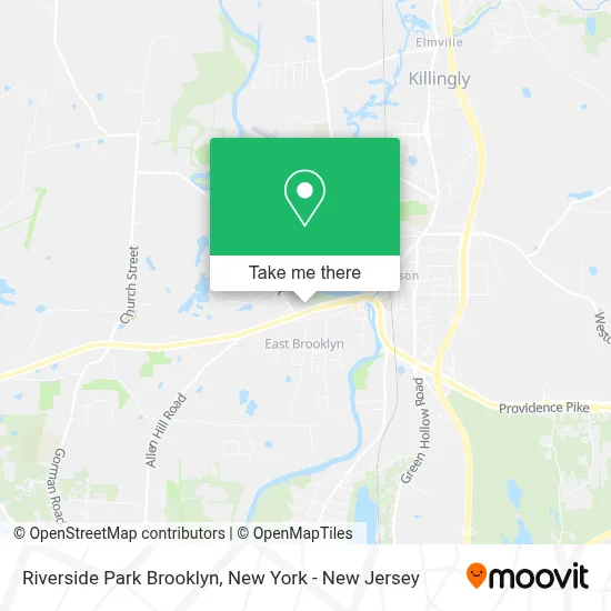
See Riverside Park Brooklyn on the map
Public Transportation to Riverside Park Brooklyn
Wondering how to get to Riverside Park Brooklyn? Moovit helps you find the best way to get to Riverside Park Brooklyn with step-by-step directions from the nearest public transit station.
Moovit provides free maps and live directions to help you navigate through your city. View schedules, routes, timetables, and find out how long does it take to get to Riverside Park Brooklyn in real time.
Looking for the nearest stop or station to Riverside Park Brooklyn? Check out this list of stops closest to your destination: Qvsc/Nddh/Salem Village.
Bus: 993, PPB, GREEN.
Want to see if there’s another route that gets you there at an earlier time? Moovit helps you find alternative routes or times. Get directions from and directions to Riverside Park Brooklyn easily from the Moovit App or Website.
We make riding to Riverside Park Brooklyn easy, which is why over 1.5 million users, including users in Brooklyn, trust Moovit as the best app for public transit. You don’t need to download an individual bus app or train app, Moovit is your all-in-one transit app that helps you find the best bus time or train time available.
For information on prices of bus and train, costs and ride fares to Riverside Park Brooklyn, please check the Moovit app.
Use the app to navigate to popular places including to the airport, hospital, stadium, grocery store, mall, coffee shop, school, college, and university.
Riverside Park Brooklyn Address: 6 Day St street in Brooklyn
- Riverbend Apartments,
- Maury Bowen Complex at Riverside Park,
- Brooklyn Riverside Little League Field,
- Kia's Plaza,
- East Coast Glam,
- Canaan Nails and Spa,
- Johnny's Pizza,
- One Stop Mini Market,
- Reese Griffin Realtor,
- Christine Costa,
- Valerie Macneil,
- Keri Roy,
- Lisa Weagle,
- Claritza Fong Torres,
- Kazantzis Real Estate,
- Brenda Engel,
- Jennifer Lehto,
- Carelot Children's Center,
- Classic Pizza Family Restaurant,
- Rr Commercial Painting
Places Near Riverside Park Brooklyn
- 66 John Street, Manhattan,
- Mountainside Hospital, Glen Ridge,
- Katz's Deli, Manhattan,
- qqqq, Manhattan,
- 911 Memorial, Manhattan,
- 1 Police Plaza, Manhattan,
- SoHo, Manhattan,
- Pier 83, Manhattan,
- Chinatown, Manhattan,
- Wall Street, Manhattan,
- Times Square, Manhattan,
- 376 Hudson Street, Manhattan,
- San Gennaro Feast, Manhattan,
- Hudson Yards, Manhattan,
- Bellevue Hospital, Manhattan,
- 3 Stone St, Manhattan,
- Queens Center Mall, Queens,
- 26 Federal Plaza, Manhattan,
- Rockefeller Center, Manhattan,
- 111 Centre New York City Supreme Court, Manhattan
How to get to popular places in New York - New Jersey with public transit
Get around Brooklyn by public transit!
Traveling around Brooklyn has never been so easy. See step by step directions as you travel to any attraction, street or major public transit station. View bus and train schedules, arrival times, service alerts and detailed routes on a map, so you know exactly how to get to anywhere in Brooklyn.
When traveling to any destination around Brooklyn use Moovit's Live Directions with Get Off Notifications to know exactly where and how far to walk, how long to wait for your line, and how many stops are left. Moovit will alert you when it's time to get off — no need to constantly re-check whether yours is the next stop.
Wondering how to use public transit in Brooklyn or how to pay for public transit in Brooklyn? Moovit public transit app can help you navigate your way with public transit easily, and at minimum cost. It includes public transit fees, ticket prices, and costs. Looking for a map of Brooklyn public transit lines? Moovit public transit app shows all public transit maps in Brooklyn with all Bus, Train, Subway, Light Rail, Ferry and Cable Car routes and stops on an interactive map.
New York - New Jersey has 6 transit type(s), including: Bus, Train, Subway, Light Rail, Ferry and Cable Car, operated by several transit agencies, including MTA Subway, Metro-North Railroad, LIRR, PATH, MTA New York City Transit - Express routes, MTA Bus, NJ Transit, NYC Ferry, NICE bus, Bee-Line Bus, NJ Transit Rail, Norwalk Transit District, Hartford Line, River Valley Transit and HART