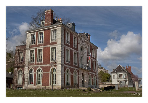
Directions to Rives en Seine (Caudebec-En-Caux) with public transportation
The following transit lines have routes that pass near Rives en Seine
 Bus: 503, 506, 530, 61, 71.
How to get to Rives en Seine by bus?
Click on the bus route to see step by step directions with maps, line arrival times and updated time schedules.
Bus stops near Rives en Seine in Caudebec-En-Caux
- Quai, 4 min walk,
- Caudebec - Quai, 5 min walk,
- Caudebec-En-Caux - Quai, 5 min walk,
Bus lines to Rives en Seine in Caudebec-En-Caux
- 61, Caudebec - Quais,
- 71, Lillebonne,
- 530, Gare Routiere,
- 530, Gare Routiere Rouen,
- 530, Rives-En-Seine,
- 503, Caudebec-En-Caux <> Yvetot,
- 506, Caudebec-En-Caux <> Le Havre,
What are the closest stations to Rives en Seine?
The closest stations to Rives en Seine are:
- Quai stop is 281 meters away, 4 min walk.
- Caudebec - Quai stop is 329 meters away, 5 min walk.
- Caudebec-En-Caux - Quai stop is 344 meters away, 5 min walk.
Which bus lines stop near Rives en Seine?
These bus lines stop near Rives en Seine: 503, 506, 530, 61.
What’s the nearest bus station to Rives en Seine in Caudebec-En-Caux?
The nearest bus station to Rives en Seine in Caudebec-En-Caux is Quai. It’s a 4 min walk away.
What time is the first bus to Rives en Seine in Caudebec-En-Caux?
The 530 is the first bus that goes to Rives en Seine in Caudebec-En-Caux. It stops nearby at 6:00 AM.
What time is the last bus to Rives en Seine in Caudebec-En-Caux?
The 530 is the last bus that goes to Rives en Seine in Caudebec-En-Caux. It stops nearby at 8:05 PM.
See Rives en Seine, Caudebec-En-Caux, on the map
Public Transit to Rives en Seine in Caudebec-En-Caux
Wondering how to get to Rives en Seine in Caudebec-En-Caux? Moovit helps you find the best way to get to Rives en Seine with step-by-step directions from the nearest public transit station.
Moovit provides free maps and live directions to help you navigate through your city. View schedules, routes, timetables, and find out how long does it take to get to Rives en Seine in real time.
Looking for the nearest stop or station to Rives en Seine? Check out this list of stops closest to your destination: Quai; Caudebec - Quai; Caudebec-En-Caux - Quai.
Bus: 503, 506, 530, 61, 71.
Want to see if there’s another route that gets you there at an earlier time? Moovit helps you find alternative routes or times. Get directions from and directions to Rives en Seine easily from the Moovit App or Website.
We make riding to Rives en Seine easy, which is why over 1.7 billion users, including users in Caudebec-En-Caux, trust Moovit as the best app for public transit. You don’t need to download an individual bus app or train app, Moovit is your all-in-one transit app that helps you find the best bus time or train time available.
For information on prices of bus and train, costs and ride fares to Rives en Seine, please check the Moovit app.
Use the app to navigate to popular places including to the airport, hospital, stadium, grocery store, mall, coffee shop, school, college, and university.
Location: Caudebec-En-Caux, Rouen
Popular routes to Rives en Seine, Caudebec-En-Caux
- Patin Jimmy Marceau,
- Notaires Rives,
- Mma Assurances Rives en Seine,
- Museoseine,
- Fromagerie d'Antan,
- Carlon,
- Maison Grangier,
- Caudebec en Caux,
- James Style,
- Pierre Transactions,
- Sam'Bott,
- Gîte du Haut des Rives,
- Création Claire Coffinet,
- Atelier Osmanthus,
- Androtech,
- Osmanthus,
- Cathedrale de Caudebec-en-Caux,
- Bar Glast Home,
- Concept Store & Fashion Shop Owlan,
- Delabarre Françoise
Places Near Rives en Seine (Caudebec-En-Caux)
- Clinique Saint-Hilaire, Rouen,
- Docks 76, Rouen,
- Centre Commercial Saint-Sever, Rouen,
- Station Saint-Sever, Rouen,
- Hyper U, Le Grand-Quevilly,
- Consultation Clinique St Hilaire, Rouen,
- Théâtre des Arts [T1,T2,T3,8,20], Rouen,
- clinique de l'europe, Rouen,
- Clinique Du Cèdre, Bois-Guillaume,
- CHU Rouen, Rouen,
- Foire St Romain, Rouen,
- Gare De Rouen, Rouen,
- Centre Henri Becquerel, Rouen,
- Zénith de Rouen, Le Grand-Quevilly,
- Saint-Hilaire, Rouen,
- Hôpital Charles Nicolle, Rouen,
- Université de Rouen, Mont-Saint-Aignan,
- Le Petit Quevilly, Le Petit-Quevilly,
- Centre Commercial Du Bois Cani, Le Grand-Quevilly,
- Jardin Des Plantes, Rouen
How to get to popular places in Rouen with public transit
Get around Caudebec-En-Caux by public transit!
Traveling around Caudebec-En-Caux has never been so easy. See step by step directions as you travel to any attraction, street or major public transit station. View bus and train schedules, arrival times, service alerts and detailed routes on a map, so you know exactly how to get to anywhere in Caudebec-En-Caux.
When traveling to any destination around Caudebec-En-Caux use Moovit's Live Directions with Get Off Notifications to know exactly where and how far to walk, how long to wait for your line, and how many stops are left. Moovit will alert you when it's time to get off — no need to constantly re-check whether yours is the next stop.
Wondering how to use public transit in Caudebec-En-Caux or how to pay for public transit in Caudebec-En-Caux? Moovit public transit app can help you navigate your way with public transit easily, and at minimum cost. It includes public transit fees, ticket prices, and costs. Looking for a map of Caudebec-En-Caux public transit lines? Moovit public transit app shows all public transit maps in Caudebec-En-Caux with all Bus, Train, Metro, Light Rail and Ferry routes and stops on an interactive map.
Rouen has 5 transit type(s), including: Bus, Train, Metro, Light Rail and Ferry, operated by several transit agencies, including Astuce (Métropole Rouen Normandie), Twisto (Caen la mer), TWISTO, LiA (Le Havre Seine Métropole), Nomad Train (SNCF, Région Normandie), Nomad Car (Région Normandie), KEOLIS, Astrobus (Lisieux Normandie), Semo (Val-de-Reuil, Louviers, Seine Eure Agglo), Rézo'Bus (Bolbec, Lillebonne, Port-Jérôme, Caux Seine Agglo), Altobus (Communauté Urbaine d'Alençon), Cap Cotentin (Cherbourg, Agglo. du Cotentin), Deep Mob (Dieppe-Maritime), SN'go! (Vernon, Les Andelys, Seine Normandie Agglo) and Transurbain (Evreux Portes de Normandie)