How to get to Riviera Beach Community Gardens by bus?
Click on the bus route to see step by step directions with maps, line arrival times and updated time schedules.
From Keiser University-West Palm Beach
75 minFrom Tanger Outlets Palm Beach
35 minFrom Whispers All Girl Staff
81 minFrom Clematis Street Historic Commercial District
42 minFrom Palm Beach County Courthouse Jurors Assembly Room
41 minFrom Amazon Fulfillment Center-DMI7
85 minFrom Mar A Lago Building
96 minFrom Mar a Lago
97 minFrom Kravis Center For the Performing Arts
59 minFrom Walmart West Palm Beach Supercenter
79 min
How to get to Riviera Beach Community Gardens by train?
Click on the train route to see step by step directions with maps, line arrival times and updated time schedules.
Bus stop near Riviera Beach Community Gardens
- MLK BLVD at AV K ST, 5 min walk,VIEW
Train station near Riviera Beach Community Gardens
- Mangonia Park Station, 56 min walk,VIEW
Bus lines to Riviera Beach Community Gardens
- 33, Rt 33 Northbound,VIEW
What are the closest stations to Riviera Beach Community Gardens?
The closest stations to Riviera Beach Community Gardens are:
- MLK BLVD at AV K ST is 340 yards away, 5 min walk.
- Mangonia Park Station is 4731 yards away, 56 min walk.
Which bus lines stop near Riviera Beach Community Gardens?
These bus lines stop near Riviera Beach Community Gardens: 1, 33.
Which train line stops near Riviera Beach Community Gardens?
TRIRAIL (Northbound To Mangonia Park)
What’s the nearest bus station to Riviera Beach Community Gardens?
The nearest bus station to Riviera Beach Community Gardens is MLK BLVD at AV K ST. It’s a 5 min walk away.
What time is the first train to Riviera Beach Community Gardens?
The TRIRAIL is the first train that goes to Riviera Beach Community Gardens. It stops nearby at 3:50 AM.
What time is the last train to Riviera Beach Community Gardens?
The TRIRAIL is the last train that goes to Riviera Beach Community Gardens. It stops nearby at 11:45 PM.
What time is the first bus to Riviera Beach Community Gardens?
The 33 is the first bus that goes to Riviera Beach Community Gardens. It stops nearby at 6:01 AM.
What time is the last bus to Riviera Beach Community Gardens?
The 33 is the last bus that goes to Riviera Beach Community Gardens. It stops nearby at 9:54 PM.
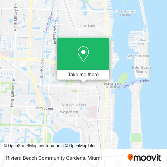
See Riviera Beach Community Gardens on the map
Public Transportation to Riviera Beach Community Gardens
Wondering how to get to Riviera Beach Community Gardens? Moovit helps you find the best way to get to Riviera Beach Community Gardens with step-by-step directions from the nearest public transit station.
Moovit provides free maps and live directions to help you navigate through your city. View schedules, routes, timetables, and find out how long does it take to get to Riviera Beach Community Gardens in real time.
Looking for the nearest stop or station to Riviera Beach Community Gardens? Check out this list of stops closest to your destination: MLK BLVD at AV K ST; Mangonia Park Station.
Bus: 1, 33.Train: TRIRAIL.
Want to see if there’s another route that gets you there at an earlier time? Moovit helps you find alternative routes or times. Get directions from and directions to Riviera Beach Community Gardens easily from the Moovit App or Website.
We make riding to Riviera Beach Community Gardens easy, which is why over 1.5 million users, including users in Riviera Beach, trust Moovit as the best app for public transit. You don’t need to download an individual bus app or train app, Moovit is your all-in-one transit app that helps you find the best bus time or train time available.
For information on prices of bus and train, costs and ride fares to Riviera Beach Community Gardens, please check the Moovit app.
Use the app to navigate to popular places including to the airport, hospital, stadium, grocery store, mall, coffee shop, school, college, and university.
Riviera Beach Community Gardens Address: 1010 W 10th St Riviera Beach, FL 33404 street in Riviera Beach
- Sunshine Plumbing Supply,
- SSC Metal Fabrication,
- Colwright Designer Delivery,
- Opella,
- Simpson Meml United Methodist CH,
- Insulation Distributors,
- Tillies,
- Pest Control Services Ants,
- ABC Riviera Lumber & Hardware,
- International BRDG Strctrl Irn,
- Teen Parent Program - Pk,
- Mullins Lumber,
- Boarderie,
- Cheeseboarder,
- National Life Insurance,
- Palm Beach Stairs, Inc.,
- TNR Lift Trucks,
- Sue's Upholstery,
- Kofi's,
- Travel Lynx Inc of Brevard County
Places Near Riviera Beach Community Gardens
- Miami Freedom Park, Miami,
- Marlins Park, Miami,
- Bayside Marketplace, Miami,
- Aventura Mall, Miami Beach,
- Dolphin Mall Bus, Miami,
- Miami VA Hospital, Miami,
- Miami-Dade County Courthouse, Miami,
- Brickell City Centre, Miami,
- Richard E. Gerstein Justice Building, Miami,
- Keiser University Flagship Campus, West Palm Beach,
- Sawgrass Mall, Miami,
- Miami Design District, Miami,
- Sawgrass mall ( FL ), Miami Beach,
- Wynwood, Miami,
- Aventura Mall, Miami,
- Port of Miami Cruise Terminal, Miami,
- Little Havana, Miami,
- Zoo Miami, Miami,
- Hard Rock Stadium, Miami Gardens,
- Dolphin Mall, Miami
How to get to popular places in Miami with public transit
Get around Riviera Beach by public transit!
Traveling around Riviera Beach has never been so easy. See step by step directions as you travel to any attraction, street or major public transit station. View bus and train schedules, arrival times, service alerts and detailed routes on a map, so you know exactly how to get to anywhere in Riviera Beach.
When traveling to any destination around Riviera Beach use Moovit's Live Directions with Get Off Notifications to know exactly where and how far to walk, how long to wait for your line, and how many stops are left. Moovit will alert you when it's time to get off — no need to constantly re-check whether yours is the next stop.
Wondering how to use public transit in Riviera Beach or how to pay for public transit in Riviera Beach? Moovit public transit app can help you navigate your way with public transit easily, and at minimum cost. It includes public transit fees, ticket prices, and costs. Looking for a map of Riviera Beach public transit lines? Moovit public transit app shows all public transit maps in Riviera Beach with all Bus, Train, Light Rail and Ferry routes and stops on an interactive map.
Miami has 4 transit type(s), including: Bus, Train, Light Rail and Ferry, operated by several transit agencies, including Broward County Transit, Miami-Dade Transit, Metrorail, Palm Tran, Tri-Rail, Brightline, MARTY, City of Homestead Trolley, Key West Transit, Treasure Coast Connector, GoLine IRT, Amtrak, Greyhound-us, FlixBus-us and Aventura Express Shuttle Bus