How to get to Rivoallon by bus?
Click on the bus route to see step by step directions with maps, line arrival times and updated time schedules.
From Clinique Terre De France, Cormontreuil
37 minFrom Beauregard, Bezannes
49 minFrom Bergelyne, Prunay
65 minFrom Bistrot de la Gare, Prunay
69 minFrom Centre Commercial Champéa, Thillois
38 minFrom Aquamoovprunay, Prunay
72 minFrom Girardin, Prunay
68 minFrom Taissy, Taissy
36 minFrom Mcdonald's, Tinqueux
37 minFrom Axial, Taissy
49 min
Bus stops near Rivoallon in Reims
Light Rail stations near Rivoallon in Reims
- Langlet, 5 min walk,VIEW
Bus lines to Rivoallon in Reims
What are the closest stations to Rivoallon?
The closest stations to Rivoallon are:
- Bel Air is 253 meters away, 4 min walk.
- Langlet is 321 meters away, 5 min walk.
- C.C. Cernay is 384 meters away, 6 min walk.
- Strasbourg is 523 meters away, 7 min walk.
- Sebastopol is 533 meters away, 7 min walk.
- Brouette is 635 meters away, 9 min walk.
Which bus line stops near Rivoallon?
U2 (Route De Witry)
What’s the nearest light rail station to Rivoallon in Reims?
The nearest light rail station to Rivoallon in Reims is Langlet. It’s a 5 min walk away.
What’s the nearest bus station to Rivoallon in Reims?
The nearest bus station to Rivoallon in Reims is Bel Air. It’s a 4 min walk away.
What time is the first light rail to Rivoallon in Reims?
The TRAM is the first light rail that goes to Rivoallon in Reims. It stops nearby at 5:14 AM.
What time is the last light rail to Rivoallon in Reims?
The TRAM is the last light rail that goes to Rivoallon in Reims. It stops nearby at 12:57 AM.
What time is the first bus to Rivoallon in Reims?
The U1 is the first bus that goes to Rivoallon in Reims. It stops nearby at 5:15 AM.
What time is the last bus to Rivoallon in Reims?
The U2 is the last bus that goes to Rivoallon in Reims. It stops nearby at 12:51 AM.
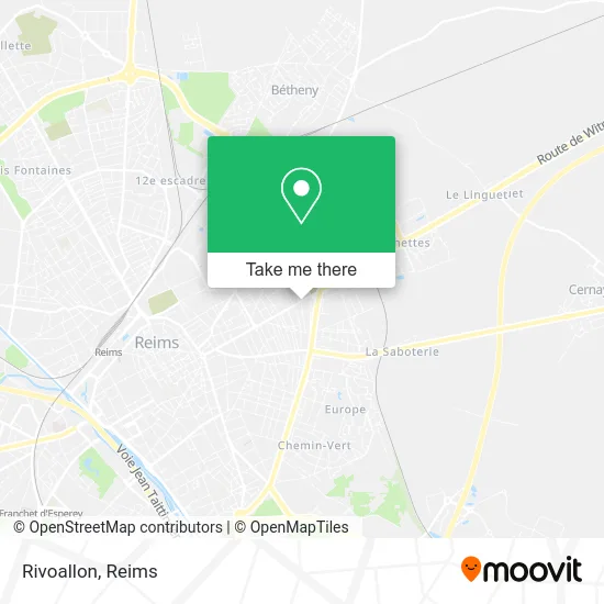
See Rivoallon, Reims, on the map
Public Transit to Rivoallon in Reims
Wondering how to get to Rivoallon in Reims? Moovit helps you find the best way to get to Rivoallon with step-by-step directions from the nearest public transit station.
Moovit provides free maps and live directions to help you navigate through your city. View schedules, routes, timetables, and find out how long does it take to get to Rivoallon in real time.
Looking for the nearest stop or station to Rivoallon? Check out this list of stops closest to your destination: Bel Air; Langlet; C.C. Cernay; Strasbourg; Sebastopol; Brouette.
Bus: U2, 20, 22, U1, U3, E2, U8, 23, E4, E3.
Want to see if there’s another route that gets you there at an earlier time? Moovit helps you find alternative routes or times. Get directions from and directions to Rivoallon easily from the Moovit App or Website.
We make riding to Rivoallon easy, which is why over 1.5 million users, including users in Reims, trust Moovit as the best app for public transit. You don’t need to download an individual bus app or train app, Moovit is your all-in-one transit app that helps you find the best bus time or train time available.
For information on prices of bus, costs and ride fares to Rivoallon, please check the Moovit app.
Use the app to navigate to popular places including to the airport, hospital, stadium, grocery store, mall, coffee shop, school, college, and university.
Rivoallon Address: 226 Avenue Jean Jaurès 51100 Reims street in Reims
- Sushi Thaï,
- Plurial Novilia,
- Al Firdaous,
- Les Arts de la Taille,
- Les Délices du Renard,
- Marbrerie Pechenard,
- Brasserie Lucida,
- Babil,
- Phybris,
- Unibeo Piscines 51,
- Si Mon Image. Photographe,
- Asie 51,
- Axa Assurance Mohamed el Haouari,
- Eco Pest Conseil,
- Cimetière De L'Est,
- Alkéos Rénovation,
- Orrpa,
- Espace Missionnaire Reims-Est,
- Perraudin Geraldine,
- Chez Christelle
Places Near Rivoallon (Reims)
- St Remi, Reims,
- Cormontreuil, Reims,
- Parc Des Expositions, Reims,
- E. Leclerc Champfleury, Champfleury,
- Polyclinique Reims Bezannes, Bezannes,
- Hôpital Maison Blanche, Reims,
- La Neuvillette, Reims,
- Campus Croix Rouge, Reims,
- Carrefour, Tinqueux,
- Croix Blandin, Reims,
- Bezannes, Bezannes,
- Moulin De La Housse, Reims,
- CHU, Reims,
- Tinqueux, Tinqueux,
- Parc de Champagne, Reims,
- Hôpital Debré, Reims,
- Gare Tgv, Bezannes,
- Bétheny, Bétheny,
- Ikea, Thillois,
- Leclerc, Saint-Brice-Courcelles
How to get to popular places in Reims with public transit
Get around Reims by public transit!
Traveling around Reims has never been so easy. See step by step directions as you travel to any attraction, street or major public transit station. View bus and train schedules, arrival times, service alerts and detailed routes on a map, so you know exactly how to get to anywhere in Reims.
When traveling to any destination around Reims use Moovit's Live Directions with Get Off Notifications to know exactly where and how far to walk, how long to wait for your line, and how many stops are left. Moovit will alert you when it's time to get off — no need to constantly re-check whether yours is the next stop.
Wondering how to use public transit in Reims or how to pay for public transit in Reims? Moovit public transit app can help you navigate your way with public transit easily, and at minimum cost. It includes public transit fees, ticket prices, and costs. Looking for a map of Reims public transit lines? Moovit public transit app shows all public transit maps in Reims with all Bus and Light Rail routes and stops on an interactive map.
Reims has 2 transit type(s), including: Bus and Light Rail, operated by several transit agencies, including Transdev Reims