How to get to Rivoli by bus?
Click on the bus route to see step by step directions with maps, line arrival times and updated time schedules.
Bus stops near Rivoli
Bus lines to Rivoli
- 36N, School Route 2 Rivoli Castle,VIEW
- 68, Condove,VIEW
- 87, Avigliana,VIEW
- 91, Rubiana,VIEW
- 432, Rivoli Hospital,VIEW
- 224, Grugliasco,VIEW
- 246, La Cassa - Primo Maggio Square,VIEW
- 248, Rivoli - Darwin Science High School,VIEW
- 274, Turin - Corso Francia Corner Via Pasteur,VIEW
- 286, Oulx - Railway Station,VIEW
What are the closest stations to Rivoli?
The closest stations to Rivoli are:
- Salvemini Park is 201 meters away, 3 min walk.
- Rivoli - Alpignano Street - Monte Nero Street is 235 meters away, 4 min walk.
- Rivoli - Susa Avenue - Old Post is 254 meters away, 4 min walk.
- Rivoli - Enel - Corso Susa 20-22 is 712 meters away, 10 min walk.
Which bus lines stop near Rivoli?
These bus lines stop near Rivoli: 17, 286, 36N, 432, 68.
What’s the nearest bus station to Rivoli?
The nearest bus station to Rivoli is Salvemini Park. It’s a 3 min walk away.
What time is the first bus to Rivoli?
The 248 is the first bus that goes to Rivoli. It stops nearby at 6:56 AM.
What time is the last bus to Rivoli?
The 432 is the last bus that goes to Rivoli. It stops nearby at 8:15 PM.
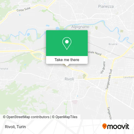
See Rivoli on the map
Public Transportation to Rivoli
Wondering how to get to Rivoli? Moovit helps you find the best way to get to Rivoli with step-by-step directions from the nearest public transit station.
Moovit provides free maps and live directions to help you navigate through your city. View schedules, routes, timetables, and find out how long does it take to get to Rivoli in real time.
Looking for the nearest stop or station to Rivoli? Check out this list of stops closest to your destination: Salvemini Park; Rivoli - Alpignano Street - Monte Nero Street; Rivoli - Susa Avenue - Old Post; Rivoli - Enel - Corso Susa 20-22.
Bus: 17, 286, 36N, 432, 68, 87, 91, 224, 246, 248, 274.
Want to see if there’s another route that gets you there at an earlier time? Moovit helps you find alternative routes or times. Get directions from and directions to Rivoli easily from the Moovit App or Website.
We make riding to Rivoli easy, which is why over 1.5 million users, including users in Rivoli, trust Moovit as the best app for public transit. You don’t need to download an individual bus app or train app, Moovit is your all-in-one transit app that helps you find the best bus time or train time available.
For information on prices of bus and metro, costs and ride fares to Rivoli, please check the Moovit app.
Use the app to navigate to popular places including to the airport, hospital, stadium, grocery store, mall, coffee shop, school, college, and university.
Rivoli Address: Monte Cimone Street street in Rivoli
- Item Installations by Antonio Vitale,
- Bertoglio Bruno,
- Mensio Meat Shop,
- Delfino Heliography by Galetti and Ruzza,
- Labor Pavimenti by Cocciolo E. & C.,
- Ortopedics and Medical Supplies by Fernanda Memo Barbara,
- Saporì Gastronomy,
- Saer Sas by Amore Carmelo & Co.,
- Davi Dr. Giovanni Francesco,
- Arcapet,
- International Pharmacy Rivoli,
- Gieffe by Brondolo Roberto e C.,
- Market,
- Caffe Posta Vecchia,
- Bruno by Bruno Antonio & C.,
- Between Restaurant,
- Susa Avenue 128,
- Susa Street, 145,
- G. Salvemini Park,
- Bio Bistro
Places Near Rivoli
- CDC Via Grazioli 11, Turin,
- Castle Square, Turin,
- Shopville Le Gru, Grugliasco,
- Regina Margherita Children's Hospital, Turin,
- CTO Hospital, Turin,
- Mauriziano Hospital, Turin,
- Cavour Street 31, Turin,
- San Luigi Hospital, Orbassano,
- Sant'Anna Hospital, Turin,
- New Gate, Turin,
- Porta Palazzo, Turin,
- Porta Susa, Turin,
- Martini Hospital, Turin,
- Prarostino Street 10/A, Turin,
- Koelliker Hospital, Turin,
- Le Gru, Grugliasco,
- Pacchiotti Giacinto Street 4, Turin,
- Arturo Farinelli Street 25, Turin,
- San Giovanni Bosco Hospital, Turin,
- Molinette Hospital, Turin
How to get to popular places in Turin with public transit
Get around Rivoli by public transit!
Traveling around Rivoli has never been so easy. See step by step directions as you travel to any attraction, street or major public transit station. View bus and train schedules, arrival times, service alerts and detailed routes on a map, so you know exactly how to get to anywhere in Rivoli.
When traveling to any destination around Rivoli use Moovit's Live Directions with Get Off Notifications to know exactly where and how far to walk, how long to wait for your line, and how many stops are left. Moovit will alert you when it's time to get off — no need to constantly re-check whether yours is the next stop.
Wondering how to use public transit in Rivoli or how to pay for public transit in Rivoli? Moovit public transit app can help you navigate your way with public transit easily, and at minimum cost. It includes public transit fees, ticket prices, and costs. Looking for a map of Rivoli public transit lines? Moovit public transit app shows all public transit maps in Rivoli with all Bus, Train, Metro, Light Rail, Funicular and Gondola routes and stops on an interactive map.
Turin has 6 transit type(s), including: Bus, Train, Metro, Light Rail, Funicular and Gondola, operated by several transit agencies, including GTT Urban Service, GTT Suburban Service, GTT Tourist Services, Trenitalia, Arenaways, Sadem, Cavourese, Grandabus Consortium, Bus Company - GrandaBus, Bus Company, Gelosobus, Nuova S.a.a.r., SAC, Giors Bus Lines and Allasia Bus Lines