Directions to Riya Enterprises (Pune & Velhe) with public transportation
The following transit lines have routes that pass near Riya Enterprises
 Bus: K14.
How to get to Riya Enterprises by bus?
Click on the bus route to see step by step directions with maps, line arrival times and updated time schedules.
From Gandhi Bhavan Mahatma Society, Pune & Velhe
67 minFrom Balaji Nagar, Pune & Velhe
72 minFrom RMD Sinhgad Warje Campus, Pune & Velhe
51 minFrom Bank of Maharashtra-Shivaji Nagar, Pune & Velhe
73 minFrom Pune Railway Station, Pune & Velhe
52 minFrom Sadashiv Peth, Pune & Velhe
47 minFrom Platforms 4 & 5, Pune & Velhe
54 minFrom 7 Loves Chowk, Pune & Velhe
40 minFrom Dutch Palace, Pune & Velhe
51 minFrom Jijamata Udyan, Pune & Velhe
40 min
Bus stop near Riya Enterprises in Pune & Velhe
- Narmada Nagar / Nibalkar Wasti, 5 min walk,VIEW
Bus lines to Riya Enterprises in Pune & Velhe
- K14, Gujarwadi,VIEW
What are the closest stations to Riya Enterprises?
The closest stations to Riya Enterprises are:
- Narmada Nagar / Nibalkar Wasti is 307 meters away, 5 min walk.
Which bus line stops near Riya Enterprises?
K14 (Gujarwadi)
What’s the nearest bus station to Riya Enterprises in Pune & Velhe?
The nearest bus station to Riya Enterprises in Pune & Velhe is Narmada Nagar / Nibalkar Wasti. It’s a 5 min walk away.
What time is the first bus to Riya Enterprises in Pune & Velhe?
The K14 is the first bus that goes to Riya Enterprises in Pune & Velhe. It stops nearby at 6:28 AM.
What time is the last bus to Riya Enterprises in Pune & Velhe?
The K14 is the last bus that goes to Riya Enterprises in Pune & Velhe. It stops nearby at 10:04 PM.
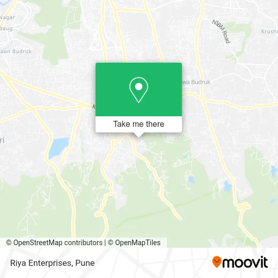
See Riya Enterprises, Pune & Velhe, on the map
Public Transit to Riya Enterprises in Pune & Velhe
Wondering how to get to Riya Enterprises in Pune & Velhe? Moovit helps you find the best way to get to Riya Enterprises with step-by-step directions from the nearest public transit station.
Moovit provides free maps and live directions to help you navigate through your city. View schedules, routes, timetables, and find out how long does it take to get to Riya Enterprises in real time.
Looking for the nearest stop or station to Riya Enterprises? Check out this list of stops closest to your destination: Narmada Nagar / Nibalkar Wasti.
Bus: K14.
Want to see if there’s another route that gets you there at an earlier time? Moovit helps you find alternative routes or times. Get directions from and directions to Riya Enterprises easily from the Moovit App or Website.
We make riding to Riya Enterprises easy, which is why over 1.5 million users, including users in Pune & Velhe, trust Moovit as the best app for public transit. You don’t need to download an individual bus app or train app, Moovit is your all-in-one transit app that helps you find the best bus time or train time available.
For information on prices of bus, costs and ride fares to Riya Enterprises, please check the Moovit app.
Use the app to navigate to popular places including to the airport, hospital, stadium, grocery store, mall, coffee shop, school, college, and university.
Riya Enterprises Address: हवेली 411046 MH street in Pune & Velhe
- Sumedhraje Enterprises,
- Seagull,
- Blessing Drawing Class,
- Esperto Preschool,
- Mahalaxmi Developers,
- Nisarg Residency Gate 2,
- Sai Gajanan Palace,
- Mahalakshmi Residency,
- Speed Automation,
- Mahalakshmi Rasodese,
- Venkateshwar Residential,
- Sarthak Residency,
- Nimbalkar Wasti-Sopankaka Nagar,
- Sahyadri Hills,
- Gurudatt Krupa C Wing,
- Pranav Kirana,
- Arju Traders,
- Shri the Perfect Print,
- Sai Balaji Heights,
- Swami Samarth Food Products
Places Near Riya Enterprises (Pune & Velhe)
- Symbiosis Lavale Bus Stop, Pune & Velhe,
- M G Road, Pune & Velhe,
- Cognizant Deccan Campus (CDC), Paud,
- BAPS Shri Swaminarayan Mandir, Pune & Velhe,
- Laxmi Road, Pune & Velhe,
- Westend Mall, Pune & Velhe,
- Sarasbaug, Pune & Velhe,
- ISKCON Nvcc Temple, Pune & Velhe,
- Vishwakarma Institute Of Technology (Vit), Pune & Velhe,
- ISKCON Pune, Pune & Velhe,
- Tulshibaug, Pune & Velhe,
- Dagadusheth Halwai Ganapati Temple, Pune & Velhe,
- Senapati Bapat Road, Pune & Velhe,
- Ion Digital Zone, Pune & Velhe,
- Pvr Icon - Pavilion Mall, Pune & Velhe,
- Dagdusheth Halwai Ganpati Mandir, Pune & Velhe,
- Pune Okayama Friendship Garden, Pune & Velhe,
- Swaminarayan Mandir, Pune & Velhe,
- Fc Road, Pune & Velhe,
- Chaturshringi Temple, Pune & Velhe
How to get to popular places in Pune with public transit
Get around Pune & Velhe by public transit!
Traveling around Pune & Velhe has never been so easy. See step by step directions as you travel to any attraction, street or major public transit station. View bus and train schedules, arrival times, service alerts and detailed routes on a map, so you know exactly how to get to anywhere in Pune & Velhe.
When traveling to any destination around Pune & Velhe use Moovit's Live Directions with Get Off Notifications to know exactly where and how far to walk, how long to wait for your line, and how many stops are left. Moovit will alert you when it's time to get off — no need to constantly re-check whether yours is the next stop.
Wondering how to use public transit in Pune & Velhe or how to pay for public transit in Pune & Velhe? Moovit public transit app can help you navigate your way with public transit easily, and at minimum cost. It includes public transit fees, ticket prices, and costs. Looking for a map of Pune & Velhe public transit lines? Moovit public transit app shows all public transit maps in Pune & Velhe with all Bus, Train and Metro routes and stops on an interactive map.
Pune has 3 transit type(s), including: Bus, Train and Metro, operated by several transit agencies, including Pune Metro (Maha Metro), PMPML, PMPML Night Bus Service (Ratrani) and Central Railways (Indian Railways)