Directions to Rizaldos Sanchez Emilio (Pantoja) with public transportation
The following transit lines have routes that pass near Rizaldos Sanchez Emilio
 Bus: VAC152.
How to get to Rizaldos Sanchez Emilio by bus?
Click on the bus route to see step by step directions with maps, line arrival times and updated time schedules.
From Hospital Infanta Cristina., Área Metropolitana De Madrid Y Corredor Del Henares
148 minFrom FABRIK, Humanes De Madrid
139 minFrom Centro Logístico El Corte Inglés, Valdemoro
149 minFrom Balneario Thermas De Griñón, Comarca Sur
136 minFrom Parla, Madrid, Parla
45 minFrom Loranca, Área Metropolitana De Madrid Y Corredor Del Henares
84 minFrom Recinto Ferial de Fuenlabrada, Fuenlabrada
110 minFrom Desguaces La Torre, Comarca Sur
44 minFrom Cobo Calleja, Fuenlabrada
82 minFrom Hospital Universitario Infanta Elena, Valdemoro
147 min
Bus stop near Rizaldos Sanchez Emilio in Pantoja
- Avda. Portugal - Pantoja, 3 min walk,VIEW
Bus lines to Rizaldos Sanchez Emilio in Pantoja
- VAC152, 017: Toledo (por Añover de Tajo),VIEW
What are the closest stations to Rizaldos Sanchez Emilio?
The closest stations to Rizaldos Sanchez Emilio are:
- Avda. Portugal - Pantoja is 202 meters away, 3 min walk.
Which bus line stops near Rizaldos Sanchez Emilio?
VAC152 (017: Toledo (por Añover de Tajo))
What’s the nearest bus station to Rizaldos Sanchez Emilio in Pantoja?
The nearest bus station to Rizaldos Sanchez Emilio in Pantoja is Avda. Portugal - Pantoja. It’s a 3 min walk away.
What time is the first bus to Rizaldos Sanchez Emilio in Pantoja?
The VAC152 is the first bus that goes to Rizaldos Sanchez Emilio in Pantoja. It stops nearby at 7:39 AM.
What time is the last bus to Rizaldos Sanchez Emilio in Pantoja?
The VAC152 is the last bus that goes to Rizaldos Sanchez Emilio in Pantoja. It stops nearby at 9:15 PM.
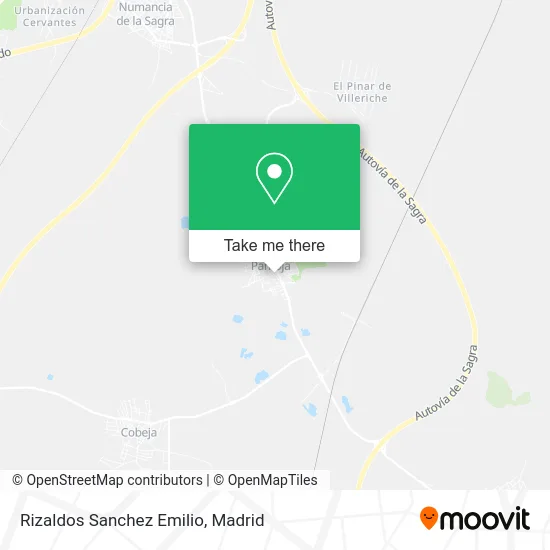
See Rizaldos Sanchez Emilio, Pantoja, on the map
Public Transit to Rizaldos Sanchez Emilio in Pantoja
Wondering how to get to Rizaldos Sanchez Emilio in Pantoja? Moovit helps you find the best way to get to Rizaldos Sanchez Emilio with step-by-step directions from the nearest public transit station.
Moovit provides free maps and live directions to help you navigate through your city. View schedules, routes, timetables, and find out how long does it take to get to Rizaldos Sanchez Emilio in real time.
Looking for the nearest stop or station to Rizaldos Sanchez Emilio? Check out this list of stops closest to your destination: Avda. Portugal - Pantoja.
Bus: VAC152.
Want to see if there’s another route that gets you there at an earlier time? Moovit helps you find alternative routes or times. Get directions from and directions to Rizaldos Sanchez Emilio easily from the Moovit App or Website.
We make riding to Rizaldos Sanchez Emilio easy, which is why over 1.5 million users, including users in Pantoja, trust Moovit as the best app for public transit. You don’t need to download an individual bus app or train app, Moovit is your all-in-one transit app that helps you find the best bus time or train time available.
For information on prices of bus and train, costs and ride fares to Rizaldos Sanchez Emilio, please check the Moovit app.
Use the app to navigate to popular places including to the airport, hospital, stadium, grocery store, mall, coffee shop, school, college, and university.
Location: Pantoja, Madrid
- Styl Baño XXI,
- Cafetería Rizaldos Rizaldos Sánchez,
- Piedras Toledo,
- Pastelería Artesana El Carmen,
- Hormicemex,
- Terrazas Oasis,
- Santander,
- Banco Español De Credito S.a.,
- Avenida Estación, 2,
- Opegasa,
- Gráficas Vallejo,
- Los Ángeles,
- Serichrome S.l.,
- Isaac Rodríguez Campanero,
- Peluquería Myriam,
- Terraza Bar,
- Bar Oasis,
- Carpinteria Jerez Cb,
- Únicaja,
- Liberbank
Places Near Rizaldos Sanchez Emilio (Pantoja)
- Plaza Mayor, Madrid,
- Mendez Alvaro, Madrid,
- Centro Comercial La Gavia, Área Metropolitana De Madrid Y Corredor Del Henares,
- Centro Comercial Islazul, Área Metropolitana De Madrid Y Corredor Del Henares,
- Calle de López de Hoyos 169, Madrid,
- Plenilunio, Área Metropolitana De Madrid Y Corredor Del Henares,
- Centro Comercial La Vaguada, Área Metropolitana De Madrid Y Corredor Del Henares,
- Hospital Universitario La Paz, Madrid,
- Centro Comercial Oasiz Madrid, Área Metropolitana De Madrid Y Corredor Del Henares,
- Sala La Riviera, Madrid,
- Nassica, Área Metropolitana De Madrid Y Corredor Del Henares,
- Rastro De Madrid, Área Metropolitana De Madrid Y Corredor Del Henares,
- Mercadillo de Majadahonda, Majadahonda,
- Hospital Universitario Ramón y Cajal, Madrid,
- Hospital Clínico Universitario San Carlos, Madrid,
- Estadio Wanda Metropolitano, Área Metropolitana De Madrid Y Corredor Del Henares,
- Palacio De Vistalegre, Área Metropolitana De Madrid Y Corredor Del Henares,
- Tres Aguas, Alcorcón,
- Wizink Center, Madrid,
- Estacion de Chamartin, Madrid
How to get to popular places in Madrid with public transit
Get around Pantoja by public transit!
Traveling around Pantoja has never been so easy. See step by step directions as you travel to any attraction, street or major public transit station. View bus and train schedules, arrival times, service alerts and detailed routes on a map, so you know exactly how to get to anywhere in Pantoja.
When traveling to any destination around Pantoja use Moovit's Live Directions with Get Off Notifications to know exactly where and how far to walk, how long to wait for your line, and how many stops are left. Moovit will alert you when it's time to get off — no need to constantly re-check whether yours is the next stop.
Wondering how to use public transit in Pantoja or how to pay for public transit in Pantoja? Moovit public transit app can help you navigate your way with public transit easily, and at minimum cost. It includes public transit fees, ticket prices, and costs. Looking for a map of Pantoja public transit lines? Moovit public transit app shows all public transit maps in Pantoja with all Bus, Train, Metro and Light Rail routes and stops on an interactive map.
Madrid has 4 transit type(s), including: Bus, Train, Metro and Light Rail, operated by several transit agencies, including Metro de Madrid, Metro Ligero, Tranvía de Parla, Renfe Cercanías - Servicios de Autobús especiales, Renfe Cercanias, Renfe Cercanías, EMT, Interurbanos, Urbanos de Alcalá de Henares, Urbanos de Alcobendas, Urbanos de Alcorcón, Urbanos de Algete, Urbanos de Aranjuez, Urbanos de Arganda del Rey and Urbanos de Arroyomolinos