How to get to Rize Credit Union by bus?
Click on the bus route to see step by step directions with maps, line arrival times and updated time schedules.
From 18b Arts District of Las Vegas, Las Vegas
36 minFrom Four Queens Hotel and Casino Las Vegas, Las Vegas
28 minFrom 18b Arts District, Las Vegas
34 minFrom The Strip & Downtown Express Bus Stop, Las Vegas
26 minFrom Valley Hospital Medical Center, Las Vegas
41 minFrom Las Vegas Arts District, Las Vegas
34 minFrom Smith Center For the Performing Arts, Las Vegas
34 minFrom Charleston And Eastern, Las Vegas
49 minFrom Walmart at Charleston, Las Vegas
35 minFrom W Tropical Pkwy, Las Vegas
66 min
Bus stops near Rize Credit Union in North Las Vegas
Bus lines to Rize Credit Union in North Las Vegas
What are the closest stations to Rize Credit Union?
The closest stations to Rize Credit Union are:
- Sb Losee After Washburn is 405 yards away, 5 min walk.
- Wb Craig After Bruce is 577 yards away, 8 min walk.
Which bus line stops near Rize Credit Union?
DVX (Downtown & Veteran Medical Center Express Northbound)
What’s the nearest bus station to Rize Credit Union in North Las Vegas?
The nearest bus station to Rize Credit Union in North Las Vegas is Sb Losee After Washburn. It’s a 5 min walk away.
What time is the first bus to Rize Credit Union in North Las Vegas?
The DVX is the first bus that goes to Rize Credit Union in North Las Vegas. It stops nearby at 4:22 AM.
What time is the last bus to Rize Credit Union in North Las Vegas?
The 219 is the last bus that goes to Rize Credit Union in North Las Vegas. It stops nearby at 1:31 AM.
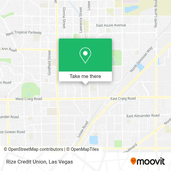
See Rize Credit Union, North Las Vegas, on the map
Public Transit to Rize Credit Union in North Las Vegas
Wondering how to get to Rize Credit Union in North Las Vegas? Moovit helps you find the best way to get to Rize Credit Union with step-by-step directions from the nearest public transit station.
Moovit provides free maps and live directions to help you navigate through your city. View schedules, routes, timetables, and find out how long does it take to get to Rize Credit Union in real time.
Looking for the nearest stop or station to Rize Credit Union? Check out this list of stops closest to your destination: Sb Losee After Washburn; Wb Craig After Bruce.
Bus: DVX, 219.
Want to see if there’s another route that gets you there at an earlier time? Moovit helps you find alternative routes or times. Get directions from and directions to Rize Credit Union easily from the Moovit App or Website.
We make riding to Rize Credit Union easy, which is why over 1.7 million users, including users in North Las Vegas, trust Moovit as the best app for public transit. You don’t need to download an individual bus app or train app, Moovit is your all-in-one transit app that helps you find the best bus time or train time available.
For information on prices of bus, costs and ride fares to Rize Credit Union, please check the Moovit app.
Use the app to navigate to popular places including to the airport, hospital, stadium, grocery store, mall, coffee shop, school, college, and university.
Rize Credit Union Address: 2215 E Lone Mountain Rd street in North Las Vegas
- Somerset Academy Losee,
- Raising Cane's (Raising Canes Craig Road),
- East Craig,
- Cannery Casino & Hotel,
- Losee Rd / E Craig Rd,
- Cannery Hotel & Casino,
- Sahara Resorts,
- E Lone Mountain Rd,
- Texas Roadhouse,
- Olive Garden,
- In-N-Out Burger,
- E Craig Rd / Donna St,
- Amazon Fulfillment Center-DLV2,
- N 5th St,
- DMV,
- Shadow Creek Golf Course,
- Losee Rd / E Ann Rd,
- Mojave High School,
- Overhead Door,
- Pecos @ Craig (S)
Places Near Rize Credit Union (North Las Vegas)
- Arte Museum Las Vegas, Paradise,
- Walmart Supercenter, Las Vegas,
- Las Vegas South Premium Outlets, Enterprise,
- Walmart, Las Vegas,
- Trump International Hotel Las Vegas, Paradise,
- The Neon Museum, Las Vegas,
- Koolsville Tattoos, Las Vegas,
- The Palms Casino Resort, Paradise,
- Omega Mart, Las Vegas,
- Gold & Silver Pawn Shop, Las Vegas,
- Town Square, Enterprise,
- Lee Canyon, Las Vegas,
- Allegiant Stadium, Paradise,
- The Deuce Bus Stop at Fremont St, Las Vegas,
- Area15, Las Vegas,
- Meow Wolf - Las Vegas (Meow Wolf's Omega Mart), Las Vegas,
- Welcome To Fabulous Las Vegas Sign, Paradise,
- Las Vegas North Premium Outlets, Las Vegas,
- Las Vegas Premium Outlets-North, Enterprise,
- Zak Bagans Haunted Museum, Las Vegas
How to get to popular places in Las Vegas with public transit
Get around North Las Vegas by public transit!
Traveling around North Las Vegas has never been so easy. See step by step directions as you travel to any attraction, street or major public transit station. View bus and train schedules, arrival times, service alerts and detailed routes on a map, so you know exactly how to get to anywhere in North Las Vegas.
When traveling to any destination around North Las Vegas use Moovit's Live Directions with Get Off Notifications to know exactly where and how far to walk, how long to wait for your line, and how many stops are left. Moovit will alert you when it's time to get off — no need to constantly re-check whether yours is the next stop.
Wondering how to use public transit in North Las Vegas or how to pay for public transit in North Las Vegas? Moovit public transit app can help you navigate your way with public transit easily, and at minimum cost. It includes public transit fees, ticket prices, and costs. Looking for a map of North Las Vegas public transit lines? Moovit public transit app shows all public transit maps in North Las Vegas with all Bus and Monorail routes and stops on an interactive map.
Las Vegas has 2 transit type(s), including: Bus and Monorail, operated by several transit agencies, including RTCSNV, City of Las Vegas, Alvand Transportation, Vegas Airporter, Las Vegas Monorail, FlixBus-us and Greyhound-us