Directions to Rizing (Stamford) with public transportation
The following transit lines have routes that pass near Rizing
 Bus: 311, 324, 345, 971, 321.
- Train: 3, NORTHEAST REGIONAL, 4, ACELA, COMMUTER RAIL.
How to get to Rizing by bus?
Click on the bus route to see step by step directions with maps, line arrival times and updated time schedules.
From Rye Playland, Rye
84 minFrom New Rochelle, NY, New Rochelle
90 minFrom GFFF, Stamford
32 minFrom Westchester Mall, White Plains
40 minFrom The Sono Collection, Norwalk
58 minFrom Port Chester, NY, Port Chester
58 minFrom Mamaroneck NY, Mamaroneck
99 minFrom White Plains, NY, White Plains
39 minFrom Elmsford, NY, Elmsford
61 min
How to get to Rizing by train?
Click on the train route to see step by step directions with maps, line arrival times and updated time schedules.
Bus stops near Rizing in Stamford
Bus lines to Rizing in Stamford
What are the closest stations to Rizing?
The closest stations to Rizing are:
- Fairfield Ave @ First Stamford Pl is 350 yards away, 5 min walk.
- Fairfield Ave @ Jackson St is 387 yards away, 5 min walk.
- Washington Blvd @ W Henry St is 732 yards away, 9 min walk.
- Riverside is 2534 yards away, 30 min walk.
- Stamford is 3456 yards away, 41 min walk.
Which bus lines stop near Rizing?
These bus lines stop near Rizing: 311, 324, 345, 971.
Which train lines stop near Rizing?
These train lines stop near Rizing: 3, NORTHEAST REGIONAL.
What’s the nearest train station to Rizing in Stamford?
The nearest train station to Rizing in Stamford is Riverside. It’s a 30 min walk away.
What’s the nearest bus station to Rizing in Stamford?
The nearest bus stations to Rizing in Stamford are Fairfield Ave @ First Stamford Pl and Fairfield Ave @ Jackson St. The closest one is a 5 min walk away.
What time is the first train to Rizing in Stamford?
The 3 is the first train that goes to Rizing in Stamford. It stops nearby at 3:02 AM.
What time is the last train to Rizing in Stamford?
The 3 is the last train that goes to Rizing in Stamford. It stops nearby at 3:02 AM.
What time is the first bus to Rizing in Stamford?
The 324 is the first bus that goes to Rizing in Stamford. It stops nearby at 5:27 AM.
What time is the last bus to Rizing in Stamford?
The 326 is the last bus that goes to Rizing in Stamford. It stops nearby at 12:11 AM.
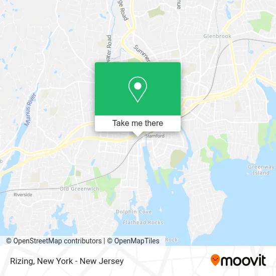
See Rizing, Stamford, on the map
Public Transit to Rizing in Stamford
Wondering how to get to Rizing in Stamford? Moovit helps you find the best way to get to Rizing with step-by-step directions from the nearest public transit station.
Moovit provides free maps and live directions to help you navigate through your city. View schedules, routes, timetables, and find out how long does it take to get to Rizing in real time.
Looking for the nearest stop or station to Rizing? Check out this list of stops closest to your destination: Fairfield Ave @ First Stamford Pl; Fairfield Ave @ Jackson St; Washington Blvd @ W Henry St; Riverside; Stamford.
Bus: 311, 324, 345, 971, 321, 326.Train: 3, NORTHEAST REGIONAL, 4, ACELA, COMMUTER RAIL, VERMONTER, 5.
Want to see if there’s another route that gets you there at an earlier time? Moovit helps you find alternative routes or times. Get directions from and directions to Rizing easily from the Moovit App or Website.
We make riding to Rizing easy, which is why over 1.5 million users, including users in Stamford, trust Moovit as the best app for public transit. You don’t need to download an individual bus app or train app, Moovit is your all-in-one transit app that helps you find the best bus time or train time available.
For information on prices of bus and train, costs and ride fares to Rizing, please check the Moovit app.
Use the app to navigate to popular places including to the airport, hospital, stadium, grocery store, mall, coffee shop, school, college, and university.
Rizing Address: 300 Stamford Pl street in Stamford
- Cam North America,
- Asc Advisors Llc,
- Novitex,
- Paycom Stamford,
- Landmark Group,
- Forevermark,
- Ey,
- Pet Accessories,
- The Guardian Life Insurance Company Of America,
- Details Matter,
- Arch Insurance Group,
- Benistar Limited,
- First Stamford Barber and Beauty Salon,
- Renaissance Capital,
- Burger Creations,
- Sea-Doo,
- Asc Surgical Center,
- Tri Tech,
- Propark America,
- Airgas Branch
Places Near Rizing (Stamford)
- Rockefeller Center, Manhattan,
- Queens Center Mall, Queens,
- 1 Police Plaza, Manhattan,
- Times Square, Manhattan,
- SoHo, Manhattan,
- 3 Stone St, Manhattan,
- Bellevue Hospital, Manhattan,
- 111 Centre New York City Supreme Court, Manhattan,
- 26 Federal Plaza, Manhattan,
- Mountainside Hospital, Glen Ridge,
- 376 Hudson Street, Manhattan,
- Hudson Yards, Manhattan,
- Wall Street, Manhattan,
- San Gennaro Feast, Manhattan,
- Katz's Deli, Manhattan,
- Chinatown, Manhattan,
- 911 Memorial, Manhattan,
- 66 John Street, Manhattan,
- Pier 83, Manhattan,
- qqqq, Manhattan
How to get to popular places in New York - New Jersey with public transit
Get around Stamford by public transit!
Traveling around Stamford has never been so easy. See step by step directions as you travel to any attraction, street or major public transit station. View bus and train schedules, arrival times, service alerts and detailed routes on a map, so you know exactly how to get to anywhere in Stamford.
When traveling to any destination around Stamford use Moovit's Live Directions with Get Off Notifications to know exactly where and how far to walk, how long to wait for your line, and how many stops are left. Moovit will alert you when it's time to get off — no need to constantly re-check whether yours is the next stop.
Wondering how to use public transit in Stamford or how to pay for public transit in Stamford? Moovit public transit app can help you navigate your way with public transit easily, and at minimum cost. It includes public transit fees, ticket prices, and costs. Looking for a map of Stamford public transit lines? Moovit public transit app shows all public transit maps in Stamford with all Bus, Train, Subway, Light Rail, Ferry and Cable Car routes and stops on an interactive map.
New York - New Jersey has 6 transit type(s), including: Bus, Train, Subway, Light Rail, Ferry and Cable Car, operated by several transit agencies, including MTA Subway, Metro-North Railroad, LIRR, PATH, MTA New York City Transit - Express routes, MTA Bus, NJ Transit, NYC Ferry, NICE bus, Bee-Line Bus, NJ Transit Rail, Norwalk Transit District, Hartford Line, River Valley Transit and HART