How to get to Rjc Engineers by bus?
Click on the bus route to see step by step directions with maps, line arrival times and updated time schedules.
From Rub & Tug Massage, Paradise
41 minFrom Del Sol Academy of the Performing Arts, Paradise
80 minFrom Town Square, Enterprise
77 minFrom Oasis Express Lube, Paradise
75 minFrom Russell Road & Polaris Avenue, Paradise
56 minFrom S Rainbow Blvd & W Hacienda Ave, Spring Valley
64 minFrom Losee Rd / E Craig Rd, North Las Vegas
47 minFrom E Flamingo Rd / Pecos McLeod, Paradise
75 minFrom Pink Box Doughnuts On The Strip, Paradise
53 minFrom AMC Theatres-Town Square 18, Enterprise
79 min
Bus stops near Rjc Engineers in Las Vegas
Monorail station near Rjc Engineers in Las Vegas
- Westgate Station, 42 min walk,VIEW
Bus lines to Rjc Engineers in Las Vegas
What are the closest stations to Rjc Engineers?
The closest stations to Rjc Engineers are:
- Sb Rancho Before Charleston is 69 yards away, 1 min walk.
- Eb Charleston After Rancho is 73 yards away, 2 min walk.
- Sb Commerce Before California is 94 yards away, 2 min walk.
- Grand Central @ Lv Premium Outlets - North (S) is 224 yards away, 3 min walk.
- Wb Pinto After Shadow is 748 yards away, 9 min walk.
- Westgate Station is 3549 yards away, 42 min walk.
Which bus lines stop near Rjc Engineers?
These bus lines stop near Rjc Engineers: 206, DEUCE.
What’s the nearest bus station to Rjc Engineers in Las Vegas?
The nearest bus station to Rjc Engineers in Las Vegas is Sb Rancho Before Charleston. It’s a 1 min walk away.
What time is the first bus to Rjc Engineers in Las Vegas?
The 206 is the first bus that goes to Rjc Engineers in Las Vegas. It stops nearby at 3:09 AM.
What time is the last bus to Rjc Engineers in Las Vegas?
The 206 is the last bus that goes to Rjc Engineers in Las Vegas. It stops nearby at 3:39 AM.
What time is the first Monorail to Rjc Engineers in Las Vegas?
The LVM is the first Monorail that goes to Rjc Engineers in Las Vegas. It stops nearby at 7:00 AM.
What time is the last Monorail to Rjc Engineers in Las Vegas?
The LVM is the last Monorail that goes to Rjc Engineers in Las Vegas. It stops nearby at 12:02 AM.
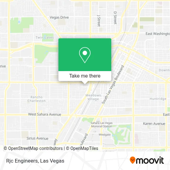
See Rjc Engineers, Las Vegas, on the map
Public Transit to Rjc Engineers in Las Vegas
Wondering how to get to Rjc Engineers in Las Vegas? Moovit helps you find the best way to get to Rjc Engineers with step-by-step directions from the nearest public transit station.
Moovit provides free maps and live directions to help you navigate through your city. View schedules, routes, timetables, and find out how long does it take to get to Rjc Engineers in real time.
Looking for the nearest stop or station to Rjc Engineers? Check out this list of stops closest to your destination: Sb Rancho Before Charleston; Eb Charleston After Rancho; Sb Commerce Before California; Grand Central @ Lv Premium Outlets - North (S); Wb Pinto After Shadow; Westgate Station.
Bus: 206, DEUCE, 119, 108, CX, DOWNTOWN LOOP, 207.Monorail: LVM.
Want to see if there’s another route that gets you there at an earlier time? Moovit helps you find alternative routes or times. Get directions from and directions to Rjc Engineers easily from the Moovit App or Website.
We make riding to Rjc Engineers easy, which is why over 1.7 million users, including users in Las Vegas, trust Moovit as the best app for public transit. You don’t need to download an individual bus app or train app, Moovit is your all-in-one transit app that helps you find the best bus time or train time available.
For information on prices of bus, costs and ride fares to Rjc Engineers, please check the Moovit app.
Use the app to navigate to popular places including to the airport, hospital, stadium, grocery store, mall, coffee shop, school, college, and university.
Rjc Engineers Address: 1701 W Charleston Blvd Ste 610 street in Las Vegas
- Unlv School of Dental Medicine,
- University Of Nevada, Las Vegas (Unlv), Shadow Lane Campus / School Of Dental Medicine - Lot 4,
- Shadow Lane Campus,
- I-15,
- Renal Dialysis of University Medical Center of Southern Nevada,
- Steinberg Diagnostic Medical Imaging,
- UMC CVCU/CCU,
- Punk Rock Museum,
- Little Darlings Totally Nude 18+,
- Slab City Bitch!,
- University Medical Center of Southern Nevada,
- ATM,
- Smith Center for the Performing Arts,
- UMC - Nevada Children's Hospital,
- Premium Outlet North Taxi Staging,
- Valley Hospital Medical Center,
- Loma Linda Transplantation Institute Las Vegas Liver Clinic (Gastrointestinal and Liver Disease),
- Nike Factory Store,
- Clark County Offices,
- Pinto Ln / Shadow Ln
Places Near Rjc Engineers (Las Vegas)
- Koolsville Tattoos, Las Vegas,
- Gold & Silver Pawn Shop, Las Vegas,
- Las Vegas Premium Outlets-North, Enterprise,
- Welcome To Fabulous Las Vegas Sign, Paradise,
- Area15, Las Vegas,
- Walmart, Las Vegas,
- Omega Mart, Las Vegas,
- The Deuce Bus Stop at Fremont St, Las Vegas,
- Allegiant Stadium, Paradise,
- The Palms Casino Resort, Paradise,
- Las Vegas North Premium Outlets, Las Vegas,
- Las Vegas South Premium Outlets, Enterprise,
- Meow Wolf - Las Vegas (Meow Wolf's Omega Mart), Las Vegas,
- Lee Canyon, Las Vegas,
- Zak Bagans Haunted Museum, Las Vegas,
- Trump International Hotel Las Vegas, Paradise,
- The Neon Museum, Las Vegas,
- Arte Museum Las Vegas, Paradise,
- Walmart Supercenter, Las Vegas,
- Town Square, Enterprise
How to get to popular places in Las Vegas with public transit
Get around Las Vegas by public transit!
Traveling around Las Vegas has never been so easy. See step by step directions as you travel to any attraction, street or major public transit station. View bus and train schedules, arrival times, service alerts and detailed routes on a map, so you know exactly how to get to anywhere in Las Vegas.
When traveling to any destination around Las Vegas use Moovit's Live Directions with Get Off Notifications to know exactly where and how far to walk, how long to wait for your line, and how many stops are left. Moovit will alert you when it's time to get off — no need to constantly re-check whether yours is the next stop.
Wondering how to use public transit in Las Vegas or how to pay for public transit in Las Vegas? Moovit public transit app can help you navigate your way with public transit easily, and at minimum cost. It includes public transit fees, ticket prices, and costs. Looking for a map of Las Vegas public transit lines? Moovit public transit app shows all public transit maps in Las Vegas with all Bus and Monorail routes and stops on an interactive map.
Las Vegas has 2 transit type(s), including: Bus and Monorail, operated by several transit agencies, including RTCSNV, City of Las Vegas, Alvand Transportation, Vegas Airporter, Las Vegas Monorail, FlixBus-us and Greyhound-us