Directions to Rk Aliança (Boa Vista) with public transportation
The following transit lines have routes that pass near Rk Aliança
How to get to Rk Aliança by bus?
Click on the bus route to see step by step directions with maps, line arrival times and updated time schedules.
From Rua Curupaitis, Santa Quitéria
59 minFrom Expotrade Convention Center, Pinhais
78 minFrom Rua Joao Alencar Guimaraes, Santa Quitéria
57 minFrom Rua Mariano Torres, Centro
35 minFrom Espaço Religião da Luta, Mossunguê
64 minFrom Shopping Pátio Batel, Batel
50 minFrom Rua Major França Gomes, Santa Quitéria
60 minFrom Linha C42 Pinhais/Bairro Alto, Bairro Alto
52 minFrom Expotrade, Pinhais
78 minFrom cemitério vaticano, Almirante Tamandaré
47 min
Bus stops near Rk Aliança in Boa Vista
Bus lines to Rk Aliança in Boa Vista
- 266 ESTRIBO AHÚ, Travessa Moreira Garcez → Estribo Ahú,VIEW
- 225 BOA VISTA / BARREIRINHA, Terminal Barreirinha → Terminal Boa Vista,VIEW
- 229 MAD. PENHA / FERNANDO DE NORONHA, Terminal Boa Vista ↺ Fernando De Noronha (Circular),VIEW
- 275 FERNANDO DE NORONHA / LARANJEIRAS, Travessa Moreira Garcez → Laranjeiras,VIEW
What are the closest stations to Rk Aliança?
The closest stations to Rk Aliança are:
- R. Carlota Straube De Araújo, 1281 is 222 meters away, 3 min walk.
- R. Lodovico Geronazzo, 1697 is 334 meters away, 5 min walk.
- Rua Vicente Geronasso, 481 is 370 meters away, 5 min walk.
Which bus lines stop near Rk Aliança?
These bus lines stop near Rk Aliança: 020 INTERBAIRROS II (HORÁRIO), 206 BARREIRINHA / SÃO JOSÉ, 225 BOA VISTA / BARREIRINHA, 266 ESTRIBO AHÚ, 702 CAIUÁ / CACHOEIRA.
What’s the nearest bus station to Rk Aliança in Boa Vista?
The nearest bus station to Rk Aliança in Boa Vista is R. Carlota Straube De Araújo, 1281. It’s a 3 min walk away.
What time is the first bus to Rk Aliança in Boa Vista?
The 229 MAD. PENHA / FERNANDO DE NORONHA is the first bus that goes to Rk Aliança in Boa Vista. It stops nearby at 3:20 AM.
What time is the last bus to Rk Aliança in Boa Vista?
The 229 MAD. PENHA / FERNANDO DE NORONHA is the last bus that goes to Rk Aliança in Boa Vista. It stops nearby at 2:26 AM.
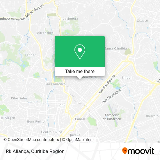
See Rk Aliança, Boa Vista, on the map
Public Transit to Rk Aliança in Boa Vista
Wondering how to get to Rk Aliança in Boa Vista? Moovit helps you find the best way to get to Rk Aliança with step-by-step directions from the nearest public transit station.
Moovit provides free maps and live directions to help you navigate through your city. View schedules, routes, timetables, and find out how long does it take to get to Rk Aliança in real time.
Looking for the nearest stop or station to Rk Aliança? Check out this list of stops closest to your destination: R. Carlota Straube De Araújo; R. Lodovico Geronazzo; Rua Vicente Geronasso.
Bus: 020 INTERBAIRROS II (HORÁRIO), 206 BARREIRINHA / SÃO JOSÉ, 225 BOA VISTA / BARREIRINHA, 266 ESTRIBO AHÚ, 702 CAIUÁ / CACHOEIRA, 229 MAD. PENHA / FERNANDO DE NORONHA, 275 FERNANDO DE NORONHA / LARANJEIRAS.
Want to see if there’s another route that gets you there at an earlier time? Moovit helps you find alternative routes or times. Get directions from and directions to Rk Aliança easily from the Moovit App or Website.
We make riding to Rk Aliança easy, which is why over 1.5 million users, including users in Boa Vista, trust Moovit as the best app for public transit. You don’t need to download an individual bus app or train app, Moovit is your all-in-one transit app that helps you find the best bus time or train time available.
For information on prices of bus, costs and ride fares to Rk Aliança, please check the Moovit app.
Use the app to navigate to popular places including to the airport, hospital, stadium, grocery store, mall, coffee shop, school, college, and university.
Rk Aliança Address: Rua Francisco Prestes Maia, 272 Boa Vista Curitiba-PR 82560-010 street in Boa Vista
- Lba Sintéticos,
- Bera Artesanatos,
- Pedras Boa Vista,
- Sandra Schnorr,
- Bodexpress,
- Designer Film,
- Estação das Bebidas,
- Dualmente,
- Magi Náutica,
- Dra. Danielle Picolo,
- Tikas & Tikos Store,
- Priscila Luz Pereira de Lima,
- Clean Centro Automotivo,
- Rua João Havro,
- Condominio Edificio Ricardo Kirk,
- Rua Carlota Straube de Araújo,
- Sebo dos Games,
- Estopim da Fiel Curitiba,
- Estopim da Fiel - Sub Sede Curitiba - PR,
- Reciclagens Boa Vista
Places Near Rk Aliança (Boa Vista)
- Hospital Nossa Senhora Das Graças, Mercês,
- Hhhhh, Fazendinha,
- Shopping Estação, Rebouças,
- Pontifícia Universidade Católica do Paraná (PUCPR), Prado Velho,
- Hospital de Clínicas (HC - UFPR), Centro,
- Jardim Botânico de Curitiba PR, Centro,
- Rua Martim Afonso 558, Mercês,
- Hospital Erasto Gaertner, Jardim Das Américas,
- Rua General Mário Tourinho, Campina Do Siqueira,
- Park Shopping Barigüi, Mossunguê,
- Hospital Da Cruz Vermelha, Batel,
- Arena Da Baixada - Curitiba,
- Parque Barigui, Mercês,
- Campo Largo, Campo,
- Hospital Universitário Evangélico de Curitiba, Bigorrilho,
- Jockey Plaza Shopping Center, Tarumã,
- Hospital Madalena Sofia, Bairro Alto,
- Hospital Angelina Caron, Campina Grande Do Sul,
- Shopping Palladium, Portão,
- Hospital do Rocio, Campo
How to get to popular places in Curitiba Region with public transit
Get around Boa Vista by public transit!
Traveling around Boa Vista has never been so easy. See step by step directions as you travel to any attraction, street or major public transit station. View bus and train schedules, arrival times, service alerts and detailed routes on a map, so you know exactly how to get to anywhere in Boa Vista.
When traveling to any destination around Boa Vista use Moovit's Live Directions with Get Off Notifications to know exactly where and how far to walk, how long to wait for your line, and how many stops are left. Moovit will alert you when it's time to get off — no need to constantly re-check whether yours is the next stop.
Wondering how to use public transit in Boa Vista or how to pay for public transit in Boa Vista? Moovit public transit app can help you navigate your way with public transit easily, and at minimum cost. It includes public transit fees, ticket prices, and costs. Looking for a map of Boa Vista public transit lines? Moovit public transit app shows all public transit maps in Boa Vista with all Bus and Cable Car routes and stops on an interactive map.
Curitiba Region has 2 transit type(s), including: Bus and Cable Car, operated by several transit agencies, including Sistema Integrado de Mobilidade (URBS), Sistema Integrado de Mobilidade (AMEP), URBS (Cartões bancários e Dinheiro), URBS (Cartões bancários / Cartão URBS), AMEP (Cartões bancários / Cartão MetroCard), AMEP (Cartões bancários / Cartão MetroCard / Dinheiro), Viação Colombo (Dinheiro), TRIAR (Cartão TRIAR / Dinheiro), Empresa Curitiba Cerro Azul (Dinheiro), Expresso Nossa Senhora da Penha (Dinheiro), Empresa Campo Alto Tijucas (Dinheiro), Auto Viação São José (Cartão VEM / Dinheiro), BRT S/A (Cartão VEM / Dinheiro), TransPiedade (Cartão Cidadão / Dinheiro) and Oceânica Sul (Cartão Transporte / Dinheiro)