Directions to Rk Police Uniform (Queens) with public transportation
The following transit lines have routes that pass near Rk Police Uniform
 Bus: Q44-SBS, Q54, Q8, Q1, Q43.
- Train: CITY TERMINAL ZONE, FAR ROCKAWAY BRANCH, LONG BEACH BRANCH, AIRTRAIN, BABYLON BRANCH.
- Subway: F, FX, J, E, Z.
How to get to Rk Police Uniform by bus?
Click on the bus route to see step by step directions with maps, line arrival times and updated time schedules.
From Northern Blvd, Queens
81 minFrom Flushing, NY, Queens
53 minFrom 74th St, Queens
68 minFrom Valley Stream, NY, Valley Stream
62 minFrom Middle Village, NY, Queens
46 minFrom Flushing Chinatown, Queens
39 minFrom Cxx, Queens
37 minFrom North Shore Towers, Queens
68 minFrom Zucker Hillside Hospital, Queens
54 min
How to get to Rk Police Uniform by train?
Click on the train route to see step by step directions with maps, line arrival times and updated time schedules.
How to get to Rk Police Uniform by subway?
Click on the subway route to see step by step directions with maps, line arrival times and updated time schedules.
Bus stops near Rk Police Uniform in Queens
Subway stations near Rk Police Uniform in Queens
Train station near Rk Police Uniform in Queens
- Jamaica, 25 min walk,VIEW
Bus lines to Rk Police Uniform in Queens
- Q1, Bellerose 243 St Via Hillside Av,VIEW
- Q43, Rush Floral Park 268 St Via Hillside Av,VIEW
- Q44-SBS, Select Bus Jamaica Via Main St,VIEW
- Q40, Rush Jamaica Hillside Av,VIEW
- Q60, Jamaica LIRR Via Queens Bl,VIEW
- Q20, College Point,VIEW
- Q56, Broadway Junction Via Jamaica Av,VIEW
- Q54, Willamsburg Bridge Plaza,VIEW
What are the closest stations to Rk Police Uniform?
The closest stations to Rk Police Uniform are:
- Sutphin Blvd/Hillside Av is 312 yards away, 4 min walk.
- Sutphin Blvd/88 Av is 369 yards away, 5 min walk.
- Jamaica Av/144 St is 427 yards away, 6 min walk.
- Jamaica Av/Queens Blvd is 502 yards away, 7 min walk.
- Briarwood is 573 yards away, 7 min walk.
- Jamaica is 2064 yards away, 25 min walk.
- Sutphin Blvd-Archer Av-Jfk Airport is 2233 yards away, 27 min walk.
Which bus lines stop near Rk Police Uniform?
These bus lines stop near Rk Police Uniform: Q44-SBS, Q54, Q8.
Which train lines stop near Rk Police Uniform?
These train lines stop near Rk Police Uniform: CITY TERMINAL ZONE, FAR ROCKAWAY BRANCH, LONG BEACH BRANCH.
Which subway lines stop near Rk Police Uniform?
These subway lines stop near Rk Police Uniform: F, FX, J.
What’s the nearest subway station to Rk Police Uniform in Queens?
The nearest subway station to Rk Police Uniform in Queens is Briarwood. It’s a 7 min walk away.
What’s the nearest train station to Rk Police Uniform in Queens?
The nearest train station to Rk Police Uniform in Queens is Jamaica. It’s a 25 min walk away.
What’s the nearest bus station to Rk Police Uniform in Queens?
The nearest bus station to Rk Police Uniform in Queens is Sutphin Blvd/Hillside Av. It’s a 4 min walk away.
What time is the first light rail to Rk Police Uniform in Queens?
The AIRTRAIN is the first light rail that goes to Rk Police Uniform in Queens. It stops nearby at 3:00 AM.
What time is the last light rail to Rk Police Uniform in Queens?
The AIRTRAIN is the last light rail that goes to Rk Police Uniform in Queens. It stops nearby at 3:06 AM.
What time is the first subway to Rk Police Uniform in Queens?
The E is the first subway that goes to Rk Police Uniform in Queens. It stops nearby at 3:00 AM.
What time is the last subway to Rk Police Uniform in Queens?
The F is the last subway that goes to Rk Police Uniform in Queens. It stops nearby at 4:10 AM.
What time is the first train to Rk Police Uniform in Queens?
The BABYLON BRANCH is the first train that goes to Rk Police Uniform in Queens. It stops nearby at 3:07 AM.
What time is the last train to Rk Police Uniform in Queens?
The MONTAUK BRANCH is the last train that goes to Rk Police Uniform in Queens. It stops nearby at 4:05 AM.
What time is the first bus to Rk Police Uniform in Queens?
The Q54 is the first bus that goes to Rk Police Uniform in Queens. It stops nearby at 3:00 AM.
What time is the last bus to Rk Police Uniform in Queens?
The Q44-SBS is the last bus that goes to Rk Police Uniform in Queens. It stops nearby at 3:43 AM.
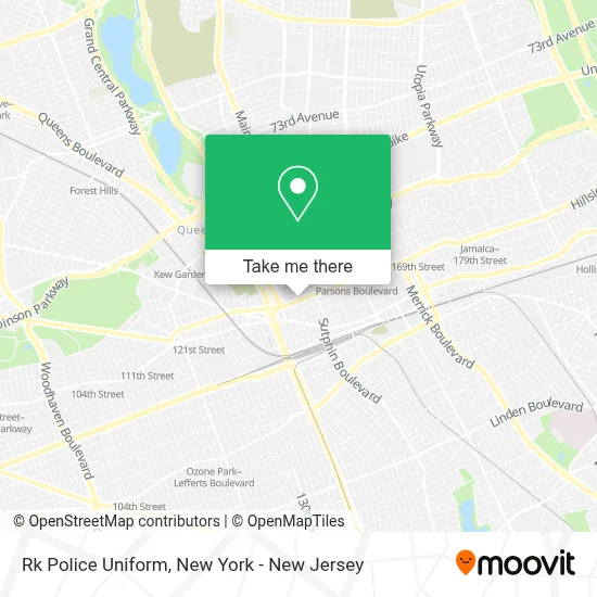
See Rk Police Uniform, Queens, on the map
Public Transit to Rk Police Uniform in Queens
Wondering how to get to Rk Police Uniform in Queens? Moovit helps you find the best way to get to Rk Police Uniform with step-by-step directions from the nearest public transit station.
Moovit provides free maps and live directions to help you navigate through your city. View schedules, routes, timetables, and find out how long does it take to get to Rk Police Uniform in real time.
Looking for the nearest stop or station to Rk Police Uniform? Check out this list of stops closest to your destination: Sutphin Blvd/Hillside Av; Sutphin Blvd/88 Av; Jamaica Av/144 St; Jamaica Av/Queens Blvd; Briarwood; Jamaica; Sutphin Blvd-Archer Av-Jfk Airport.
Bus: Q44-SBS, Q54, Q8, Q1, Q43, Q40.Train: CITY TERMINAL ZONE, FAR ROCKAWAY BRANCH, LONG BEACH BRANCH, AIRTRAIN, BABYLON BRANCH, HEMPSTEAD BRANCH.Subway: F, FX, J, E, Z.
Want to see if there’s another route that gets you there at an earlier time? Moovit helps you find alternative routes or times. Get directions from and directions to Rk Police Uniform easily from the Moovit App or Website.
We make riding to Rk Police Uniform easy, which is why over 1.5 million users, including users in Queens, trust Moovit as the best app for public transit. You don’t need to download an individual bus app or train app, Moovit is your all-in-one transit app that helps you find the best bus time or train time available.
For information on prices of subway, bus and train, costs and ride fares to Rk Police Uniform, please check the Moovit app.
Use the app to navigate to popular places including to the airport, hospital, stadium, grocery store, mall, coffee shop, school, college, and university.
Rk Police Uniform Address: 143-05 Hillside Ave street in Queens
- Bakery Restaurant El S,
- El Sembrador,
- Nyc Guardian Brokerage Inc.,
- Izla Technologies Inc,
- Bh Auto,
- Ms Motors,
- B & H Auto Services,
- Q20,
- 144th St,
- 144th St & Hillside Ave,
- Amit Aery: Allstate Insurance,
- Aftab Super Market,
- Power Motors Nyc Queens - Used Car Dealership,
- Church City Usa,
- Prime Usa Store,
- 87th Road Mini Market,
- Elite Mitsubishi,
- Kiki Printing,
- Hillside Honda Used Cars,
- Western Union
Places Near Rk Police Uniform (Queens)
- Pier 83, Manhattan,
- Times Square, Manhattan,
- SoHo, Manhattan,
- Rockefeller Center, Manhattan,
- Mountainside Hospital, Glen Ridge,
- 26 Federal Plaza, Manhattan,
- Wall Street, Manhattan,
- Katz's Deli, Manhattan,
- 376 Hudson Street, Manhattan,
- qqqq, Manhattan,
- 3 Stone St, Manhattan,
- 1 Police Plaza, Manhattan,
- 111 Centre New York City Supreme Court, Manhattan,
- 911 Memorial, Manhattan,
- Hudson Yards, Manhattan,
- 66 John Street, Manhattan,
- Chinatown, Manhattan,
- Bellevue Hospital, Manhattan,
- San Gennaro Feast, Manhattan,
- Queens Center Mall, Queens
How to get to popular places in New York - New Jersey with public transit
Get around Queens by public transit!
Traveling around Queens has never been so easy. See step by step directions as you travel to any attraction, street or major public transit station. View bus and train schedules, arrival times, service alerts and detailed routes on a map, so you know exactly how to get to anywhere in Queens.
When traveling to any destination around Queens use Moovit's Live Directions with Get Off Notifications to know exactly where and how far to walk, how long to wait for your line, and how many stops are left. Moovit will alert you when it's time to get off — no need to constantly re-check whether yours is the next stop.
Wondering how to use public transit in Queens or how to pay for public transit in Queens? Moovit public transit app can help you navigate your way with public transit easily, and at minimum cost. It includes public transit fees, ticket prices, and costs. Looking for a map of Queens public transit lines? Moovit public transit app shows all public transit maps in Queens with all Bus, Train, Subway, Light Rail, Ferry and Cable Car routes and stops on an interactive map.
New York - New Jersey has 6 transit type(s), including: Bus, Train, Subway, Light Rail, Ferry and Cable Car, operated by several transit agencies, including MTA Subway, Metro-North Railroad, LIRR, PATH, MTA New York City Transit - Express routes, MTA Bus, NJ Transit, NYC Ferry, NICE bus, Bee-Line Bus, NJ Transit Rail, Norwalk Transit District, Hartford Line, River Valley Transit and HART