Directions to Rkd (Mercês) with public transportation
The following transit lines have routes that pass near Rkd
How to get to Rkd by bus?
Click on the bus route to see step by step directions with maps, line arrival times and updated time schedules.
From Hospital Vita, Bairro Alto
43 minFrom Uberaba, Uberaba
50 minFrom Terminal do Pinheirinho, Pinheirinho
58 minFrom UPA 24h - Unidade de Pronto Atendimento Cajuru, Cajuru
52 minFrom Estação Tubo Vila Olímpica, Jardim Social
49 minFrom Jardim das Americas, Jardim Das Américas
47 minFrom João Bettega, 736 - Portão, Portão
41 minFrom Cidade da Lapa (PR), Capão Raso
54 minFrom Rua Waldemar Loureiro Campos, Boqueirão
45 minFrom Rua Brigadeiro Arthur Carlos Peralta 137, Boqueirão
44 min
Bus stops near Rkd in Mercês
- Av. Cândido Hartmann, 1174, 3 min walk,VIEW
- R. Padre Agostinho, 1600, 4 min walk,VIEW
- R. Padre Agostinho, 1400 (Praça da Ucrânia), 5 min walk,VIEW
- R. Capitão Souza Franco, 965 (Praça da Ucrânia), 6 min walk,VIEW
- R. Padre Anchieta, 1300, 6 min walk,VIEW
- Praça da Ucrânia, 7 min walk,VIEW
- R. Jacarezinho, 400, 7 min walk,VIEW
Bus lines to Rkd in Mercês
- 876 SAVOIA, Praça Tiradentes → Savoia,VIEW
- J62 CAMPO LARGO / GUADALUPE, Terminal Guadalupe → Terminal Campo Largo,VIEW
- 870 SÃO BRAZ, Praça Tiradentes → São Braz,VIEW
- 889 MAD. SÃO BRAZ, Praça Rui Barbosa ↺ São Braz (Circular),VIEW
- 011 INTERBAIRROS I (ANTI-HORÁRIO), Estação PUC (Linha Verde) → Prefeitura,VIEW
- 010 INTERBAIRROS I (HORÁRIO), Estação PUC (Linha Verde) → Prefeitura,VIEW
- 809 MAD. CAMPO COMPRIDO, CIC Norte / Gabnieto → Praça Rui Barbosa,VIEW
- 303 CENTENÁRIO / CAMPO COMPRIDO, Terminal Campo Comprido → Terminal Centenário,VIEW
- 021 INTERBAIRROS II (ANTI-HORÁRIO), Cabral → Campina do Siqueira,VIEW
- 020 INTERBAIRROS II (HORÁRIO), Campina do Siqueira → Cabral,VIEW
What are the closest stations to Rkd?
The closest stations to Rkd are:
- Av. Cândido Hartmann, 1174 is 208 meters away, 3 min walk.
- R. Padre Agostinho, 1600 is 272 meters away, 4 min walk.
- R. Padre Agostinho, 1400 (Praça da Ucrânia) is 339 meters away, 5 min walk.
- R. Capitão Souza Franco, 965 (Praça da Ucrânia) is 385 meters away, 6 min walk.
- R. Padre Anchieta, 1300 is 459 meters away, 6 min walk.
- Praça da Ucrânia is 472 meters away, 7 min walk.
- R. Jacarezinho, 400 is 493 meters away, 7 min walk.
Which bus lines stop near Rkd?
These bus lines stop near Rkd: 010 INTERBAIRROS I (HORÁRIO), 303 CENTENÁRIO / CAMPO COMPRIDO, J62 CAMPO LARGO / GUADALUPE.
What’s the nearest bus station to Rkd in Mercês?
The nearest bus station to Rkd in Mercês is Av. Cândido Hartmann, 1174. It’s a 3 min walk away.
What time is the first bus to Rkd in Mercês?
The 809 MAD. CAMPO COMPRIDO is the first bus that goes to Rkd in Mercês. It stops nearby at 3:05 AM.
What time is the last bus to Rkd in Mercês?
The 809 MAD. CAMPO COMPRIDO is the last bus that goes to Rkd in Mercês. It stops nearby at 2:42 AM.
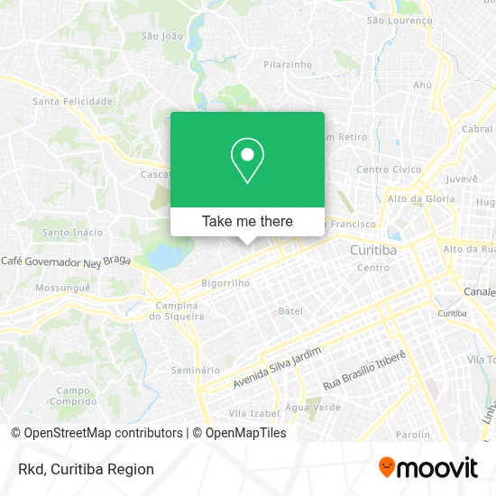
See Rkd, Mercês, on the map
Public Transit to Rkd in Mercês
Wondering how to get to Rkd in Mercês? Moovit helps you find the best way to get to Rkd with step-by-step directions from the nearest public transit station.
Moovit provides free maps and live directions to help you navigate through your city. View schedules, routes, timetables, and find out how long does it take to get to Rkd in real time.
Looking for the nearest stop or station to Rkd? Check out this list of stops closest to your destination: Av. Cândido Hartmann; R. Padre Agostinho; R. Padre Agostinho; R. Capitão Souza Franco; R. Padre Anchieta; Praça da Ucrânia; R. Jacarezinho.
Bus: 010 INTERBAIRROS I (HORÁRIO), 303 CENTENÁRIO / CAMPO COMPRIDO, J62 CAMPO LARGO / GUADALUPE, 876 SAVOIA, 870 SÃO BRAZ, 889 MAD. SÃO BRAZ, 011 INTERBAIRROS I (ANTI-HORÁRIO), 809 MAD. CAMPO COMPRIDO.
Want to see if there’s another route that gets you there at an earlier time? Moovit helps you find alternative routes or times. Get directions from and directions to Rkd easily from the Moovit App or Website.
We make riding to Rkd easy, which is why over 1.5 million users, including users in Mercês, trust Moovit as the best app for public transit. You don’t need to download an individual bus app or train app, Moovit is your all-in-one transit app that helps you find the best bus time or train time available.
For information on prices of bus, costs and ride fares to Rkd, please check the Moovit app.
Use the app to navigate to popular places including to the airport, hospital, stadium, grocery store, mall, coffee shop, school, college, and university.
Rkd Address: Rua Frederico Cantarelli, 80 Mercês Curitiba-PR 80710-240 street in Mercês
- Traizkeeubebo Bar E Petiscaria,
- Czar Bar e Petiscaria,
- Cuidar Cpap,
- Jardim Raio de Sol,
- Leticia Silva - Personal,
- Bem Estar Animal Pet Shop,
- Jardim Secreto-Arranjos,
- Luiz Carlos Matias,
- D Nair Costuras,
- Pereira Camargo Consultoria,
- d'Pil,
- Nhac Nhoc,
- Be Mindful,
- Frolatto,
- U.T.I das Loiras Cabeleireiros e Estética,
- Get UP Coffee,
- Hospital da Plástica Curitiba,
- Rock Dog,
- Adolfo Stedile,
- Connect Gestao Contabil
Places Near Rkd (Mercês)
- Campo Largo, Campo,
- Hospital Da Cruz Vermelha, Batel,
- Hospital Universitário Evangélico de Curitiba, Bigorrilho,
- Park Shopping Barigüi, Mossunguê,
- Hhhhh, Fazendinha,
- Jardim Botânico de Curitiba PR, Centro,
- Hospital do Rocio, Campo,
- Rua Martim Afonso 558, Mercês,
- Shopping Palladium, Portão,
- Hospital Angelina Caron, Campina Grande Do Sul,
- Hospital de Clínicas (HC - UFPR), Centro,
- Jockey Plaza Shopping Center, Tarumã,
- Hospital Erasto Gaertner, Jardim Das Américas,
- Rua General Mário Tourinho, Campina Do Siqueira,
- Shopping Estação, Rebouças,
- Hospital Nossa Senhora Das Graças, Mercês,
- Hospital Madalena Sofia, Bairro Alto,
- Pontifícia Universidade Católica do Paraná (PUCPR), Prado Velho,
- Parque Barigui, Mercês,
- Arena Da Baixada - Curitiba
How to get to popular places in Curitiba Region with public transit
Get around Mercês by public transit!
Traveling around Mercês has never been so easy. See step by step directions as you travel to any attraction, street or major public transit station. View bus and train schedules, arrival times, service alerts and detailed routes on a map, so you know exactly how to get to anywhere in Mercês.
When traveling to any destination around Mercês use Moovit's Live Directions with Get Off Notifications to know exactly where and how far to walk, how long to wait for your line, and how many stops are left. Moovit will alert you when it's time to get off — no need to constantly re-check whether yours is the next stop.
Wondering how to use public transit in Mercês or how to pay for public transit in Mercês? Moovit public transit app can help you navigate your way with public transit easily, and at minimum cost. It includes public transit fees, ticket prices, and costs. Looking for a map of Mercês public transit lines? Moovit public transit app shows all public transit maps in Mercês with all Bus and Cable Car routes and stops on an interactive map.
Curitiba Region has 2 transit type(s), including: Bus and Cable Car, operated by several transit agencies, including Sistema Integrado de Mobilidade (URBS), Sistema Integrado de Mobilidade (AMEP), URBS (Cartões bancários e Dinheiro), URBS (Cartões bancários / Cartão URBS), AMEP (Cartões bancários / Cartão MetroCard), AMEP (Cartões bancários / Cartão MetroCard / Dinheiro), Viação Colombo (Dinheiro), TRIAR (Cartão TRIAR / Dinheiro), Empresa Curitiba Cerro Azul (Dinheiro), Expresso Nossa Senhora da Penha (Dinheiro), Empresa Campo Alto Tijucas (Dinheiro), Auto Viação São José (Cartão VEM / Dinheiro), BRT S/A (Cartão VEM / Dinheiro), TransPiedade (Cartão Cidadão / Dinheiro) and Oceânica Sul (Cartão Transporte / Dinheiro)