Directions to Rm Reformas (São Braz) with public transportation
The following transit lines have routes that pass near Rm Reformas
How to get to Rm Reformas by bus?
Click on the bus route to see step by step directions with maps, line arrival times and updated time schedules.
From Bairro Seminario - Urb.Curitiba/,PR, Seminário
42 minFrom Rua maua, Alto Da Glória
56 minFrom Estação Tubo Moyses Marcondes, Juvevê
56 minFrom Portão, Portão
58 minFrom Avenida Presidente Arthur da Silva Bernardes 2350, Portão
59 minFrom Rua Professor Algacyr Munhoz Mader, Cic
61 minFrom Linha 702 Ligeirinho Fazendinha/Tamandaré, Rebouças
47 minFrom Rua Comendador Macedo, Centro
52 minFrom Hospital Pilar, São Francisco
48 minFrom Rua Conselheiro Laurindo, Centro
46 min
Bus stops near Rm Reformas in São Braz
Bus lines to Rm Reformas in São Braz
What are the closest stations to Rm Reformas?
The closest stations to Rm Reformas are:
- R. Brasílio Cuman, 850 is 89 meters away, 2 min walk.
- R. Brasílio Cuman, 849 is 97 meters away, 2 min walk.
- Rua São José Da Boa Vista, 241 is 334 meters away, 5 min walk.
Which bus lines stop near Rm Reformas?
These bus lines stop near Rm Reformas: 812 MONTANA, 821 FERNÃO DIAS, 876 SAVOIA.
What’s the nearest bus station to Rm Reformas in São Braz?
The nearest bus stations to Rm Reformas in São Braz are R. Brasílio Cuman, 850 and R. Brasílio Cuman, 849. The closest one is a 2 min walk away.
What time is the first bus to Rm Reformas in São Braz?
The 889 MAD. SÃO BRAZ is the first bus that goes to Rm Reformas in São Braz. It stops nearby at 3:28 AM.
What time is the last bus to Rm Reformas in São Braz?
The 889 MAD. SÃO BRAZ is the last bus that goes to Rm Reformas in São Braz. It stops nearby at 2:35 AM.
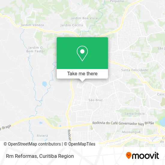
See Rm Reformas, São Braz, on the map
Public Transit to Rm Reformas in São Braz
Wondering how to get to Rm Reformas in São Braz? Moovit helps you find the best way to get to Rm Reformas with step-by-step directions from the nearest public transit station.
Moovit provides free maps and live directions to help you navigate through your city. View schedules, routes, timetables, and find out how long does it take to get to Rm Reformas in real time.
Looking for the nearest stop or station to Rm Reformas? Check out this list of stops closest to your destination: R. Brasílio Cuman; R. Brasílio Cuman; Rua São José Da Boa Vista.
Bus: 812 MONTANA, 821 FERNÃO DIAS, 876 SAVOIA, 889 MAD. SÃO BRAZ.
Want to see if there’s another route that gets you there at an earlier time? Moovit helps you find alternative routes or times. Get directions from and directions to Rm Reformas easily from the Moovit App or Website.
We make riding to Rm Reformas easy, which is why over 1.5 million users, including users in São Braz, trust Moovit as the best app for public transit. You don’t need to download an individual bus app or train app, Moovit is your all-in-one transit app that helps you find the best bus time or train time available.
For information on prices of bus, costs and ride fares to Rm Reformas, please check the Moovit app.
Use the app to navigate to popular places including to the airport, hospital, stadium, grocery store, mall, coffee shop, school, college, and university.
Rm Reformas Address: Rua Brasílio Cuman, 929 São Braz Curitiba-PR 82315-010 street in São Braz
- Auto Mecanica Pavan,
- Muniz Neves Sociedade Individual de Advocacia,
- Possoli - Fisioterapia e Terapias Integrativas,
- Ggn do Brasil,
- Deck Brasil - Solucoes Em Madeira,
- Rua Brasílio Cuman 960,
- Rua Brasilio Cuman,
- Carlos de Carvalho Textos,
- Mário Haroldo Tramonti,
- Plandor Technologies Inova Simples (I.S.),
- Ponto final Montana - 812,
- Jonathan Cabeleireiro,
- Fph Transportes,
- Savoia,
- Fh Participações,
- Mercearia Sao Braz,
- Confiança Engenharia,
- Ricardo Stuwer,
- Pedreira de Campo Magro - Paredão Sul,
- Instalacoes e Acabamentos
Places Near Rm Reformas (São Braz)
- Rua Martim Afonso 558, Mercês,
- Hospital Madalena Sofia, Bairro Alto,
- Hospital Nossa Senhora Das Graças, Mercês,
- Shopping Estação, Rebouças,
- Jardim Botânico de Curitiba PR, Centro,
- Parque Barigui, Mercês,
- Hospital Erasto Gaertner, Jardim Das Américas,
- Hospital Universitário Evangélico de Curitiba, Bigorrilho,
- Pontifícia Universidade Católica do Paraná (PUCPR), Prado Velho,
- Hospital de Clínicas (HC - UFPR), Centro,
- Hospital Angelina Caron, Campina Grande Do Sul,
- Hospital Da Cruz Vermelha, Batel,
- Hospital do Rocio, Campo,
- Campo Largo, Campo,
- Rua General Mário Tourinho, Campina Do Siqueira,
- Hhhhh, Fazendinha,
- Jockey Plaza Shopping Center, Tarumã,
- Park Shopping Barigüi, Mossunguê,
- Arena Da Baixada - Curitiba,
- Shopping Palladium, Portão
How to get to popular places in Curitiba Region with public transit
Get around São Braz by public transit!
Traveling around São Braz has never been so easy. See step by step directions as you travel to any attraction, street or major public transit station. View bus and train schedules, arrival times, service alerts and detailed routes on a map, so you know exactly how to get to anywhere in São Braz.
When traveling to any destination around São Braz use Moovit's Live Directions with Get Off Notifications to know exactly where and how far to walk, how long to wait for your line, and how many stops are left. Moovit will alert you when it's time to get off — no need to constantly re-check whether yours is the next stop.
Wondering how to use public transit in São Braz or how to pay for public transit in São Braz? Moovit public transit app can help you navigate your way with public transit easily, and at minimum cost. It includes public transit fees, ticket prices, and costs. Looking for a map of São Braz public transit lines? Moovit public transit app shows all public transit maps in São Braz with all Bus and Cable Car routes and stops on an interactive map.
Curitiba Region has 2 transit type(s), including: Bus and Cable Car, operated by several transit agencies, including Sistema Integrado de Mobilidade (URBS), Sistema Integrado de Mobilidade (AMEP), URBS (Cartões bancários e Dinheiro), URBS (Cartões bancários / Cartão URBS), AMEP (Cartões bancários / Cartão MetroCard), AMEP (Cartões bancários / Cartão MetroCard / Dinheiro), Viação Colombo (Dinheiro), TRIAR (Cartão TRIAR / Dinheiro), Empresa Curitiba Cerro Azul (Dinheiro), Expresso Nossa Senhora da Penha (Dinheiro), Empresa Campo Alto Tijucas (Dinheiro), Auto Viação São José (Cartão VEM / Dinheiro), BRT S/A (Cartão VEM / Dinheiro), TransPiedade (Cartão Cidadão / Dinheiro) and Oceânica Sul (Cartão Transporte / Dinheiro)