Directions to Rmfar (Queens) with public transportation
The following transit lines have routes that pass near Rmfar
 Bus: N22, Q1, Q36, Q43, Q76.
- Train: HEMPSTEAD BRANCH, PORT JEFFERSON BRANCH, RONKONKOMA BRANCH, MONTAUK BRANCH.
- Subway: F, E, FX.
How to get to Rmfar by bus?
Click on the bus route to see step by step directions with maps, line arrival times and updated time schedules.
From Glendale, NY, Queens
78 minFrom Garden City, NY, Garden City
57 minFrom Elmhurst, NY, Queens
61 minFrom Resorts World Shuttle Bus, Queens
62 minFrom College Point, NY, Queens
48 minFrom Townsend Harris High School, Queens
38 minFrom North Shore Towers, Queens
53 minFrom Flushing Chinatown, Queens
39 minFrom Middle Village, NY, Queens
70 minFrom Resort World Casino New York City, Queens
56 min
How to get to Rmfar by train?
Click on the train route to see step by step directions with maps, line arrival times and updated time schedules.
How to get to Rmfar by subway?
Click on the subway route to see step by step directions with maps, line arrival times and updated time schedules.
Bus stops near Rmfar in Queens
Subway station near Rmfar in Queens
- Jamaica-179 St, 24 min walk,VIEW
Bus lines to Rmfar in Queens
- Q76, Jamaica Bus Terminal Via Francis Lewis,VIEW
- Q1, Bellerose 243 St Via Hillside Av,VIEW
- Q36, Rush Jamaica Bus Terminal,VIEW
- Q43, Rush Floral Park 268 St Via Hillside Av,VIEW
- QM68, Floral Park,VIEW
- Q77, Rush Springfield Gardens Rockaway Blvd,VIEW
- Q82, Rush Belmont Park,VIEW
- N1, Elmont Rd / Central Av,VIEW
- N6, Hempstead Tp Local,VIEW
- N22, Hillside Av Local,VIEW
- N22X, Hillside Av Express,VIEW
- N24, Jericho Tp,VIEW
- N26, Hillside Av / Lakeville Rd,VIEW
What are the closest stations to Rmfar?
The closest stations to Rmfar are:
- Francis Lewis Blvd/Hillside Av is 40 yards away, 1 min walk.
- Hillside Av/Francis Lewis Blvd is 74 yards away, 2 min walk.
- 205 St / Hillside is 110 yards away, 2 min walk.
- Jamaica-179 St is 1946 yards away, 24 min walk.
- Hollis is 2642 yards away, 31 min walk.
- Hillside Facility is 3317 yards away, 39 min walk.
Which bus lines stop near Rmfar?
These bus lines stop near Rmfar: N22, Q1, Q36, Q43, Q76, Q77.
Which train line stops near Rmfar?
HEMPSTEAD BRANCH (New York)
Which subway line stops near Rmfar?
F (Uptown & Queens)
What’s the nearest subway station to Rmfar in Queens?
The nearest subway station to Rmfar in Queens is Jamaica-179 St. It’s a 24 min walk away.
What’s the nearest bus station to Rmfar in Queens?
The nearest bus station to Rmfar in Queens is Francis Lewis Blvd/Hillside Av. It’s a 1 min walk away.
What time is the first subway to Rmfar in Queens?
The F is the first subway that goes to Rmfar in Queens. It stops nearby at 3:07 AM.
What time is the last subway to Rmfar in Queens?
The F is the last subway that goes to Rmfar in Queens. It stops nearby at 4:30 AM.
What time is the first train to Rmfar in Queens?
The HEMPSTEAD BRANCH is the first train that goes to Rmfar in Queens. It stops nearby at 3:09 AM.
What time is the last train to Rmfar in Queens?
The HEMPSTEAD BRANCH is the last train that goes to Rmfar in Queens. It stops nearby at 3:09 AM.
What time is the first bus to Rmfar in Queens?
The Q1 is the first bus that goes to Rmfar in Queens. It stops nearby at 3:10 AM.
What time is the last bus to Rmfar in Queens?
The Q43 is the last bus that goes to Rmfar in Queens. It stops nearby at 2:58 AM.
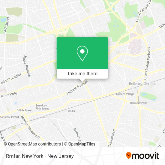
See Rmfar, Queens, on the map
Public Transit to Rmfar in Queens
Wondering how to get to Rmfar in Queens? Moovit helps you find the best way to get to Rmfar with step-by-step directions from the nearest public transit station.
Moovit provides free maps and live directions to help you navigate through your city. View schedules, routes, timetables, and find out how long does it take to get to Rmfar in real time.
Looking for the nearest stop or station to Rmfar? Check out this list of stops closest to your destination: Francis Lewis Blvd/Hillside Av; Hillside Av/Francis Lewis Blvd; 205 St / Hillside; Jamaica-179 St; Hollis; Hillside Facility.
Bus: N22, Q1, Q36, Q43, Q76, Q77, QM68, N1, N6, N22X, N24.Train: HEMPSTEAD BRANCH, PORT JEFFERSON BRANCH, RONKONKOMA BRANCH, MONTAUK BRANCH.Subway: F, E, FX.
Want to see if there’s another route that gets you there at an earlier time? Moovit helps you find alternative routes or times. Get directions from and directions to Rmfar easily from the Moovit App or Website.
We make riding to Rmfar easy, which is why over 1.5 million users, including users in Queens, trust Moovit as the best app for public transit. You don’t need to download an individual bus app or train app, Moovit is your all-in-one transit app that helps you find the best bus time or train time available.
For information on prices of bus, subway and train, costs and ride fares to Rmfar, please check the Moovit app.
Use the app to navigate to popular places including to the airport, hospital, stadium, grocery store, mall, coffee shop, school, college, and university.
Rmfar Address: 205-07 Hillside Ave street in Queens
- Martinez Miguel,
- 26,
- Optum Pediatrics - Hollis,
- Cinnabon Carvel,
- Advanced Neurology P.C.: Irina Kogan, Md,
- Labcorp,
- Gnc,
- Haque International Logistics Corporation,
- Chase Atm,
- Shred Nations,
- Libertyx Bitcoin Atm,
- Medical Waste Pros,
- T&M Supply Spot,
- Franhill Pharmacy & Surgical,
- MTA Bus (Hillside Ave / Francis Lewis Blvd),
- S&S Property Management,
- Blue Haven Counseling and Psychotherapy,
- Evergreen Tree & Shrub,
- Northwell Health Physician Partners Behavioral Health at Hollis,
- Cove Aba
Places Near Rmfar (Queens)
- SoHo, Manhattan,
- 66 John Street, Manhattan,
- qqqq, Manhattan,
- Hudson Yards, Manhattan,
- Katz's Deli, Manhattan,
- Mountainside Hospital, Glen Ridge,
- San Gennaro Feast, Manhattan,
- 376 Hudson Street, Manhattan,
- 3 Stone St, Manhattan,
- 26 Federal Plaza, Manhattan,
- Bellevue Hospital, Manhattan,
- Rockefeller Center, Manhattan,
- Chinatown, Manhattan,
- Times Square, Manhattan,
- Pier 83, Manhattan,
- Queens Center Mall, Queens,
- 911 Memorial, Manhattan,
- 1 Police Plaza, Manhattan,
- 111 Centre New York City Supreme Court, Manhattan,
- Wall Street, Manhattan
How to get to popular places in New York - New Jersey with public transit
Get around Queens by public transit!
Traveling around Queens has never been so easy. See step by step directions as you travel to any attraction, street or major public transit station. View bus and train schedules, arrival times, service alerts and detailed routes on a map, so you know exactly how to get to anywhere in Queens.
When traveling to any destination around Queens use Moovit's Live Directions with Get Off Notifications to know exactly where and how far to walk, how long to wait for your line, and how many stops are left. Moovit will alert you when it's time to get off — no need to constantly re-check whether yours is the next stop.
Wondering how to use public transit in Queens or how to pay for public transit in Queens? Moovit public transit app can help you navigate your way with public transit easily, and at minimum cost. It includes public transit fees, ticket prices, and costs. Looking for a map of Queens public transit lines? Moovit public transit app shows all public transit maps in Queens with all Bus, Train, Subway, Light Rail, Ferry and Cable Car routes and stops on an interactive map.
New York - New Jersey has 6 transit type(s), including: Bus, Train, Subway, Light Rail, Ferry and Cable Car, operated by several transit agencies, including MTA Subway, Metro-North Railroad, LIRR, PATH, MTA New York City Transit - Express routes, MTA Bus, NJ Transit, NYC Ferry, NICE bus, Bee-Line Bus, NJ Transit Rail, Norwalk Transit District, Hartford Line, River Valley Transit and HART