How to get to Rmn by bus?
Click on the bus route to see step by step directions with maps, line arrival times and updated time schedules.
From Guyancourt, Guyancourt
25 minFrom Hopital Foch, Suresnes
81 minFrom Hôpital Raymond Poincaré, Garches
31 minFrom Stade Roland Garros, Paris
61 minFrom Technocentre Renault, Guyancourt
36 minFrom Chatou, Chatou
61 minFrom Crematorium de Clamart, Clamart
70 minFrom Stade Jean Bouin, Paris
67 minFrom Grille Clemenceau, Arrondissement de Nanterre
45 minFrom Roland Garros, Paris
61 min
How to get to Rmn by train?
Click on the train route to see step by step directions with maps, line arrival times and updated time schedules.
Bus stops near Rmn in Versailles
RER station near Rmn in Versailles
- Versailles Château Rive Gauche, 9 min walk,VIEW
Train stations near Rmn in Versailles
Bus lines to Rmn in Versailles
- 6201, Porte Des Hauts-De-Seine / Picardie,VIEW
- 6202, Porchefontaine Louis XIV,VIEW
- 6203, Satory,VIEW
- 6204, Gare Routière de Versailles Chantiers - Quai F,VIEW
- 6210, Gare de Vaucresson,VIEW
- 171, Château - Pont De Sèvres,VIEW
- 6123, Europe - Vélizy 2,VIEW
- 6161, Gare De Versailles Château - Rive Gauche - Haut-Pré,VIEW
- 6162, Gare De Saint-Rémy-Lès-Chevreuse - Gare De Versailles Château - Rive Gauche,VIEW
- 6163, Gare De Versailles Château - Rive Gauche - Gare De Saint-Rémy-Lès-Chevreuse,VIEW
- 6185, Gare De Versailles Château - Rive Gauche - Pointe Ouest,VIEW
- 6213, Gare Routière de Versailles Chantiers - Quai A,VIEW
- 6214, Europe,VIEW
- 6284, Lycée Franco-Allemand / Collège Martin Luther King,VIEW
- EX01, Rue Thiers,VIEW
- 7809, Gare Routière Nord (A5),VIEW
- 7819, Aérospatiale,VIEW
- 6173, Gare de Versailles Château - Rive Gauche,VIEW
- N160, Gare Montparnasse,VIEW
- N161, La Verrière Gare - Quai C,VIEW
What are the closest stations to Rmn?
The closest stations to Rmn are:
- Préfecture is 100 meters away, 2 min walk.
- Hôtel de Ville is 172 meters away, 3 min walk.
- Europe is 248 meters away, 4 min walk.
- Château is 339 meters away, 5 min walk.
- Gare de Versailles Château - Rive Gauche is 569 meters away, 8 min walk.
- Versailles Château Rive Gauche is 628 meters away, 9 min walk.
- Versailles Chantiers is 1297 meters away, 17 min walk.
- Versailles Rive Droite is 1303 meters away, 18 min walk.
Which train line stops near Rmn?
L (Paris-Saint-Lazare)
Which RER line stops near Rmn?
C (Pontoise/ Saint-Quentin-en-Yvelines/ Versailles-Chantiers/ Versailles-Château-Rive-Gauche)
Which bus lines stop near Rmn?
These bus lines stop near Rmn: 171, 5141, 6201, 6202, 6210, 6214, EX01.
What’s the nearest train station to Rmn in Versailles?
The nearest train station to Rmn in Versailles is Versailles Chantiers. It’s a 17 min walk away.
What’s the nearest bus station to Rmn in Versailles?
The nearest bus station to Rmn in Versailles is Préfecture. It’s a 2 min walk away.
What’s the nearest RER station to Rmn in Versailles?
The nearest RER station to Rmn in Versailles is Versailles Château Rive Gauche. It’s a 9 min walk away.
What time is the first train to Rmn in Versailles?
The L is the first train that goes to Rmn in Versailles. It stops nearby at 4:48 AM.
What time is the last train to Rmn in Versailles?
The L is the last train that goes to Rmn in Versailles. It stops nearby at 1:34 AM.
What time is the first bus to Rmn in Versailles?
The N160 is the first bus that goes to Rmn in Versailles. It stops nearby at 3:07 AM.
What time is the last bus to Rmn in Versailles?
The N161 is the last bus that goes to Rmn in Versailles. It stops nearby at 3:41 AM.
What time is the first RER to Rmn in Versailles?
The C is the first RER that goes to Rmn in Versailles. It stops nearby at 4:55 AM.
What time is the last RER to Rmn in Versailles?
The C is the last RER that goes to Rmn in Versailles. It stops nearby at 12:35 AM.
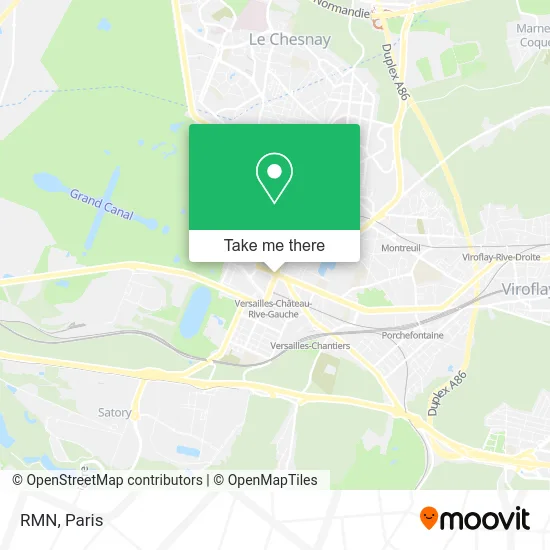
See Rmn, Versailles, on the map
Public Transit to Rmn in Versailles
Wondering how to get to Rmn in Versailles? Moovit helps you find the best way to get to Rmn with step-by-step directions from the nearest public transit station.
Moovit provides free maps and live directions to help you navigate through your city. View schedules, routes, timetables, and find out how long does it take to get to Rmn in real time.
Looking for the nearest stop or station to Rmn? Check out this list of stops closest to your destination: Préfecture; Hôtel de Ville; Europe; Château; Gare de Versailles Château - Rive Gauche; Versailles Château Rive Gauche; Versailles Chantiers; Versailles Rive Droite.
Train: L, N, TER, TER, U, V.RER: C.Bus: 171, 5141, 6201, 6202, 6210, 6214, EX01, 6203, 6204, 6123, 6161, 6162, 6163, 6213, 6284.
Want to see if there’s another route that gets you there at an earlier time? Moovit helps you find alternative routes or times. Get directions from and directions to Rmn easily from the Moovit App or Website.
We make riding to Rmn easy, which is why over 1.5 million users, including users in Versailles, trust Moovit as the best app for public transit. You don’t need to download an individual bus app or train app, Moovit is your all-in-one transit app that helps you find the best bus time or train time available.
For information on prices of bus, train and RER, costs and ride fares to Rmn, please check the Moovit app.
Use the app to navigate to popular places including to the airport, hospital, stadium, grocery store, mall, coffee shop, school, college, and university.
Rmn Address: Avenue du Général de Gaulle 78000 Versailles street in Versailles
- La Petite Venise,
- La Flotille,
- La Boucherie du Cantal,
- Hôtel Le Louis, Versailles Château - MGallery By Sofitel,
- Centre Commercial Parly 2,
- 2 bis Avenue de Paris,
- Hotel Ibis Versailles,
- Versailles France,
- Sept Lieux,
- Hôtel de ville de Versailles,
- ibis Versailles Château,
- Hôtel Ibis,
- E.H.P.A.D. Ma Maison,
- Opéra Royal de Versailles,
- MAIRIE,
- Ville de Versailles,
- Préfecture des Yvelines,
- 1 Avenue de l'Europe,
- Groupe Csf,
- La Table Ibérique Chez José à Versailles
Places Near Rmn (Versailles)
- Hôpital Cochin, Paris,
- Fondation Louis Vuitton, Paris,
- Institut Curie, Paris,
- Créteil Soleil, Creteil,
- Galeries Lafayette Haussmann, Paris,
- Marché Saint-Pierre, Paris,
- Hôpital Saint-Joseph, Paris,
- Centre Hospitalier des 15/20, Paris,
- 29 Rue Manin, Paris,
- Théâtre Mogador, Paris,
- Gare Routière Flixbus, Paris,
- Hôpital Beaujon, Clichy,
- Hopital Foch, Suresnes,
- Hopital Lariboisière, Paris,
- Atelier Des Lumieres, Paris,
- Hôpital Pitié Salpêtrière, Paris,
- Hôpital Henri Mondor, Creteil,
- Hôpital Necker, Paris,
- Hôpital de la Pitié-Salpêtrière, Paris,
- Galeries Lafayette, Paris
How to get to popular places in Paris with public transit
Get around Versailles by public transit!
Traveling around Versailles has never been so easy. See step by step directions as you travel to any attraction, street or major public transit station. View bus and train schedules, arrival times, service alerts and detailed routes on a map, so you know exactly how to get to anywhere in Versailles.
When traveling to any destination around Versailles use Moovit's Live Directions with Get Off Notifications to know exactly where and how far to walk, how long to wait for your line, and how many stops are left. Moovit will alert you when it's time to get off — no need to constantly re-check whether yours is the next stop.
Wondering how to use public transit in Versailles or how to pay for public transit in Versailles? Moovit public transit app can help you navigate your way with public transit easily, and at minimum cost. It includes public transit fees, ticket prices, and costs. Looking for a map of Versailles public transit lines? Moovit public transit app shows all public transit maps in Versailles with all Bus, Train, Metro, Light Rail, RER, Funicular and Gondola routes and stops on an interactive map.
Paris has 7 transit type(s), including: Bus, Train, Metro, Light Rail, RER, Funicular and Gondola, operated by several transit agencies, including RATP, RER, RER Bus de remplacement, Train, Train Bus de remplacement, Tramway Bus de remplacement, TER, ADP, Magical Shuttle, Argenteuil - Boucles de Seine, Autocars Dominique, Bièvre, Brie et 2 Morin, Le Bus - C.C. du Clermontois and Cœur d’Essonne