Directions to Rms Safety (Indianapolis City (Balance)) with public transportation
The following transit lines have routes that pass near Rms Safety
 Bus: 37.
How to get to Rms Safety by bus?
Click on the bus route to see step by step directions with maps, line arrival times and updated time schedules.
From CVS, Indianapolis City (Balance)
75 minFrom Park Tudor School, Meridian Hills
146 minFrom Catholic Archdiocese of Indianapolis Churches, Indianapolis City (Balance)
57 minFrom 4600 Sunset Ave Parking, Indianapolis City (Balance)
99 minFrom STARBUCKS, Indianapolis City (Balance)
98 minFrom St. Vincent Heart Center of Indiana, Indianapolis City (Balance)
115 minFrom Just, Indianapolis City (Balance)
44 minFrom Harvest Nights at Newfields, Indianapolis City (Balance)
71 minFrom Amazon Locker-Izel, Indianapolis City (Balance)
157 minFrom Redline Imports, Indianapolis City (Balance)
95 min
Bus stop near Rms Safety in Indianapolis City (Balance)
- 74th St & Woodland Dr, 3 min walk,VIEW
Bus lines to Rms Safety in Indianapolis City (Balance)
- 37, Transit Center,VIEW
What are the closest stations to Rms Safety?
The closest stations to Rms Safety are:
- 74th St & Woodland Dr is 119 yards away, 3 min walk.
Which bus line stops near Rms Safety?
37 (Intech Park)
What’s the nearest bus station to Rms Safety in Indianapolis City (Balance)?
The nearest bus station to Rms Safety in Indianapolis City (Balance) is 74th St & Woodland Dr. It’s a 3 min walk away.
What time is the first bus to Rms Safety in Indianapolis City (Balance)?
The 37 is the first bus that goes to Rms Safety in Indianapolis City (Balance). It stops nearby at 4:29 AM.
What time is the last bus to Rms Safety in Indianapolis City (Balance)?
The 37 is the last bus that goes to Rms Safety in Indianapolis City (Balance). It stops nearby at 10:48 PM.
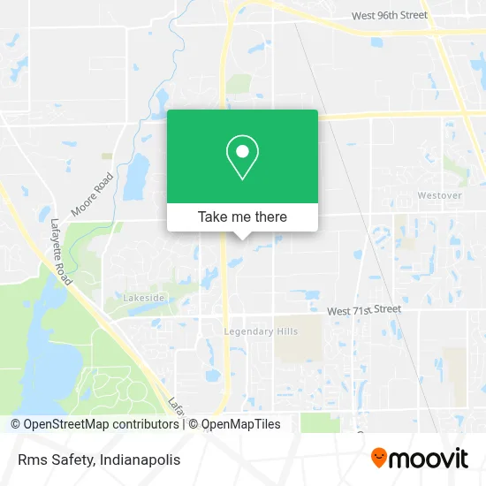
See Rms Safety, Indianapolis City (Balance), on the map
Public Transit to Rms Safety in Indianapolis City (Balance)
Wondering how to get to Rms Safety in Indianapolis City (Balance)? Moovit helps you find the best way to get to Rms Safety with step-by-step directions from the nearest public transit station.
Moovit provides free maps and live directions to help you navigate through your city. View schedules, routes, timetables, and find out how long does it take to get to Rms Safety in real time.
Looking for the nearest stop or station to Rms Safety? Check out this list of stops closest to your destination: 74th St & Woodland Dr.
Bus: 37.
Want to see if there’s another route that gets you there at an earlier time? Moovit helps you find alternative routes or times. Get directions from and directions to Rms Safety easily from the Moovit App or Website.
We make riding to Rms Safety easy, which is why over 1.5 million users, including users in Indianapolis City (Balance), trust Moovit as the best app for public transit. You don’t need to download an individual bus app or train app, Moovit is your all-in-one transit app that helps you find the best bus time or train time available.
For information on prices of bus, costs and ride fares to Rms Safety, please check the Moovit app.
Use the app to navigate to popular places including to the airport, hospital, stadium, grocery store, mall, coffee shop, school, college, and university.
Rms Safety Address: 7702 Woodland Dr street in Indianapolis City (Balance)
- Parts Super Center,
- Genesys Telecommunications,
- Interactive Intelligence Company Gym,
- 465 east,
- Castillon Cheap Locksmith,
- Rexel USA Branch Resource Center - Closed,
- Candlewood Suites Indianapolis Northwest,
- Harris, Brent L, Agt,
- Unitedhealthcare Hearing,
- Butler-MacDonald Inc.,
- International Global Solutions,
- Priio,
- Zionsville Rd & 74th St,
- Primedia Business Magazine,
- Kpaul,
- Prima Staffing Solutions,
- Park 100 industrial center,
- Herff Jones,
- Hudson,
- Dbisp
Places Near Rms Safety (Indianapolis City (Balance))
- Indiana Convention Center, Indianapolis City (Balance),
- Plainfield, IN, Plainfield,
- Indiana, Indianapolis City (Balance),
- Cotter's Massage Parlor With Happy Endings, Indianapolis City (Balance),
- Eskenazi Hospital, Indianapolis City (Balance),
- Methodist Hospital of Indianapolis, Indianapolis City (Balance),
- Castleton Square Mall, Indianapolis,
- I U Health Methodist Hospital, Indianapolis City (Balance),
- Indianapolis Airport Zone 2, Indianapolis City (Balance),
- Gainbridge Fieldhouse, Indianapolis City (Balance),
- St. Vincent Hospital - Indianapolis, Indianapolis City (Balance),
- Train Ride At Castleton Mall, Indianapolis City (Balance),
- I-465 / I-65 Interchange, Indianapolis City (Balance),
- Indianapolis Motor Speedway, Speedway,
- Jersey Barn, Indianapolis City (Balance),
- Lucas Oil Stadium, Indianapolis City (Balance),
- St. Vincent entrance #1, Indianapolis City (Balance),
- 119 W 19th St Parking, Indianapolis City (Balance),
- Lilly Corporate Center (Eli Lilly & Co), Indianapolis City (Balance),
- THE BALT, Indianapolis City (Balance)
How to get to popular places in Indianapolis with public transit
Get around Indianapolis City (Balance) by public transit!
Traveling around Indianapolis City (Balance) has never been so easy. See step by step directions as you travel to any attraction, street or major public transit station. View bus and train schedules, arrival times, service alerts and detailed routes on a map, so you know exactly how to get to anywhere in Indianapolis City (Balance).
When traveling to any destination around Indianapolis City (Balance) use Moovit's Live Directions with Get Off Notifications to know exactly where and how far to walk, how long to wait for your line, and how many stops are left. Moovit will alert you when it's time to get off — no need to constantly re-check whether yours is the next stop.
Wondering how to use public transit in Indianapolis City (Balance) or how to pay for public transit in Indianapolis City (Balance)? Moovit public transit app can help you navigate your way with public transit easily, and at minimum cost. It includes public transit fees, ticket prices, and costs. Looking for a map of Indianapolis City (Balance) public transit lines? Moovit public transit app shows all public transit maps in Indianapolis City (Balance) with all bus routes and stops on an interactive map.
Indianapolis has 1 transit type(s), including: bus, operated by several transit agencies, including IndyGo, FlixBus-us and Greyhound-us