Directions to Rnd Group (Indianapolis City (Balance)) with public transportation
The following transit lines have routes that pass near Rnd Group
 Bus: 82.
How to get to Rnd Group by bus?
Click on the bus route to see step by step directions with maps, line arrival times and updated time schedules.
From 1300 E 86th St Parking, Indianapolis City (Balance)
32 minFrom 38th Street and Shadeland Ave., Indianapolis City (Balance)
89 minFrom North Central High School, Indianapolis City (Balance)
31 minFrom Binford Blvd / Allisonville Rd, Indianapolis City (Balance)
75 minFrom 46th Street & Emerson Avenue, Indianapolis City (Balance)
66 minFrom Pendleton Pike, Exit 42, Indianapolis City (Balance)
97 minFrom Carmel, Plaindfield & Greenwood, Indianapolis City (Balance)
92 minFrom N Emerson Ave / E 38th St, Indianapolis City (Balance)
83 minFrom Blue Rhino, Indianapolis City (Balance)
45 minFrom Carvel Club, Indianapolis City (Balance)
74 min
Bus stop near Rnd Group in Indianapolis City (Balance)
- 86th St & Allisonville Rd, 14 min walk,VIEW
Bus lines to Rnd Group in Indianapolis City (Balance)
- 82, Community Hosp North,VIEW
What are the closest stations to Rnd Group?
The closest stations to Rnd Group are:
- 86th St & Allisonville Rd is 1156 yards away, 14 min walk.
Which bus line stops near Rnd Group?
82 (Community Hosp North)
What’s the nearest bus station to Rnd Group in Indianapolis City (Balance)?
The nearest bus station to Rnd Group in Indianapolis City (Balance) is 86th St & Allisonville Rd. It’s a 14 min walk away.
What time is the first bus to Rnd Group in Indianapolis City (Balance)?
The 82 is the first bus that goes to Rnd Group in Indianapolis City (Balance). It stops nearby at 5:07 AM.
What time is the last bus to Rnd Group in Indianapolis City (Balance)?
The 82 is the last bus that goes to Rnd Group in Indianapolis City (Balance). It stops nearby at 10:38 PM.
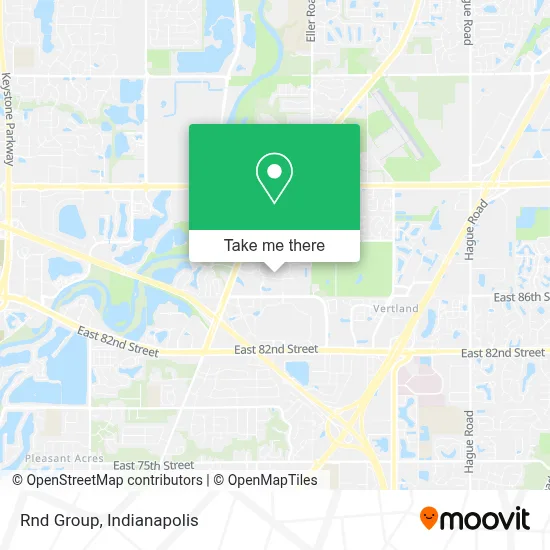
See Rnd Group, Indianapolis City (Balance), on the map
Public Transit to Rnd Group in Indianapolis City (Balance)
Wondering how to get to Rnd Group in Indianapolis City (Balance)? Moovit helps you find the best way to get to Rnd Group with step-by-step directions from the nearest public transit station.
Moovit provides free maps and live directions to help you navigate through your city. View schedules, routes, timetables, and find out how long does it take to get to Rnd Group in real time.
Looking for the nearest stop or station to Rnd Group? Check out this list of stops closest to your destination: 86th St & Allisonville Rd.
Bus: 82.
Want to see if there’s another route that gets you there at an earlier time? Moovit helps you find alternative routes or times. Get directions from and directions to Rnd Group easily from the Moovit App or Website.
We make riding to Rnd Group easy, which is why over 1.5 million users, including users in Indianapolis City (Balance), trust Moovit as the best app for public transit. You don’t need to download an individual bus app or train app, Moovit is your all-in-one transit app that helps you find the best bus time or train time available.
For information on prices of bus, costs and ride fares to Rnd Group, please check the Moovit app.
Use the app to navigate to popular places including to the airport, hospital, stadium, grocery store, mall, coffee shop, school, college, and university.
Rnd Group Address: 5975 Castle Creek Parkway North Dr street in Indianapolis City (Balance)
- Belle Tire,
- Gander Mountain,
- Integrity Mortgage Group,
- Infinity Locksmith & Key,
- Appliance Repair Monogram Repair Service,
- Urban Underpriced Furniture,
- Kim's Natural Lounge,
- Nita's Unique Touch,
- Buffalo Wild Wings,
- Train Ride At Castleton Mall,
- Miracle-Ear,
- Gemmer Wealth Management,
- American Diabetes Association,
- Sahm Park / Castleton Recycling Bin,
- Disc Crazy Indianapolis,
- Dxl,
- Columbia,
- Arc'teryx,
- Saraga International Supermarket,
- Kittle's Furniture
Places Near Rnd Group (Indianapolis City (Balance))
- Train Ride At Castleton Mall, Indianapolis City (Balance),
- Methodist Hospital of Indianapolis, Indianapolis City (Balance),
- Indiana Convention Center, Indianapolis City (Balance),
- Lucas Oil Stadium, Indianapolis City (Balance),
- Cotter's Massage Parlor With Happy Endings, Indianapolis City (Balance),
- I-465 / I-65 Interchange, Indianapolis City (Balance),
- THE BALT, Indianapolis City (Balance),
- Indiana, Indianapolis City (Balance),
- 119 W 19th St Parking, Indianapolis City (Balance),
- St. Vincent Hospital - Indianapolis, Indianapolis City (Balance),
- Lilly Corporate Center (Eli Lilly & Co), Indianapolis City (Balance),
- Eskenazi Hospital, Indianapolis City (Balance),
- Indianapolis Airport Zone 2, Indianapolis City (Balance),
- Jersey Barn, Indianapolis City (Balance),
- Plainfield, IN, Plainfield,
- St. Vincent entrance #1, Indianapolis City (Balance),
- Gainbridge Fieldhouse, Indianapolis City (Balance),
- I U Health Methodist Hospital, Indianapolis City (Balance),
- Indianapolis Motor Speedway, Speedway,
- Castleton Square Mall, Indianapolis
How to get to popular places in Indianapolis with public transit
Get around Indianapolis City (Balance) by public transit!
Traveling around Indianapolis City (Balance) has never been so easy. See step by step directions as you travel to any attraction, street or major public transit station. View bus and train schedules, arrival times, service alerts and detailed routes on a map, so you know exactly how to get to anywhere in Indianapolis City (Balance).
When traveling to any destination around Indianapolis City (Balance) use Moovit's Live Directions with Get Off Notifications to know exactly where and how far to walk, how long to wait for your line, and how many stops are left. Moovit will alert you when it's time to get off — no need to constantly re-check whether yours is the next stop.
Wondering how to use public transit in Indianapolis City (Balance) or how to pay for public transit in Indianapolis City (Balance)? Moovit public transit app can help you navigate your way with public transit easily, and at minimum cost. It includes public transit fees, ticket prices, and costs. Looking for a map of Indianapolis City (Balance) public transit lines? Moovit public transit app shows all public transit maps in Indianapolis City (Balance) with all bus routes and stops on an interactive map.
Indianapolis has 1 transit type(s), including: bus, operated by several transit agencies, including IndyGo, FlixBus-us and Greyhound-us