How to get to Rndc - Indiana by bus?
Click on the bus route to see step by step directions with maps, line arrival times and updated time schedules.
From Sunoco, Indianapolis City (Balance)
57 minFrom Butler University Jordan Hall, Indianapolis City (Balance)
76 minFrom Budget, Indianapolis City (Balance)
57 minFrom Social Security, Indianapolis City (Balance)
82 minFrom Wheeler Mission Center For Women & Children, Indianapolis City (Balance)
39 minFrom Southern Plaza Shopping Center, Indianapolis City (Balance)
32 minFrom Southport High School's Baseball Field, Indianapolis City (Balance)
56 minFrom S Arlington Ave / E Raymond St, Indianapolis City (Balance)
88 minFrom Carvel Club, Indianapolis City (Balance)
52 minFrom MSD Wayne Township Operations Center, Indianapolis City (Balance)
75 min
Bus stops near Rndc - Indiana in Indianapolis City (Balance)
Bus lines to Rndc - Indiana in Indianapolis City (Balance)
What are the closest stations to Rndc - Indiana?
The closest stations to Rndc - Indiana are:
- Meridian St & Wilkins St is 481 yards away, 6 min walk.
- Kentucky Ave & Mccarty Ct is 594 yards away, 8 min walk.
Which bus lines stop near Rndc - Indiana?
These bus lines stop near Rndc - Indiana: 16, 24, 31, 8.
What’s the nearest bus station to Rndc - Indiana in Indianapolis City (Balance)?
The nearest bus station to Rndc - Indiana in Indianapolis City (Balance) is Meridian St & Wilkins St. It’s a 6 min walk away.
What time is the first bus to Rndc - Indiana in Indianapolis City (Balance)?
The 16 is the first bus that goes to Rndc - Indiana in Indianapolis City (Balance). It stops nearby at 5:29 AM.
What time is the last bus to Rndc - Indiana in Indianapolis City (Balance)?
The 31 is the last bus that goes to Rndc - Indiana in Indianapolis City (Balance). It stops nearby at 9:36 PM.
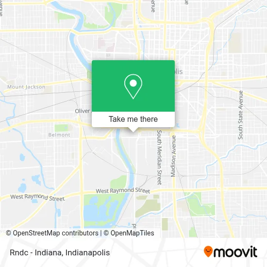
See Rndc - Indiana, Indianapolis City (Balance), on the map
Public Transit to Rndc - Indiana in Indianapolis City (Balance)
Wondering how to get to Rndc - Indiana in Indianapolis City (Balance)? Moovit helps you find the best way to get to Rndc - Indiana with step-by-step directions from the nearest public transit station.
Moovit provides free maps and live directions to help you navigate through your city. View schedules, routes, timetables, and find out how long does it take to get to Rndc - Indiana in real time.
Looking for the nearest stop or station to Rndc - Indiana? Check out this list of stops closest to your destination: Meridian St & Wilkins St; Kentucky Ave & Mccarty Ct.
Bus: 16, 24, 31, 8.
Want to see if there’s another route that gets you there at an earlier time? Moovit helps you find alternative routes or times. Get directions from and directions to Rndc - Indiana easily from the Moovit App or Website.
We make riding to Rndc - Indiana easy, which is why over 1.5 million users, including users in Indianapolis City (Balance), trust Moovit as the best app for public transit. You don’t need to download an individual bus app or train app, Moovit is your all-in-one transit app that helps you find the best bus time or train time available.
For information on prices of bus, costs and ride fares to Rndc - Indiana, please check the Moovit app.
Use the app to navigate to popular places including to the airport, hospital, stadium, grocery store, mall, coffee shop, school, college, and university.
Rndc - Indiana Address: 700 W Morris St street in Indianapolis City (Balance)
- RNDC,
- Mark-It Express,
- Pumpmeisters,
- Indiana Department of Administration,
- Coroner's Office,
- Illini Swallow Lines,
- Terrace Ave & S West St,
- Jem Consulting Services,
- Hurst Bean Field,
- 846 S KENWOOD Ave Parking,
- Thomas A Edison Middle School (Key Learning Community High School),
- Wcwo Wrestling,
- Horseshoe Silver Lot,
- Ben Auto Repair,
- 828 Venue Management Company,
- Edison School Of the Arts #47,
- Round Town Brewery Tap Room,
- Tweatherford Inc.,
- 1144 Kentucky Ave Parking,
- 1106 S Meridian St Parking
Places Near Rndc - Indiana (Indianapolis City (Balance))
- Eskenazi Hospital, Indianapolis City (Balance),
- St. Vincent Hospital - Indianapolis, Indianapolis City (Balance),
- I-465 / I-65 Interchange, Indianapolis City (Balance),
- Gainbridge Fieldhouse, Indianapolis City (Balance),
- Indiana Convention Center, Indianapolis City (Balance),
- Indiana, Indianapolis City (Balance),
- Jersey Barn, Indianapolis City (Balance),
- Train Ride At Castleton Mall, Indianapolis City (Balance),
- Lilly Corporate Center (Eli Lilly & Co), Indianapolis City (Balance),
- Castleton Square Mall, Indianapolis,
- Cotter's Massage Parlor With Happy Endings, Indianapolis City (Balance),
- 119 W 19th St Parking, Indianapolis City (Balance),
- Methodist Hospital of Indianapolis, Indianapolis City (Balance),
- Indianapolis Motor Speedway, Speedway,
- St. Vincent entrance #1, Indianapolis City (Balance),
- Plainfield, IN, Plainfield,
- Indianapolis Airport Zone 2, Indianapolis City (Balance),
- THE BALT, Indianapolis City (Balance),
- Lucas Oil Stadium, Indianapolis City (Balance),
- I U Health Methodist Hospital, Indianapolis City (Balance)
How to get to popular places in Indianapolis with public transit
Get around Indianapolis City (Balance) by public transit!
Traveling around Indianapolis City (Balance) has never been so easy. See step by step directions as you travel to any attraction, street or major public transit station. View bus and train schedules, arrival times, service alerts and detailed routes on a map, so you know exactly how to get to anywhere in Indianapolis City (Balance).
When traveling to any destination around Indianapolis City (Balance) use Moovit's Live Directions with Get Off Notifications to know exactly where and how far to walk, how long to wait for your line, and how many stops are left. Moovit will alert you when it's time to get off — no need to constantly re-check whether yours is the next stop.
Wondering how to use public transit in Indianapolis City (Balance) or how to pay for public transit in Indianapolis City (Balance)? Moovit public transit app can help you navigate your way with public transit easily, and at minimum cost. It includes public transit fees, ticket prices, and costs. Looking for a map of Indianapolis City (Balance) public transit lines? Moovit public transit app shows all public transit maps in Indianapolis City (Balance) with all bus routes and stops on an interactive map.
Indianapolis has 1 transit type(s), including: bus, operated by several transit agencies, including IndyGo, FlixBus-us and Greyhound-us