How to get to Rngimages by bus?
Click on the bus route to see step by step directions with maps, line arrival times and updated time schedules.
From Horseshoe Baltimore, Baltimore
35 minFrom Hyatt Regency Baltimore Inner Harbor, Baltimore
32 minFrom Towson, MD, Baltimore County
55 minFrom Johns Hopkins Bayview Medical Center, Baltimore
61 minFrom I-695 @ Exit 17 (Security Blvd/MD 122), Baltimore County
33 minFrom Randallstown, MD, Baltimore County
45 minFrom National Aquarium-Baltimore, Baltimore
34 minFrom National Aquarium, Baltimore
34 minFrom Bwi2 Employee Shuttles, Baltimore
44 minFrom Eastern Ave (eastern avenue and dundalk av), Baltimore
63 min
How to get to Rngimages by train?
Click on the train route to see step by step directions with maps, line arrival times and updated time schedules.
How to get to Rngimages by metro?
Click on the metro route to see step by step directions with maps, line arrival times and updated time schedules.
Bus stops near Rngimages in Baltimore
Metro station near Rngimages in Baltimore
- Upton Metro, 18 min walk,VIEW
Train station near Rngimages in Baltimore
- West Baltimore Marc Nb, 40 min walk,VIEW
Bus lines to Rngimages in Baltimore
What are the closest stations to Rngimages?
The closest stations to Rngimages are:
- North Ave & Longwood St Eb is 82 yards away, 2 min walk.
- Bloomingdale Rd & Rosedale St Nb is 283 yards away, 4 min walk.
- Upton Metro is 1497 yards away, 18 min walk.
- West Baltimore Marc Nb is 3294 yards away, 40 min walk.
Which bus lines stop near Rngimages?
These bus lines stop near Rngimages: 79, 80, CITYLINK GOLD.
Which train line stops near Rngimages?
MARC (Inbound - Penn)
Which metro line stops near Rngimages?
METRO (Towards Owing Mills)
What’s the nearest metro station to Rngimages in Baltimore?
The nearest metro station to Rngimages in Baltimore is Upton Metro. It’s a 18 min walk away.
What’s the nearest bus station to Rngimages in Baltimore?
The nearest bus station to Rngimages in Baltimore is North Ave & Longwood St Eb. It’s a 2 min walk away.
What time is the first metro to Rngimages in Baltimore?
The METRO is the first metro that goes to Rngimages in Baltimore. It stops nearby at 5:01 AM.
What time is the last metro to Rngimages in Baltimore?
The METRO is the last metro that goes to Rngimages in Baltimore. It stops nearby at 12:20 AM.
What time is the first train to Rngimages in Baltimore?
The MARC is the first train that goes to Rngimages in Baltimore. It stops nearby at 4:39 AM.
What time is the last train to Rngimages in Baltimore?
The MARC is the last train that goes to Rngimages in Baltimore. It stops nearby at 10:53 PM.
What time is the first bus to Rngimages in Baltimore?
The 80 is the first bus that goes to Rngimages in Baltimore. It stops nearby at 3:11 AM.
What time is the last bus to Rngimages in Baltimore?
The 80 is the last bus that goes to Rngimages in Baltimore. It stops nearby at 3:10 AM.
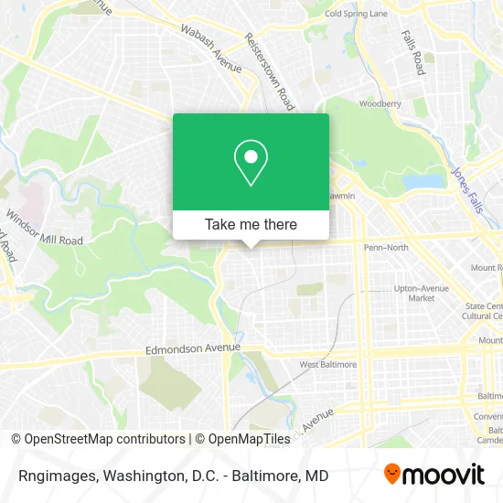
See Rngimages, Baltimore, on the map
Public Transit to Rngimages in Baltimore
Wondering how to get to Rngimages in Baltimore? Moovit helps you find the best way to get to Rngimages with step-by-step directions from the nearest public transit station.
Moovit provides free maps and live directions to help you navigate through your city. View schedules, routes, timetables, and find out how long does it take to get to Rngimages in real time.
Looking for the nearest stop or station to Rngimages? Check out this list of stops closest to your destination: North Ave & Longwood St Eb; Bloomingdale Rd & Rosedale St Nb; Upton Metro; West Baltimore Marc Nb.
Bus: 79, 80, CITYLINK GOLD, 29, 38.Train: MARC.Metro: METRO.
Want to see if there’s another route that gets you there at an earlier time? Moovit helps you find alternative routes or times. Get directions from and directions to Rngimages easily from the Moovit App or Website.
We make riding to Rngimages easy, which is why over 1.5 million users, including users in Baltimore, trust Moovit as the best app for public transit. You don’t need to download an individual bus app or train app, Moovit is your all-in-one transit app that helps you find the best bus time or train time available.
For information on prices of bus, train and metro, costs and ride fares to Rngimages, please check the Moovit app.
Use the app to navigate to popular places including to the airport, hospital, stadium, grocery store, mall, coffee shop, school, college, and university.
Rngimages Address: Westwood Ave street in Baltimore
- Westwood Food Market,
- Asap Locksmith,
- ATM,
- Los Robertones Food Market,
- Make the City Pretty,
- JK Property Management,
- St Matthew's Outreach,
- North Avenue Gateway,
- North Ave & Longwood St Eb,
- St. Matthew's Community Long-Term Outreach Center,
- North Partners,
- W North Ave (north avenue / longwood),
- W North Ave and Longwood,
- Pizza City,
- Henninghan Luther Rev,
- W North Ave Building 3004,
- Emotions Aid Victims Fndtn,
- Gateway Apartment,
- Presbury St (presbury and N Longwood St),
- Presbury St Bloomingdale
Places Near Rngimages (Baltimore)
- Museum Of The Bible, Washington,
- Camden Yards, Baltimore,
- Georgetown, Washington,
- Washington DC VA Medical Center, Washington,
- The Anthem, Washington,
- Westfield Montgomery Mall, Montgomery County,
- Amazon Hq2, Arlington County,
- National Zoo, Washington,
- Marriott Marquis Washington, DC, Washington,
- Washington National Cathedral, Washington,
- Rock Creek Tennis Center, Washington,
- Pennsylvania Ave NW (3rd st and pennsylvania), Washington,
- Warner Theatre, Washington,
- National Museum of African American History and Culture, Washington,
- M&T Bank Stadium, Baltimore,
- PG Mall, Prince George's County,
- Basilica of the National Shrine, Washington,
- Capital One Arena, Washington,
- National Mall, Washington,
- Sibley Memorial Hospital, Washington
How to get to popular places in Washington, D.C. - Baltimore, MD with public transit
Get around Baltimore by public transit!
Traveling around Baltimore has never been so easy. See step by step directions as you travel to any attraction, street or major public transit station. View bus and train schedules, arrival times, service alerts and detailed routes on a map, so you know exactly how to get to anywhere in Baltimore.
When traveling to any destination around Baltimore use Moovit's Live Directions with Get Off Notifications to know exactly where and how far to walk, how long to wait for your line, and how many stops are left. Moovit will alert you when it's time to get off — no need to constantly re-check whether yours is the next stop.
Wondering how to use public transit in Baltimore or how to pay for public transit in Baltimore? Moovit public transit app can help you navigate your way with public transit easily, and at minimum cost. It includes public transit fees, ticket prices, and costs. Looking for a map of Baltimore public transit lines? Moovit public transit app shows all public transit maps in Baltimore with all Bus, Train, Metro, Light Rail and Ferry routes and stops on an interactive map.
Washington, D.C. - Baltimore, MD has 5 transit type(s), including: Bus, Train, Metro, Light Rail and Ferry, operated by several transit agencies, including WMATA, Montgomery County Ride On, Fairfax Connector, TheBus, PRTC, DASH - Alexandria, Arlington Transit (ART), RTA of Central Maryland, MDOT MTA, MDOT MTA Light RailLink, MDOT MTA Commuter Bus, MDOT MTA Local Bus, FXBGO!, Virginia Railway Express (VRE) and MARC