Directions to Rnr Transporte e Logística (Umbará) with public transportation
The following transit lines have routes that pass near Rnr Transporte e Logística
How to get to Rnr Transporte e Logística by bus?
Click on the bus route to see step by step directions with maps, line arrival times and updated time schedules.
From Rua José Cadilhe, Água Verde
55 minFrom Rua Doutor Bley Zornig, Boqueirão
51 minFrom Complexo Hospitalar Do Trabalhador, Novo Mundo
37 minFrom Avenida Senador Salgado Filho, Uberaba
53 minFrom Avenida República Argentina 1336, Vila Izabel
55 minFrom Rua João Bettega, Cic
54 minFrom Estação Tubo Morretes, Portão
48 minFrom Vila Izabel, Vila Izabel
50 minFrom Hospital Cardiológico Costantini, Portão
51 minFrom Santa Quiteria, Santa Quitéria
59 min
Bus stops near Rnr Transporte e Logística in Umbará
Bus lines to Rnr Transporte e Logística in Umbará
- 528 BOQUEIRÃO / PINHEIRINHO, Futurama → Terminal Pinheirinho,VIEW
- 639 FUTURAMA, Terminal Pinheirinho → Futurama,VIEW
- 641 LUIZ NICHELE, Luiz Nichele → Terminal Pinheirinho,VIEW
- 638 PINHEIRINHO, Bairro Pinheirinho → Terminal Pinheirinho,VIEW
- 642 GANCHINHO, Terminal Pinheirinho → Ganchinho,VIEW
- 708 TATUQUARA / SÍTIO CERCADO, Terminal Tatuquara → Terminal Sítio Cercado,VIEW
- 640 PALMEIRA, Palmeira → Terminal Pinheirinho,VIEW
- 643 UMBARÁ, Terminal Pinheirinho → Umbará (Via Campo Belo),VIEW
- 794 PARQUE LAGO AZUL, Terminal Pinheirinho → Parque Lago Azul,VIEW
What are the closest stations to Rnr Transporte e Logística?
The closest stations to Rnr Transporte e Logística are:
- R. Herminio Nichele, 333 is 229 meters away, 4 min walk.
- Estrada do Ganchinho, 282 is 266 meters away, 4 min walk.
- R. Nicola Pellanda, 2460 is 539 meters away, 8 min walk.
Which bus lines stop near Rnr Transporte e Logística?
These bus lines stop near Rnr Transporte e Logística: 528 BOQUEIRÃO / PINHEIRINHO, 641 LUIZ NICHELE.
What’s the nearest bus station to Rnr Transporte e Logística in Umbará?
The nearest bus stations to Rnr Transporte e Logística in Umbará are R. Herminio Nichele, 333 and Estrada do Ganchinho, 282. The closest one is a 4 min walk away.
What time is the first bus to Rnr Transporte e Logística in Umbará?
The 639 FUTURAMA is the first bus that goes to Rnr Transporte e Logística in Umbará. It stops nearby at 4:52 AM.
What time is the last bus to Rnr Transporte e Logística in Umbará?
The 528 BOQUEIRÃO / PINHEIRINHO is the last bus that goes to Rnr Transporte e Logística in Umbará. It stops nearby at 1:25 AM.
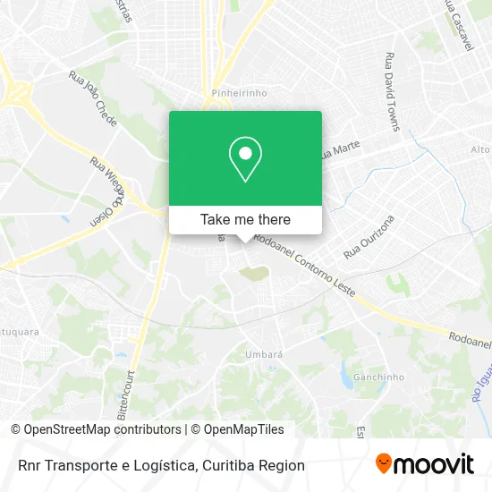
See Rnr Transporte e Logística, Umbará, on the map
Public Transit to Rnr Transporte e Logística in Umbará
Wondering how to get to Rnr Transporte e Logística in Umbará? Moovit helps you find the best way to get to Rnr Transporte e Logística with step-by-step directions from the nearest public transit station.
Moovit provides free maps and live directions to help you navigate through your city. View schedules, routes, timetables, and find out how long does it take to get to Rnr Transporte e Logística in real time.
Looking for the nearest stop or station to Rnr Transporte e Logística? Check out this list of stops closest to your destination: R. Herminio Nichele; Estrada do Ganchinho; R. Nicola Pellanda.
Bus: 528 BOQUEIRÃO / PINHEIRINHO, 641 LUIZ NICHELE, 639 FUTURAMA, 638 PINHEIRINHO, 642 GANCHINHO, 708 TATUQUARA / SÍTIO CERCADO, 640 PALMEIRA, 643 UMBARÁ, 794 PARQUE LAGO AZUL.
Want to see if there’s another route that gets you there at an earlier time? Moovit helps you find alternative routes or times. Get directions from and directions to Rnr Transporte e Logística easily from the Moovit App or Website.
We make riding to Rnr Transporte e Logística easy, which is why over 1.5 million users, including users in Umbará, trust Moovit as the best app for public transit. You don’t need to download an individual bus app or train app, Moovit is your all-in-one transit app that helps you find the best bus time or train time available.
For information on prices of bus, costs and ride fares to Rnr Transporte e Logística, please check the Moovit app.
Use the app to navigate to popular places including to the airport, hospital, stadium, grocery store, mall, coffee shop, school, college, and university.
Rnr Transporte e Logística Address: Rua Profeta Elias, 56 Umbará Curitiba-PR 81930-020 street in Umbará
- Elizete Araújo,
- Pastilhas e Massas Tio Chico,
- Top Miudezas e Confeções,
- Jardim Futurama,
- Matheus Machado Pereira,
- Santuário da Divina Misericordia,
- Cantu Pneus - a Maior Distribuidora de Pneus do Brasil,
- Cps Log,
- Rua João Sikora 201,
- Estrada do Ganchinho 570,
- Palácio das Telhas,
- Mano Arte Moveis e Decoracoes,
- Rua Hermínio Nichele, 334 - Umbara,
- Santuário Nacional Da Divina Misericórdia,
- Paccini & Cia,
- Rua João Amadeu Pedro Bom, 203 - Tatuquara,
- Viação Cidade Sorriso,
- Farmácia Hiperfarma,
- Viação Cidade Sorriso,
- Mapa Madeiras Paletes e Embalagens
Places Near Rnr Transporte e Logística (Umbará)
- Hospital Erasto Gaertner, Jardim Das Américas,
- Hospital do Rocio, Campo,
- Pontifícia Universidade Católica do Paraná (PUCPR), Prado Velho,
- Rua General Mário Tourinho, Campina Do Siqueira,
- Rua Martim Afonso 558, Mercês,
- Campo Largo, Campo,
- Shopping Palladium, Portão,
- Parque Barigui, Mercês,
- Hhhhh, Fazendinha,
- Jardim Botânico de Curitiba PR, Centro,
- Hospital Da Cruz Vermelha, Batel,
- Arena Da Baixada - Curitiba,
- Hospital Angelina Caron, Campina Grande Do Sul,
- Park Shopping Barigüi, Mossunguê,
- Hospital Nossa Senhora Das Graças, Mercês,
- Hospital Universitário Evangélico de Curitiba, Bigorrilho,
- Jockey Plaza Shopping Center, Tarumã,
- Hospital Madalena Sofia, Bairro Alto,
- Shopping Estação, Rebouças,
- Hospital de Clínicas (HC - UFPR), Centro
How to get to popular places in Curitiba Region with public transit
Get around Umbará by public transit!
Traveling around Umbará has never been so easy. See step by step directions as you travel to any attraction, street or major public transit station. View bus and train schedules, arrival times, service alerts and detailed routes on a map, so you know exactly how to get to anywhere in Umbará.
When traveling to any destination around Umbará use Moovit's Live Directions with Get Off Notifications to know exactly where and how far to walk, how long to wait for your line, and how many stops are left. Moovit will alert you when it's time to get off — no need to constantly re-check whether yours is the next stop.
Wondering how to use public transit in Umbará or how to pay for public transit in Umbará? Moovit public transit app can help you navigate your way with public transit easily, and at minimum cost. It includes public transit fees, ticket prices, and costs. Looking for a map of Umbará public transit lines? Moovit public transit app shows all public transit maps in Umbará with all Bus and Cable Car routes and stops on an interactive map.
Curitiba Region has 2 transit type(s), including: Bus and Cable Car, operated by several transit agencies, including Sistema Integrado de Mobilidade (URBS), Sistema Integrado de Mobilidade (AMEP), URBS (Cartões bancários e Dinheiro), URBS (Cartões bancários / Cartão URBS), AMEP (Cartões bancários / Cartão MetroCard), AMEP (Cartões bancários / Cartão MetroCard / Dinheiro), Viação Colombo (Dinheiro), TRIAR (Cartão TRIAR / Dinheiro), Empresa Curitiba Cerro Azul (Dinheiro), Expresso Nossa Senhora da Penha (Dinheiro), Empresa Campo Alto Tijucas (Dinheiro), Auto Viação São José (Cartão VEM / Dinheiro), BRT S/A (Cartão VEM / Dinheiro), TransPiedade (Cartão Cidadão / Dinheiro) and Oceânica Sul (Cartão Transporte / Dinheiro)