How to get to Robert Chupas DDS by bus?
Click on the bus route to see step by step directions with maps, line arrival times and updated time schedules.
Bus stops near Robert Chupas DDS in Wethersfield
Bus lines to Robert Chupas DDS in Wethersfield
What are the closest stations to Robert Chupas DDS?
The closest stations to Robert Chupas DDS are:
- Silas Deane Hwy @ Maple St is 366 yards away, 5 min walk.
- Silas Deane Hwy @ New England Patio & Hearth is 460 yards away, 6 min walk.
Which bus lines stop near Robert Chupas DDS?
These bus lines stop near Robert Chupas DDS: 53, 55, 950.
What’s the nearest bus station to Robert Chupas DDS in Wethersfield?
The nearest bus station to Robert Chupas DDS in Wethersfield is Silas Deane Hwy @ Maple St. It’s a 5 min walk away.
What time is the first bus to Robert Chupas DDS in Wethersfield?
The 47 is the first bus that goes to Robert Chupas DDS in Wethersfield. It stops nearby at 5:16 AM.
What time is the last bus to Robert Chupas DDS in Wethersfield?
The 91 is the last bus that goes to Robert Chupas DDS in Wethersfield. It stops nearby at 12:00 AM.
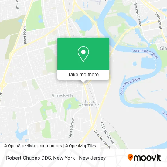
See Robert Chupas DDS, Wethersfield, on the map
Public Transit to Robert Chupas DDS in Wethersfield
Wondering how to get to Robert Chupas DDS in Wethersfield? Moovit helps you find the best way to get to Robert Chupas DDS with step-by-step directions from the nearest public transit station.
Moovit provides free maps and live directions to help you navigate through your city. View schedules, routes, timetables, and find out how long does it take to get to Robert Chupas DDS in real time.
Looking for the nearest stop or station to Robert Chupas DDS? Check out this list of stops closest to your destination: Silas Deane Hwy @ Maple St; Silas Deane Hwy @ New England Patio & Hearth.
Bus: 53, 55, 950, 47, 91.
Want to see if there’s another route that gets you there at an earlier time? Moovit helps you find alternative routes or times. Get directions from and directions to Robert Chupas DDS easily from the Moovit App or Website.
We make riding to Robert Chupas DDS easy, which is why over 1.5 million users, including users in Wethersfield, trust Moovit as the best app for public transit. You don’t need to download an individual bus app or train app, Moovit is your all-in-one transit app that helps you find the best bus time or train time available.
For information on prices of bus and train, costs and ride fares to Robert Chupas DDS, please check the Moovit app.
Use the app to navigate to popular places including to the airport, hospital, stadium, grocery store, mall, coffee shop, school, college, and university.
Robert Chupas DDS Address: 899 Silas Deane Hwy Wethersfield, CT 06109 street in Wethersfield
- Maite Vasquez Realtor,
- A Better Life Homecare Ct,
- Ben Tabellione,
- Xvivo Scientific Animation,
- The Connecticut Team,
- Yankee Institute,
- Drisdelle Homes Llc,
- Axe It - Axe Throwing Social,
- Opulent Retreat Salon & Suites,
- Resource Options Inc.,
- Adult and Pediatric Allergy and Asthma,
- Connecticut Construction Industries Association - Ccia,
- Divaje Consignment Boutique Llc,
- Euphoria Loft Event Venue,
- Western Union,
- The Fresh Monkee,
- Western Union,
- Tom's Trains Of Connecticut,
- Fasmart 303,
- Pops Tire
Places Near Robert Chupas DDS (Wethersfield)
- Mountainside Hospital, Glen Ridge,
- Wall Street, Manhattan,
- 26 Federal Plaza, Manhattan,
- Pier 83, Manhattan,
- 376 Hudson Street, Manhattan,
- Queens Center Mall, Queens,
- Katz's Deli, Manhattan,
- Chinatown, Manhattan,
- SoHo, Manhattan,
- Hudson Yards, Manhattan,
- 1 Police Plaza, Manhattan,
- Rockefeller Center, Manhattan,
- 3 Stone St, Manhattan,
- 911 Memorial, Manhattan,
- Times Square, Manhattan,
- qqqq, Manhattan,
- San Gennaro Feast, Manhattan,
- 66 John Street, Manhattan,
- 111 Centre New York City Supreme Court, Manhattan,
- Bellevue Hospital, Manhattan
How to get to popular places in New York - New Jersey with public transit
Get around Wethersfield by public transit!
Traveling around Wethersfield has never been so easy. See step by step directions as you travel to any attraction, street or major public transit station. View bus and train schedules, arrival times, service alerts and detailed routes on a map, so you know exactly how to get to anywhere in Wethersfield.
When traveling to any destination around Wethersfield use Moovit's Live Directions with Get Off Notifications to know exactly where and how far to walk, how long to wait for your line, and how many stops are left. Moovit will alert you when it's time to get off — no need to constantly re-check whether yours is the next stop.
Wondering how to use public transit in Wethersfield or how to pay for public transit in Wethersfield? Moovit public transit app can help you navigate your way with public transit easily, and at minimum cost. It includes public transit fees, ticket prices, and costs. Looking for a map of Wethersfield public transit lines? Moovit public transit app shows all public transit maps in Wethersfield with all Bus, Train, Subway, Light Rail, Ferry and Cable Car routes and stops on an interactive map.
New York - New Jersey has 6 transit type(s), including: Bus, Train, Subway, Light Rail, Ferry and Cable Car, operated by several transit agencies, including MTA Subway, Metro-North Railroad, LIRR, PATH, MTA New York City Transit - Express routes, MTA Bus, NJ Transit, NYC Ferry, NICE bus, Bee-Line Bus, NJ Transit Rail, Norwalk Transit District, Hartford Line, River Valley Transit and HART