How to get to Robert J. Talbot Baseball Field by bus?
Click on the bus route to see step by step directions with maps, line arrival times and updated time schedules.
From Audi Field, Washington
82 minFrom DoubleTree by Hilton Hotel Washington DC-Crystal City, Arlington County
84 minFrom Coast Guard HQ & Bus Bay D, Washington
106 minFrom 21st St NW & L St NW, Washington
56 minFrom Consulate General Of Peru, Washington
57 minFrom U.S. Department of Health and Human Services (HHS), Washington
70 minFrom Walter Reed National Military Medical Center, Montgomery County
85 minFrom Beltway Plaza Mall, Prince George's County
81 minFrom Islamic Center of Washington, Washington
69 minFrom Malcolm X Park, Washington
113 min
How to get to Robert J. Talbot Baseball Field by metro?
Click on the metro route to see step by step directions with maps, line arrival times and updated time schedules.
From Audi Field, Washington
60 minFrom DoubleTree by Hilton Hotel Washington DC-Crystal City, Arlington County
53 minFrom Coast Guard HQ & Bus Bay D, Washington
64 minFrom 21st St NW & L St NW, Washington
44 minFrom Consulate General Of Peru, Washington
52 minFrom U.S. Department of Health and Human Services (HHS), Washington
44 minFrom Walter Reed National Military Medical Center, Montgomery County
60 minFrom Islamic Center of Washington, Washington
57 minFrom Malcolm X Park, Washington
66 min
Bus stop near Robert J. Talbot Baseball Field in Washington
- Hawaii Av Ne+2 St NE, 8 min walk,VIEW
Metro station near Robert J. Talbot Baseball Field in Washington
- Fort Totten, 19 min walk,VIEW
Bus lines to Robert J. Talbot Baseball Field in Washington
- D74, East To Rhode Island Av,VIEW
What are the closest stations to Robert J. Talbot Baseball Field?
The closest stations to Robert J. Talbot Baseball Field are:
- Hawaii Av Ne+2 St NE is 619 yards away, 8 min walk.
- Fort Totten is 1509 yards away, 19 min walk.
Which bus lines stop near Robert J. Talbot Baseball Field?
These bus lines stop near Robert J. Talbot Baseball Field: D74, P32.
Which metro lines stop near Robert J. Talbot Baseball Field?
These metro lines stop near Robert J. Talbot Baseball Field: GREEN, RED, YELLOW.
What’s the nearest metro station to Robert J. Talbot Baseball Field in Washington?
The nearest metro station to Robert J. Talbot Baseball Field in Washington is Fort Totten. It’s a 19 min walk away.
What’s the nearest bus station to Robert J. Talbot Baseball Field in Washington?
The nearest bus station to Robert J. Talbot Baseball Field in Washington is Hawaii Av Ne+2 St NE. It’s a 8 min walk away.
What time is the first metro to Robert J. Talbot Baseball Field in Washington?
The GREEN is the first metro that goes to Robert J. Talbot Baseball Field in Washington. It stops nearby at 5:08 AM.
What time is the last metro to Robert J. Talbot Baseball Field in Washington?
The GREEN is the last metro that goes to Robert J. Talbot Baseball Field in Washington. It stops nearby at 12:33 AM.
What time is the first bus to Robert J. Talbot Baseball Field in Washington?
The D74 is the first bus that goes to Robert J. Talbot Baseball Field in Washington. It stops nearby at 5:08 AM.
What time is the last bus to Robert J. Talbot Baseball Field in Washington?
The D74 is the last bus that goes to Robert J. Talbot Baseball Field in Washington. It stops nearby at 1:06 AM.
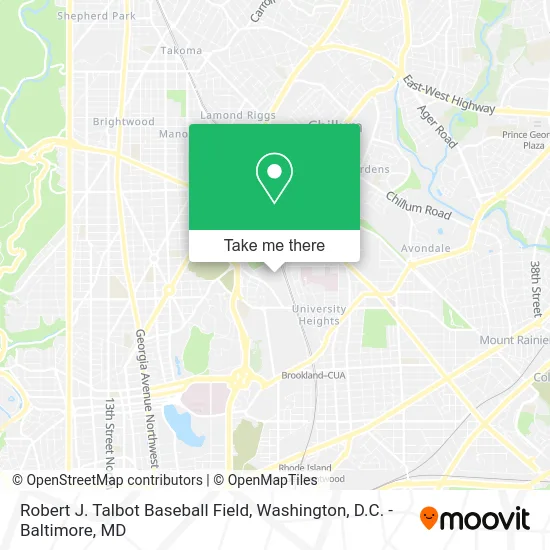
See Robert J. Talbot Baseball Field, Washington, on the map
Public Transit to Robert J. Talbot Baseball Field in Washington
Wondering how to get to Robert J. Talbot Baseball Field in Washington? Moovit helps you find the best way to get to Robert J. Talbot Baseball Field with step-by-step directions from the nearest public transit station.
Moovit provides free maps and live directions to help you navigate through your city. View schedules, routes, timetables, and find out how long does it take to get to Robert J. Talbot Baseball Field in real time.
Looking for the nearest stop or station to Robert J. Talbot Baseball Field? Check out this list of stops closest to your destination: Hawaii Av Ne+2 St NE; Fort Totten.
Bus: D74, P32.Metro: GREEN, RED, YELLOW.
Want to see if there’s another route that gets you there at an earlier time? Moovit helps you find alternative routes or times. Get directions from and directions to Robert J. Talbot Baseball Field easily from the Moovit App or Website.
We make riding to Robert J. Talbot Baseball Field easy, which is why over 1.5 million users, including users in Washington, trust Moovit as the best app for public transit. You don’t need to download an individual bus app or train app, Moovit is your all-in-one transit app that helps you find the best bus time or train time available.
For information on prices of bus and metro, costs and ride fares to Robert J. Talbot Baseball Field, please check the Moovit app.
Use the app to navigate to popular places including to the airport, hospital, stadium, grocery store, mall, coffee shop, school, college, and university.
Robert J. Talbot Baseball Field Address: Brookland Avenue Northeast street in Washington
- Carlini Field,
- Maynor Empowerment Group,
- Fort Totten Transfer Station,
- Hollingsworth,
- London Construction Services,
- Raymond A. Dufour (Athletic) Center,
- H8 Bus Stop 1002420,
- Ascension Living Carroll Manor,
- Capital Area Food Bank,
- Washington Yu Ying Public Charter School,
- Carroll Manor,
- Fort Totten Park,
- Archbishop Carroll High School,
- Ukrainian Catholic National Shrine Of The Holy Family,
- Raymond A. Dufour (Athletic) Center,
- 64 Bus Stop Fort Totten,
- United States Soldiers' and Airmen's Home National Cemetery (Soldiers Home Cemetery),
- President Lincoln's Cottage,
- United States Soldiers' and Airmen's Home National Cemetery,
- Fort Totten Metro Parking Lot
Places Near Robert J. Talbot Baseball Field (Washington)
- National Museum of African American History and Culture, Washington,
- Amazon Hq2, Arlington County,
- National Theatre, Washington,
- Camden Yards, Baltimore,
- The Anthem, Washington,
- Rock Creek Tennis Center, Washington,
- Washington DC VA Medical Center, Washington,
- Basilica of the National Shrine, Washington,
- Museum Of The Bible, Washington,
- Pennsylvania Ave NW (3rd st and pennsylvania), Washington,
- M&T Bank Stadium, Baltimore,
- Washington National Cathedral, Washington,
- Sibley Memorial Hospital, Washington,
- Westfield Montgomery Mall, Montgomery County,
- National Zoo, Washington,
- Warner Theatre, Washington,
- Marriott Marquis Washington, DC, Washington,
- PG Mall, Prince George's County,
- Capital One Arena, Washington,
- Georgetown, Washington
How to get to popular places in Washington, D.C. - Baltimore, MD with public transit
Get around Washington by public transit!
Traveling around Washington has never been so easy. See step by step directions as you travel to any attraction, street or major public transit station. View bus and train schedules, arrival times, service alerts and detailed routes on a map, so you know exactly how to get to anywhere in Washington.
When traveling to any destination around Washington use Moovit's Live Directions with Get Off Notifications to know exactly where and how far to walk, how long to wait for your line, and how many stops are left. Moovit will alert you when it's time to get off — no need to constantly re-check whether yours is the next stop.
Wondering how to use public transit in Washington or how to pay for public transit in Washington? Moovit public transit app can help you navigate your way with public transit easily, and at minimum cost. It includes public transit fees, ticket prices, and costs. Looking for a map of Washington public transit lines? Moovit public transit app shows all public transit maps in Washington with all Bus, Train, Metro, Light Rail and Ferry routes and stops on an interactive map.
Washington, D.C. - Baltimore, MD has 5 transit type(s), including: Bus, Train, Metro, Light Rail and Ferry, operated by several transit agencies, including WMATA, Montgomery County Ride On, Fairfax Connector, TheBus, PRTC, DASH - Alexandria, Arlington Transit (ART), RTA of Central Maryland, MDOT MTA, MDOT MTA Light RailLink, MDOT MTA Commuter Bus, MDOT MTA Local Bus, FXBGO!, Virginia Railway Express (VRE) and MARC