How to get to Robi Giant Yard Cards by bus?
Click on the bus route to see step by step directions with maps, line arrival times and updated time schedules.
From N Meridian St Suite, Indianapolis City (Balance)
160 minFrom Dina Varano Ma LMHC, Indianapolis City (Balance)
102 minFrom 86th St & Westfield Blvd, Indianapolis City (Balance)
140 minFrom Lara Paintings, Indianapolis City (Balance)
64 minFrom Butler High Ropes Course, Indianapolis City (Balance)
88 minFrom Fastenal, Indianapolis City (Balance)
36 minFrom Exit 121/Lafayette Rd/N, Indianapolis City (Balance)
39 minFrom STARBUCKS, Indianapolis City (Balance)
85 minFrom St. Vincent Hospital Associate Fitness Center, Indianapolis City (Balance)
50 min
Bus stop near Robi Giant Yard Cards in Indianapolis City (Balance)
- Moller Rd & 86th St, 3 min walk,VIEW
Bus lines to Robi Giant Yard Cards in Indianapolis City (Balance)
- 37, Transit Center,VIEW
What are the closest stations to Robi Giant Yard Cards?
The closest stations to Robi Giant Yard Cards are:
- Moller Rd & 86th St is 176 yards away, 3 min walk.
Which bus lines stop near Robi Giant Yard Cards?
These bus lines stop near Robi Giant Yard Cards: 34, 37.
What’s the nearest bus station to Robi Giant Yard Cards in Indianapolis City (Balance)?
The nearest bus station to Robi Giant Yard Cards in Indianapolis City (Balance) is Moller Rd & 86th St. It’s a 3 min walk away.
What time is the first bus to Robi Giant Yard Cards in Indianapolis City (Balance)?
The 37 is the first bus that goes to Robi Giant Yard Cards in Indianapolis City (Balance). It stops nearby at 4:36 AM.
What time is the last bus to Robi Giant Yard Cards in Indianapolis City (Balance)?
The 37 is the last bus that goes to Robi Giant Yard Cards in Indianapolis City (Balance). It stops nearby at 10:52 PM.
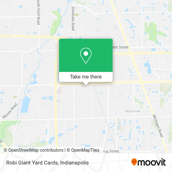
See Robi Giant Yard Cards, Indianapolis City (Balance), on the map
Public Transit to Robi Giant Yard Cards in Indianapolis City (Balance)
Wondering how to get to Robi Giant Yard Cards in Indianapolis City (Balance)? Moovit helps you find the best way to get to Robi Giant Yard Cards with step-by-step directions from the nearest public transit station.
Moovit provides free maps and live directions to help you navigate through your city. View schedules, routes, timetables, and find out how long does it take to get to Robi Giant Yard Cards in real time.
Looking for the nearest stop or station to Robi Giant Yard Cards? Check out this list of stops closest to your destination: Moller Rd & 86th St.
Bus: 34, 37.
Want to see if there’s another route that gets you there at an earlier time? Moovit helps you find alternative routes or times. Get directions from and directions to Robi Giant Yard Cards easily from the Moovit App or Website.
We make riding to Robi Giant Yard Cards easy, which is why over 1.5 million users, including users in Indianapolis City (Balance), trust Moovit as the best app for public transit. You don’t need to download an individual bus app or train app, Moovit is your all-in-one transit app that helps you find the best bus time or train time available.
For information on prices of bus, costs and ride fares to Robi Giant Yard Cards, please check the Moovit app.
Use the app to navigate to popular places including to the airport, hospital, stadium, grocery store, mall, coffee shop, school, college, and university.
Robi Giant Yard Cards Address: 5361 W 86th St street in Indianapolis City (Balance)
- Low Dough Auto Repair,
- Door Renew,
- Facilities Management,
- Stewarts Custom Cabinetry and Interior Trim,
- RSC Developments,
- Wildwood Exteriors,
- Aed Metal Products,
- Laketon Refining,
- Allens Therapuetic Services,
- Williams Realty,
- Body Sculpting by Vicki,
- Coworx Staffing Services,
- Kim Washam,
- Quality Appraisal,
- BEST ONE TIRE & SERVICE,
- Alpha Office Solutions,
- Dawson Tire & Wheel,
- Indianapolis Lock and Key,
- next,
- Central Indiana Snow and Ice Management
Places Near Robi Giant Yard Cards (Indianapolis City (Balance))
- Eskenazi Hospital, Indianapolis City (Balance),
- St. Vincent Hospital - Indianapolis, Indianapolis City (Balance),
- I-465 / I-65 Interchange, Indianapolis City (Balance),
- Gainbridge Fieldhouse, Indianapolis City (Balance),
- Indiana Convention Center, Indianapolis City (Balance),
- Indiana, Indianapolis City (Balance),
- Jersey Barn, Indianapolis City (Balance),
- Train Ride At Castleton Mall, Indianapolis City (Balance),
- Lilly Corporate Center (Eli Lilly & Co), Indianapolis City (Balance),
- Castleton Square Mall, Indianapolis,
- Cotter's Massage Parlor With Happy Endings, Indianapolis City (Balance),
- 119 W 19th St Parking, Indianapolis City (Balance),
- Methodist Hospital of Indianapolis, Indianapolis City (Balance),
- Indianapolis Motor Speedway, Speedway,
- St. Vincent entrance #1, Indianapolis City (Balance),
- Plainfield, IN, Plainfield,
- Indianapolis Airport Zone 2, Indianapolis City (Balance),
- THE BALT, Indianapolis City (Balance),
- Lucas Oil Stadium, Indianapolis City (Balance),
- I U Health Methodist Hospital, Indianapolis City (Balance)
How to get to popular places in Indianapolis with public transit
Get around Indianapolis City (Balance) by public transit!
Traveling around Indianapolis City (Balance) has never been so easy. See step by step directions as you travel to any attraction, street or major public transit station. View bus and train schedules, arrival times, service alerts and detailed routes on a map, so you know exactly how to get to anywhere in Indianapolis City (Balance).
When traveling to any destination around Indianapolis City (Balance) use Moovit's Live Directions with Get Off Notifications to know exactly where and how far to walk, how long to wait for your line, and how many stops are left. Moovit will alert you when it's time to get off — no need to constantly re-check whether yours is the next stop.
Wondering how to use public transit in Indianapolis City (Balance) or how to pay for public transit in Indianapolis City (Balance)? Moovit public transit app can help you navigate your way with public transit easily, and at minimum cost. It includes public transit fees, ticket prices, and costs. Looking for a map of Indianapolis City (Balance) public transit lines? Moovit public transit app shows all public transit maps in Indianapolis City (Balance) with all bus routes and stops on an interactive map.
Indianapolis has 1 transit type(s), including: bus, operated by several transit agencies, including IndyGo, FlixBus-us and Greyhound-us