How to get to Robie's Learning Corner by bus?
Click on the bus route to see step by step directions with maps, line arrival times and updated time schedules.
Bus stops near Robie's Learning Corner in Wethersfield
Bus lines to Robie's Learning Corner in Wethersfield
What are the closest stations to Robie's Learning Corner?
The closest stations to Robie's Learning Corner are:
- Wolcott Hill Rd @ Nott St is 131 yards away, 2 min walk.
- Silas Deane Hwy @ Nott St is 422 yards away, 6 min walk.
Which bus lines stop near Robie's Learning Corner?
These bus lines stop near Robie's Learning Corner: 43, 55, 950.
What’s the nearest bus station to Robie's Learning Corner in Wethersfield?
The nearest bus station to Robie's Learning Corner in Wethersfield is Wolcott Hill Rd @ Nott St. It’s a 2 min walk away.
What time is the first bus to Robie's Learning Corner in Wethersfield?
The 47 is the first bus that goes to Robie's Learning Corner in Wethersfield. It stops nearby at 5:20 AM.
What time is the last bus to Robie's Learning Corner in Wethersfield?
The 47 is the last bus that goes to Robie's Learning Corner in Wethersfield. It stops nearby at 11:25 PM.
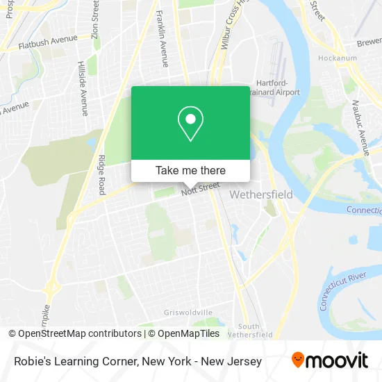
See Robie's Learning Corner, Wethersfield, on the map
Public Transit to Robie's Learning Corner in Wethersfield
Wondering how to get to Robie's Learning Corner in Wethersfield? Moovit helps you find the best way to get to Robie's Learning Corner with step-by-step directions from the nearest public transit station.
Moovit provides free maps and live directions to help you navigate through your city. View schedules, routes, timetables, and find out how long does it take to get to Robie's Learning Corner in real time.
Looking for the nearest stop or station to Robie's Learning Corner? Check out this list of stops closest to your destination: Wolcott Hill Rd @ Nott St; Silas Deane Hwy @ Nott St.
Bus: 43, 55, 950, 47.
Want to see if there’s another route that gets you there at an earlier time? Moovit helps you find alternative routes or times. Get directions from and directions to Robie's Learning Corner easily from the Moovit App or Website.
We make riding to Robie's Learning Corner easy, which is why over 1.5 million users, including users in Wethersfield, trust Moovit as the best app for public transit. You don’t need to download an individual bus app or train app, Moovit is your all-in-one transit app that helps you find the best bus time or train time available.
For information on prices of bus and train, costs and ride fares to Robie's Learning Corner, please check the Moovit app.
Use the app to navigate to popular places including to the airport, hospital, stadium, grocery store, mall, coffee shop, school, college, and university.
Robie's Learning Corner Address: 226 Nott St Wethersfield, CT 06109 street in Wethersfield
- Charles Wright School,
- Francis B Cleary DDS,
- The American Legion,
- Principal Advisory Group,
- Joseloff & Joseloff,
- Luis Miguel Art & Aesthetics,
- ITT Business Communications Division,
- The Energize Connecticut Multifamily Initiative,
- Roots Massage & Bodywork, LLC,
- Wethersfield Senior Center,
- Community Center,
- Lombardo Piano Technology,
- Northeast Combustion,
- Dish Network,
- A Little Time for,
- Sofianos Margaret Real Estate School of New England,
- Sora My Way,
- Lamore's Service Station,
- Wethersfield Meadows,
- Wethersfield Rental
Places Near Robie's Learning Corner (Wethersfield)
- qqqq, Manhattan,
- Mountainside Hospital, Glen Ridge,
- 1 Police Plaza, Manhattan,
- Bellevue Hospital, Manhattan,
- Wall Street, Manhattan,
- 3 Stone St, Manhattan,
- Chinatown, Manhattan,
- Rockefeller Center, Manhattan,
- 26 Federal Plaza, Manhattan,
- 376 Hudson Street, Manhattan,
- 66 John Street, Manhattan,
- San Gennaro Feast, Manhattan,
- SoHo, Manhattan,
- Queens Center Mall, Queens,
- Pier 83, Manhattan,
- Times Square, Manhattan,
- 111 Centre New York City Supreme Court, Manhattan,
- 911 Memorial, Manhattan,
- Hudson Yards, Manhattan,
- Katz's Deli, Manhattan
How to get to popular places in New York - New Jersey with public transit
Get around Wethersfield by public transit!
Traveling around Wethersfield has never been so easy. See step by step directions as you travel to any attraction, street or major public transit station. View bus and train schedules, arrival times, service alerts and detailed routes on a map, so you know exactly how to get to anywhere in Wethersfield.
When traveling to any destination around Wethersfield use Moovit's Live Directions with Get Off Notifications to know exactly where and how far to walk, how long to wait for your line, and how many stops are left. Moovit will alert you when it's time to get off — no need to constantly re-check whether yours is the next stop.
Wondering how to use public transit in Wethersfield or how to pay for public transit in Wethersfield? Moovit public transit app can help you navigate your way with public transit easily, and at minimum cost. It includes public transit fees, ticket prices, and costs. Looking for a map of Wethersfield public transit lines? Moovit public transit app shows all public transit maps in Wethersfield with all Bus, Train, Subway, Light Rail, Ferry and Cable Car routes and stops on an interactive map.
New York - New Jersey has 6 transit type(s), including: Bus, Train, Subway, Light Rail, Ferry and Cable Car, operated by several transit agencies, including MTA Subway, Metro-North Railroad, LIRR, PATH, MTA New York City Transit - Express routes, MTA Bus, NJ Transit, NYC Ferry, NICE bus, Bee-Line Bus, NJ Transit Rail, Norwalk Transit District, Hartford Line, River Valley Transit and HART