How to get to Robin Carpio by bus?
Click on the bus route to see step by step directions with maps, line arrival times and updated time schedules.
From Av. Heroe Inmortal, Aguascalientes
41 minFrom Recinto Apalilla 404 113, Aguascalientes
66 minFrom Lomas del Gachupín, Aguascalientes
51 minFrom Plaza del Vestir, Aguascalientes
54 minFrom Jose Maria Chavez, Aguascalientes
48 minFrom Fraccionamiento Benito Palomino Dena, Aguascalientes
36 minFrom Norias de Ojocaliente, Aguascalientes
71 minFrom Sabropollo rastro, Aguascalientes
46 minFrom Avenida Mariano Hidalgo, Aguascalientes
52 min
Bus stops near Robin Carpio in Aguascalientes
Bus lines to Robin Carpio in Aguascalientes
What are the closest stations to Robin Carpio?
The closest stations to Robin Carpio are:
- Avenida Independencia, 2214(145) is 398 meters away, 6 min walk.
- Boulevard Luis Donaldo Colosio Murrieta, 1722(722) is 648 meters away, 9 min walk.
Which bus lines stop near Robin Carpio?
These bus lines stop near Robin Carpio: RUTA 06, RUTA 18, RUTA 35, RUTA 45.
What’s the nearest bus station to Robin Carpio in Aguascalientes?
The nearest bus station to Robin Carpio in Aguascalientes is Avenida Independencia, 2214(145). It’s a 6 min walk away.
What time is the first bus to Robin Carpio in Aguascalientes?
The RUTA 10 is the first bus that goes to Robin Carpio in Aguascalientes. It stops nearby at 6:10 AM.
What time is the last bus to Robin Carpio in Aguascalientes?
The RUTA 10 is the last bus that goes to Robin Carpio in Aguascalientes. It stops nearby at 10:15 PM.
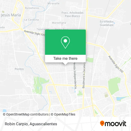
See Robin Carpio, Aguascalientes, on the map
Public Transit to Robin Carpio in Aguascalientes
Wondering how to get to Robin Carpio in Aguascalientes? Moovit helps you find the best way to get to Robin Carpio with step-by-step directions from the nearest public transit station.
Moovit provides free maps and live directions to help you navigate through your city. View schedules, routes, timetables, and find out how long does it take to get to Robin Carpio in real time.
Looking for the nearest stop or station to Robin Carpio? Check out this list of stops closest to your destination: Avenida Independencia; Boulevard Luis Donaldo Colosio Murrieta.
Bus: RUTA 06, RUTA 18, RUTA 35, RUTA 45, RUTA 10.
Want to see if there’s another route that gets you there at an earlier time? Moovit helps you find alternative routes or times. Get directions from and directions to Robin Carpio easily from the Moovit App or Website.
We make riding to Robin Carpio easy, which is why over 1.5 million users, including users in Aguascalientes, trust Moovit as the best app for public transit. You don’t need to download an individual bus app or train app, Moovit is your all-in-one transit app that helps you find the best bus time or train time available.
For information on prices of bus, costs and ride fares to Robin Carpio, please check the Moovit app.
Use the app to navigate to popular places including to the airport, hospital, stadium, grocery store, mall, coffee shop, school, college, and university.
Robin Carpio Address: Prolongación General Ignacio Zaragoza 815, Fracc Trojes de Oriente II, 20115 Aguascalientes, Aguasc street in Aguascalientes
- Inmobiliaria Lomelisalas,
- Clínica Isabel Orrantia,
- Rainbowlsags,
- Cugini,
- Centro de Estudios Fiscales, innovación y Negocios,
- Blue Boat,
- Shoestique Ags,
- Plaza Infinite,
- K&L Boutique,
- Thunder Disco,
- Waffles & Coffee Aguascalientes,
- Extra Pollo,
- Plasti Dp Ags - Norte,
- Plaza Zaragoza 712,
- Carnitas Chili,
- La Chiqueada de la Casa,
- Coparmex Aguascalientes,
- Centro de Energía Lakesh,
- Starbucks,
- Union de Credito Sn Marcos
Places Near Robin Carpio (Aguascalientes)
- La Isla San Marcos, Aguascalientes,
- Universidad Autónoma de Aguascalientes, Aguascalientes,
- Ciudad industrial, Aguascalientes,
- Agropecuario, Aguascalientes,
- ESPACIOS, Aguascalientes,
- Terminal De Combis, Aguascalientes,
- Aeropuerto de Aguascalientes S.A. de C.V., Aguascalientes,
- Centro Comercial Altaria, Aguascalientes,
- Central De Autobuses, Aguascalientes,
- Blvd. Luis Donaldo Colosio, Aguascalientes,
- Parque Las Tres Centurias, Aguascalientes,
- Isla San Marcos, Aguascalientes,
- Centro, Aguascalientes,
- clinica 3 uaa, Aguascalientes,
- Nuevo Hospital Hidalgo, Aguascalientes,
- Imss Clinica 1, Aguascalientes,
- Hospital Imss No. 3, Aguascalientes,
- Jesús María, Aguascalientes,
- Villas de Nuestra Señora de la Asunción, Aguascalientes,
- Villasuncion, Aguascalientes
How to get to popular places in Aguascalientes with public transit
Get around Aguascalientes by public transit!
Traveling around Aguascalientes has never been so easy. See step by step directions as you travel to any attraction, street or major public transit station. View bus and train schedules, arrival times, service alerts and detailed routes on a map, so you know exactly how to get to anywhere in Aguascalientes.
When traveling to any destination around Aguascalientes use Moovit's Live Directions with Get Off Notifications to know exactly where and how far to walk, how long to wait for your line, and how many stops are left. Moovit will alert you when it's time to get off — no need to constantly re-check whether yours is the next stop.
Wondering how to use public transit in Aguascalientes or how to pay for public transit in Aguascalientes? Moovit public transit app can help you navigate your way with public transit easily, and at minimum cost. It includes public transit fees, ticket prices, and costs. Looking for a map of Aguascalientes public transit lines? Moovit public transit app shows all public transit maps in Aguascalientes with all bus routes and stops on an interactive map.
Aguascalientes has 1 transit type(s), including: bus, operated by several transit agencies, including Coordinación General de Movilidad