How to get to Robin Hood Project by bus?
Click on the bus route to see step by step directions with maps, line arrival times and updated time schedules.
From Lormit Professional Svc, Edmonton
41 minFrom La Cite Francophone, Edmonton
49 minFrom Commonwealth Community Recreation Centre, Edmonton
52 minFrom Royal Alberta Museum (New Location), Edmonton
35 minFrom High Level Bridge, Edmonton
49 minFrom 11910 111 Avenue Northwest, Edmonton
35 minFrom Big Iron Drilling, Edmonton
40 minFrom Hearinglife, Edmonton
41 minFrom Real Canadian Superstore, Edmonton
34 minFrom NAIT Souch Campus, Edmonton
51 min
Bus stops near Robin Hood Project in Edmonton
Bus lines to Robin Hood Project in Edmonton
- 002, West Edmonton Mall - Stadium - Clareview,VIEW
- 004, Lewis Farms - University - Capilano,VIEW
- 052, Northgate - West Edmonton Mall,VIEW
- 055, Meadows - Southgate - West Edmonton Mall,VIEW
- 056, Meadows - Leger - West Edmonton Mall,VIEW
- 671, Alex Janvier - Wem,VIEW
- 673, Hillcrest - Wem,VIEW
- 674, H.E. Beriault - Lewis Farms,VIEW
- 904, West Edmonton Mall - Westmount,VIEW
- 924, 149 Street & 76 Avenue,VIEW
- 007, West Edmonton Mall - Downtown,VIEW
- 054, West Edmonton Mall - West Clareview,VIEW
- 205, West Edmonton,VIEW
- 681, Ross Sheppard - A. Macdonald - Lewis Farms,VIEW
- 692, Victoria School - Wem,VIEW
- 900X, Lewis Farms - Downtown,VIEW
- 906, West Edmonton Mall - Westmount,VIEW
- 907, West Edmonton Mall - Westmount,VIEW
- 913, West Edmonton Mall - Jamieson Place,VIEW
- 914, West Edmonton Mall - Jasper Place,VIEW
What are the closest stations to Robin Hood Project?
The closest stations to Robin Hood Project are:
- 169 Street & 87 Avenue is 600 meters away, 8 min walk.
- 168 Street & 88 Avenue is 624 meters away, 8 min walk.
- North West Edmonton Mall Tc is 796 meters away, 11 min walk.
Which bus lines stop near Robin Hood Project?
These bus lines stop near Robin Hood Project: 002, 004, 007, 054, 055.
What’s the nearest bus station to Robin Hood Project in Edmonton?
The nearest bus stations to Robin Hood Project in Edmonton are 169 Street & 87 Avenue and 168 Street & 88 Avenue. The closest one is a 8 min walk away.
What time is the first bus to Robin Hood Project in Edmonton?
The 002 is the first bus that goes to Robin Hood Project in Edmonton. It stops nearby at 3:01 AM.
What time is the last bus to Robin Hood Project in Edmonton?
The 004 is the last bus that goes to Robin Hood Project in Edmonton. It stops nearby at 3:38 AM.
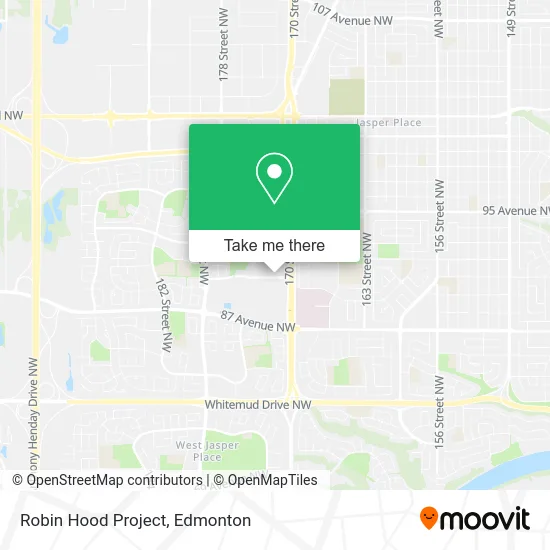
See Robin Hood Project, Edmonton, on the map
Public Transit to Robin Hood Project in Edmonton
Wondering how to get to Robin Hood Project in Edmonton? Moovit helps you find the best way to get to Robin Hood Project with step-by-step directions from the nearest public transit station.
Moovit provides free maps and live directions to help you navigate through your city. View schedules, routes, timetables, and find out how long does it take to get to Robin Hood Project in real time.
Looking for the nearest stop or station to Robin Hood Project? Check out this list of stops closest to your destination: 169 Street & 87 Avenue; 168 Street & 88 Avenue; North West Edmonton Mall Tc.
Bus: 002, 004, 007, 054, 055, 052, 056, 924, 205, 681, 692.
Want to see if there’s another route that gets you there at an earlier time? Moovit helps you find alternative routes or times. Get directions from and directions to Robin Hood Project easily from the Moovit App or Website.
We make riding to Robin Hood Project easy, which is why over 1.5 million users, including users in Edmonton, trust Moovit as the best app for public transit. You don’t need to download an individual bus app or train app, Moovit is your all-in-one transit app that helps you find the best bus time or train time available.
For information on prices of bus and light rail, costs and ride fares to Robin Hood Project, please check the Moovit app.
Use the app to navigate to popular places including to the airport, hospital, stadium, grocery store, mall, coffee shop, school, college, and university.
Robin Hood Project Address: Edmonton, AB T5T 1L6 street in Edmonton
- MR.Barber Westgate,
- WESTERN UNION,
- Yarniversity by River City Yarns,
- Vstudiozzz,
- Ihms,
- ATM Building Services,
- RMW Construction,
- Grange Homeowners Accociation,
- Alberta Association of Landscape Architects,
- Paradigm Esteem,
- Curran Advertising,
- Hydro Blasters,
- Altitude Power Sports,
- Serenity Veterinary Services,
- A&W,
- Firehouse Subs Edmonton Westgate Centre,
- Lava Grill,
- Baymont-West Edmonton,
- Pho King,
- Coco Fresh Tea & Juice
Places Near Robin Hood Project (Edmonton)
- Borden Park, Edmonton,
- University of Alberta, Edmonton,
- Kingsway Mall, Edmonton,
- West Edmonton Mall, Edmonton,
- Rogers Place, Edmonton,
- Whyte Avenue, Edmonton,
- Edmonton EXPO Centre, Edmonton,
- Northgate Centre, Edmonton,
- Edmonton VIA Rail Station, Edmonton,
- MacEwan University, Edmonton,
- Royal Alexandra Hospital, Edmonton,
- Fort Edmonton Park, Edmonton,
- Kaye Edmonton Clinic, Edmonton,
- Alberta Legislature Building, Edmonton,
- Canada Place Service Canada Centre, Edmonton,
- Edmonton Valley Zoo, Edmonton,
- Cross Cancer Institute, Edmonton,
- Londonderry Mall, Edmonton,
- Grey Nuns Community Hospital, Edmonton,
- Edmonton Commonwealth Stadium, Edmonton
How to get to popular places in Edmonton with public transit
Get around Edmonton by public transit!
Traveling around Edmonton has never been so easy. See step by step directions as you travel to any attraction, street or major public transit station. View bus and train schedules, arrival times, service alerts and detailed routes on a map, so you know exactly how to get to anywhere in Edmonton.
When traveling to any destination around Edmonton use Moovit's Live Directions with Get Off Notifications to know exactly where and how far to walk, how long to wait for your line, and how many stops are left. Moovit will alert you when it's time to get off — no need to constantly re-check whether yours is the next stop.
Wondering how to use public transit in Edmonton or how to pay for public transit in Edmonton? Moovit public transit app can help you navigate your way with public transit easily, and at minimum cost. It includes public transit fees, ticket prices, and costs. Looking for a map of Edmonton public transit lines? Moovit public transit app shows all public transit maps in Edmonton with all Bus and Light Rail routes and stops on an interactive map.
Edmonton has 2 transit type(s), including: Bus and Light Rail, operated by several transit agencies, including ETS LRT, ETS, Strathcona County Transit, St. Albert Transit, Spruce Grove Transit, Fort Saskatchewan Transit, Beaumont Transit and Leduc Transit