How to get to Robleda by bus?
Click on the bus route to see step by step directions with maps, line arrival times and updated time schedules.
From Calle Narváez, Madrid
42 minFrom Calle Sepúlveda 3, Madrid
90 minFrom Basílica de N. P. Jesús de Medinaceli (Parroquia Jesus de Medinaceli), Madrid
49 minFrom Bernabeu Stadium, Madrid
65 minFrom Teatro Lara, Madrid
61 minFrom Calle Uruguay, Madrid
72 minFrom Parque de San Isidro, Madrid
97 minFrom Primark, Madrid
59 minFrom Estadio Santiago Bernabéu, Madrid
65 minFrom Calle Orense, Madrid
65 min
How to get to Robleda by train?
Click on the train route to see step by step directions with maps, line arrival times and updated time schedules.
From Calle Narváez, Madrid
51 minFrom Calle Sepúlveda 3, Madrid
54 minFrom Basílica de N. P. Jesús de Medinaceli (Parroquia Jesus de Medinaceli), Madrid
43 minFrom Bernabeu Stadium, Madrid
44 minFrom Teatro Lara, Madrid
46 minFrom Calle Uruguay, Madrid
58 minFrom Parque de San Isidro, Madrid
54 minFrom Primark, Madrid
43 minFrom Estadio Santiago Bernabéu, Madrid
43 minFrom Calle Orense, Madrid
37 min
How to get to Robleda by metro?
Click on the metro route to see step by step directions with maps, line arrival times and updated time schedules.
From Calle Narváez, Madrid
50 minFrom Calle Sepúlveda 3, Madrid
74 minFrom Basílica de N. P. Jesús de Medinaceli (Parroquia Jesus de Medinaceli), Madrid
51 minFrom Bernabeu Stadium, Madrid
58 minFrom Teatro Lara, Madrid
48 minFrom Calle Uruguay, Madrid
60 minFrom Parque de San Isidro, Madrid
67 minFrom Primark, Madrid
45 minFrom Estadio Santiago Bernabéu, Madrid
58 minFrom Calle Orense, Madrid
55 min
Bus stops near Robleda in Madrid
Metro station near Robleda in Madrid
- Villa De Vallecas, 4 min walk,VIEW
Train station near Robleda in Madrid
- Vallecas, 5 min walk,VIEW
Bus lines to Robleda in Madrid
What are the closest stations to Robleda?
The closest stations to Robleda are:
- Avenida Santa Eugenia - Castrillo De Aza is 80 meters away, 2 min walk.
- Avenida Santa Eugenia - Camino De Vasares is 183 meters away, 3 min walk.
- Avenida Santa Eugenia - Camino Vasares is 228 meters away, 4 min walk.
- Villa De Vallecas is 254 meters away, 4 min walk.
- Vallecas is 359 meters away, 5 min walk.
Which bus lines stop near Robleda?
These bus lines stop near Robleda: 145, 58, 63.
Which train lines stop near Robleda?
These train lines stop near Robleda: C2, C7.
Which metro line stops near Robleda?
M-1 (Valdecarros)
What’s the nearest metro station to Robleda in Madrid?
The nearest metro station to Robleda in Madrid is Villa De Vallecas. It’s a 4 min walk away.
What’s the nearest train station to Robleda in Madrid?
The nearest train station to Robleda in Madrid is Vallecas. It’s a 5 min walk away.
What’s the nearest bus station to Robleda in Madrid?
The nearest bus station to Robleda in Madrid is Avenida Santa Eugenia - Castrillo De Aza. It’s a 2 min walk away.
What time is the first metro to Robleda in Madrid?
The M-1 is the first metro that goes to Robleda in Madrid. It stops nearby at 6:05 AM.
What time is the last metro to Robleda in Madrid?
The M-1 is the last metro that goes to Robleda in Madrid. It stops nearby at 2:17 AM.
What time is the first train to Robleda in Madrid?
The C2 is the first train that goes to Robleda in Madrid. It stops nearby at 5:51 AM.
What time is the last train to Robleda in Madrid?
The C2 is the last train that goes to Robleda in Madrid. It stops nearby at 12:02 AM.
What time is the first bus to Robleda in Madrid?
The N9 is the first bus that goes to Robleda in Madrid. It stops nearby at 3:02 AM.
What time is the last bus to Robleda in Madrid?
The N9 is the last bus that goes to Robleda in Madrid. It stops nearby at 3:28 AM.
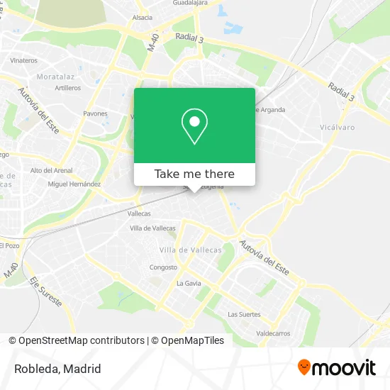
See Robleda, Madrid, on the map
Public Transit to Robleda in Madrid
Wondering how to get to Robleda in Madrid? Moovit helps you find the best way to get to Robleda with step-by-step directions from the nearest public transit station.
Moovit provides free maps and live directions to help you navigate through your city. View schedules, routes, timetables, and find out how long does it take to get to Robleda in real time.
Looking for the nearest stop or station to Robleda? Check out this list of stops closest to your destination: Avenida Santa Eugenia - Castrillo De Aza; Avenida Santa Eugenia - Camino De Vasares; Avenida Santa Eugenia - Camino Vasares; Villa De Vallecas; Vallecas.
Bus: 145, 58, 63, N9.Train: C2, C7.Metro: M-1.
Want to see if there’s another route that gets you there at an earlier time? Moovit helps you find alternative routes or times. Get directions from and directions to Robleda easily from the Moovit App or Website.
We make riding to Robleda easy, which is why over 1.5 million users, including users in Madrid, trust Moovit as the best app for public transit. You don’t need to download an individual bus app or train app, Moovit is your all-in-one transit app that helps you find the best bus time or train time available.
For information on prices of bus, train and metro, costs and ride fares to Robleda, please check the Moovit app.
Use the app to navigate to popular places including to the airport, hospital, stadium, grocery store, mall, coffee shop, school, college, and university.
Robleda Address: Calle de Castrillo de Aza, 30 28031 Santa Eugenia Madrid street in Madrid
- Sanz & Domecq,
- Academia de Estética-Peluqueria y Salon de Belleza,
- Esteban Saperas Feliciano,
- Churreria Helice,
- Daniel,
- Calle Castrillo de Aza 19,
- Centro Cultural Pilar Miró,
- Avenida de Santa Eugenia,
- Vilcap Peluqueros,
- Joaquín Emiliano Roda López-Otazu,
- Chalaura Sala Rociera,
- Oficina De Empleo Av. Santa Eugenia,
- Centro de Estética Vanesa Sánchez,
- Maxi China,
- Tecnison,
- San Bernardo,
- Escuela de Baile y Fitness Pilar Rivas,
- Inem Oficina de Empleo Vallecas,
- Av. de Santa Eugenia 14,
- AltaFit Santa Eugenia
Places Near Robleda (Madrid)
- Centro Comercial La Gavia, Área Metropolitana De Madrid Y Corredor Del Henares,
- Centro Comercial Oasiz Madrid, Área Metropolitana De Madrid Y Corredor Del Henares,
- Plaza Mayor, Madrid,
- Palacio De Vistalegre, Área Metropolitana De Madrid Y Corredor Del Henares,
- Hospital Universitario Ramón y Cajal, Madrid,
- Hospital Universitario La Paz, Madrid,
- Nassica, Área Metropolitana De Madrid Y Corredor Del Henares,
- Tres Aguas, Alcorcón,
- Estacion de Chamartin, Madrid,
- Wizink Center, Madrid,
- Centro Comercial Islazul, Área Metropolitana De Madrid Y Corredor Del Henares,
- Plenilunio, Área Metropolitana De Madrid Y Corredor Del Henares,
- Calle de López de Hoyos 169, Madrid,
- Centro Comercial La Vaguada, Área Metropolitana De Madrid Y Corredor Del Henares,
- Sala La Riviera, Madrid,
- Rastro De Madrid, Área Metropolitana De Madrid Y Corredor Del Henares,
- Mendez Alvaro, Madrid,
- Hospital Clínico Universitario San Carlos, Madrid,
- Mercadillo de Majadahonda, Majadahonda,
- Estadio Wanda Metropolitano, Área Metropolitana De Madrid Y Corredor Del Henares
How to get to popular places in Madrid with public transit
Get around Madrid by public transit!
Traveling around Madrid has never been so easy. See step by step directions as you travel to any attraction, street or major public transit station. View bus and train schedules, arrival times, service alerts and detailed routes on a map, so you know exactly how to get to anywhere in Madrid.
When traveling to any destination around Madrid use Moovit's Live Directions with Get Off Notifications to know exactly where and how far to walk, how long to wait for your line, and how many stops are left. Moovit will alert you when it's time to get off — no need to constantly re-check whether yours is the next stop.
Wondering how to use public transit in Madrid or how to pay for public transit in Madrid? Moovit public transit app can help you navigate your way with public transit easily, and at minimum cost. It includes public transit fees, ticket prices, and costs. Looking for a map of Madrid public transit lines? Moovit public transit app shows all public transit maps in Madrid with all Bus, Train, Metro and Light Rail routes and stops on an interactive map.
Madrid has 4 transit type(s), including: Bus, Train, Metro and Light Rail, operated by several transit agencies, including Metro de Madrid, Metro Ligero, Tranvía de Parla, Renfe Cercanías - Servicios de Autobús especiales, Renfe Cercanias, Renfe Cercanías, EMT, Interurbanos, Urbanos de Alcalá de Henares, Urbanos de Alcobendas, Urbanos de Alcorcón, Urbanos de Algete, Urbanos de Aranjuez, Urbanos de Arganda del Rey and Urbanos de Arroyomolinos