How to get to Rocas de Plata by Colectivo?
Click on the Colectivo route to see step by step directions with maps, line arrival times and updated time schedules.
From Hospital Evita Pueblo, Berazategui
43 minFrom Quilmes, Quilmes
62 minFrom Parada 219 3 Negro, Berazategui
52 minFrom Avenida Calchaquí, Quilmes
44 minFrom Estación Berazategui - Linea Roca, Berazategui
50 minFrom Clinica Modelo Quilmes, Quilmes
73 minFrom Burzaco, Almirante Brown
71 minFrom Ranelagh, Berazategui
47 minFrom Dinamarca / Ericson, Lomas De Zamora
77 minFrom Clinica Espora, Almirante Brown
77 min
How to get to Rocas de Plata by train?
Click on the train route to see step by step directions with maps, line arrival times and updated time schedules.
From Hospital Evita Pueblo, Berazategui
42 minFrom Quilmes, Quilmes
54 minFrom Parada 219 3 Negro, Berazategui
50 minFrom Estación Berazategui - Linea Roca, Berazategui
35 minFrom Clinica Modelo Quilmes, Quilmes
68 minFrom Burzaco, Almirante Brown
53 minFrom Ranelagh, Berazategui
28 minFrom Clinica Espora, Almirante Brown
35 min
Colectivo stops near Rocas de Plata in Florencio Varela
- Manuel Quintana 2-58, 2 min walk,VIEW
- Avenida Eva Perón Y Quintana, 2 min walk,VIEW
- Aniceto Díaz Y Avenida Eva Perón, 3 min walk,VIEW
- Belgrano Y Quintana, 5 min walk,VIEW
- Avenida Perón Y Avenida San Martín (383 - 500 - 502 - 503 - 506 - 507 - 508 - 509 - 512 - 513), 7 min walk,VIEW
- Avenida Perón Y Avenida San Martín (79 - 178 - 403 - 505), 7 min walk,VIEW
- Avenida Perón Y Avenida San Martín (324), 8 min walk,VIEW
- Avenida Perón Y San Martín (148 - 197), 8 min walk,VIEW
Train station near Rocas de Plata in Florencio Varela
- Zeballos, 4 min walk,VIEW
Colectivo lines to Rocas de Plata in Florencio Varela
- 266, 5: Est. Lomas de Zamora x Solano,VIEW
- 148, A: Cementerio x Yrigoyen,VIEW
- 503, K: La Colonia x Senzabello,VIEW
- 500, 1: Hospital El Cruce x Yrigoyen,VIEW
- 508, Cruce Varela ,VIEW
- 178, RC: B - Pompeya x Mitre,VIEW
- 383, 7: Estación Claypole,VIEW
- 501, Lederle,VIEW
- 504, Est. Varela - Est. Sourigues,VIEW
- 505, B: Santa Rosa,VIEW
- 506, Rotonda de Monteverde x Senzabello,VIEW
- 509, 8L: La Carolina x La Sirena,VIEW
- 511, 8J: Bº Don José x Thevenet,VIEW
- 512, 8M: Cruce Varela x La Sirena,VIEW
- 507, 3: Monteverde x Senzaballo ,VIEW
- 513, S: Santa Inés x Km. 26,VIEW
- 79, Est. Varela - Constitución,VIEW
- 403, Est. Lomas,VIEW
- 324, 1: Don Bosco (Nocturno),VIEW
- 197, E: Retiro (R. 14),VIEW
What are the closest stations to Rocas de Plata?
The closest stations to Rocas de Plata are:
- Manuel Quintana 2-58 is 80 meters away, 2 min walk.
- Avenida Eva Perón Y Quintana is 97 meters away, 2 min walk.
- Aniceto Díaz Y Avenida Eva Perón is 212 meters away, 3 min walk.
- Zeballos is 298 meters away, 4 min walk.
- Belgrano Y Quintana is 384 meters away, 5 min walk.
- Avenida Perón Y Avenida San Martín (383 - 500 - 502 - 503 - 506 - 507 - 508 - 509 - 512 - 513) is 517 meters away, 7 min walk.
- Avenida Perón Y Avenida San Martín (79 - 178 - 403 - 505) is 533 meters away, 7 min walk.
- Avenida Perón Y Avenida San Martín (324) is 555 meters away, 8 min walk.
- Avenida Perón Y San Martín (148 - 197) is 576 meters away, 8 min walk.
Which Colectivo lines stop near Rocas de Plata?
These Colectivo lines stop near Rocas de Plata: 148, 500, 503.
Which train line stops near Rocas de Plata?
ROCA (Bosques→Constitución)
What’s the nearest train station to Rocas de Plata in Florencio Varela?
The nearest train station to Rocas de Plata in Florencio Varela is Zeballos. It’s a 4 min walk away.
What’s the nearest Colectivo station to Rocas de Plata in Florencio Varela?
The nearest Colectivo stations to Rocas de Plata in Florencio Varela are Manuel Quintana 2-58 and Avenida Eva Perón Y Quintana. The closest one is a 2 min walk away.
What time is the first train to Rocas de Plata in Florencio Varela?
The ROCA is the first train that goes to Rocas de Plata in Florencio Varela. It stops nearby at 4:19 AM.
What time is the last train to Rocas de Plata in Florencio Varela?
The ROCA is the last train that goes to Rocas de Plata in Florencio Varela. It stops nearby at 9:29 PM.
What time is the first Colectivo to Rocas de Plata in Florencio Varela?
The 403 is the first Colectivo that goes to Rocas de Plata in Florencio Varela. It stops nearby at 3:00 AM.
What time is the last Colectivo to Rocas de Plata in Florencio Varela?
The 178 is the last Colectivo that goes to Rocas de Plata in Florencio Varela. It stops nearby at 4:12 AM.
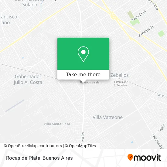
See Rocas de Plata, Florencio Varela, on the map
Public Transit to Rocas de Plata in Florencio Varela
Wondering how to get to Rocas de Plata in Florencio Varela? Moovit helps you find the best way to get to Rocas de Plata with step-by-step directions from the nearest public transit station.
Moovit provides free maps and live directions to help you navigate through your city. View schedules, routes, timetables, and find out how long does it take to get to Rocas de Plata in real time.
Looking for the nearest stop or station to Rocas de Plata? Check out this list of stops closest to your destination: Manuel Quintana 2-58; Avenida Eva Perón Y Quintana; Aniceto Díaz Y Avenida Eva Perón; Zeballos; Belgrano Y Quintana; Avenida Perón Y Avenida San Martín (383 - 500 - 502 - 503 - 506 - 507 - 508 - 509 - 512 - 513); Avenida Perón Y Avenida San Martín (79 - 178 - 403 - 505); Avenida Perón Y Avenida San Martín (324); Avenida Perón Y San Martín (148 - 197).
Colectivo: 148, 500, 503, 266, 508, 178, 383, 501, 504, 505, 507, 513.Train: ROCA.
Want to see if there’s another route that gets you there at an earlier time? Moovit helps you find alternative routes or times. Get directions from and directions to Rocas de Plata easily from the Moovit App or Website.
We make riding to Rocas de Plata easy, which is why over 1.5 million users, including users in Florencio Varela, trust Moovit as the best app for public transit. You don’t need to download an individual bus app or train app, Moovit is your all-in-one transit app that helps you find the best bus time or train time available.
For information on prices of Colectivo and train, costs and ride fares to Rocas de Plata, please check the Moovit app.
Use the app to navigate to popular places including to the airport, hospital, stadium, grocery store, mall, coffee shop, school, college, and university.
Rocas de Plata Address: Rocas de Plata, Avenida Eva Perón 3530, 1888 Gobernador Monteverde street in Florencio Varela
- Santa Lucía,
- Somiro Multieventos,
- Hidrosur,
- Avenida Eva Perón / Vicente López y Planes,
- Fabrica de pastas La Paloma,
- Club nago,
- Instituto de Danzas Árabes Sheila Majul,
- Vicente López y Planes 38,
- Manuel Quintana / Avenida Eva Perón,
- Centro Odontológico Modelo,
- Florencio Varela 142,
- Presidente Peron 3725,
- A Comerla Pizza Lista para Hornear,
- Santa Fé 3711,
- Instituto Santa Lucía,
- Ginecologo-Mattioni Susana Graciela,
- San Luis Florencio Varela,
- Colegio de la Comunidad Santa Lucia,
- Colegio Madre Teresa de Calcuta,
- Pugliese
Places Near Rocas de Plata (Florencio Varela)
- Movistar Arena, Distrito Federal,
- Abasto Shopping, Distrito Federal,
- CABA, Distrito Federal,
- Once, Distrito Federal,
- Jardín Japonés, Distrito Federal,
- Barrio Chino, Distrito Federal,
- Dot Baires Shopping, Vicente López,
- Buenos Aires, Distrito Federal,
- Aeroparque Jorge Newbery,
- La Plata, La Plata,
- Avellaneda, Avellaneda,
- Tecnópolis, Vicente López,
- Facultad de Odontología (UBA), Distrito Federal,
- Aeropuerto Ezeiza, Distrito Federal,
- Hospital Santa Lucia, Distrito Federal,
- Flores, Distrito Federal,
- Unicenter Shopping, San Isidro,
- La Plata, La Plata,
- Estadio Monumental (River Plate), Distrito Federal,
- Parque de la Ciudad, Distrito Federal
How to get to popular places in Buenos Aires with public transit
Get around Florencio Varela by public transit!
Traveling around Florencio Varela has never been so easy. See step by step directions as you travel to any attraction, street or major public transit station. View bus and train schedules, arrival times, service alerts and detailed routes on a map, so you know exactly how to get to anywhere in Florencio Varela.
When traveling to any destination around Florencio Varela use Moovit's Live Directions with Get Off Notifications to know exactly where and how far to walk, how long to wait for your line, and how many stops are left. Moovit will alert you when it's time to get off — no need to constantly re-check whether yours is the next stop.
Wondering how to use public transit in Florencio Varela or how to pay for public transit in Florencio Varela? Moovit public transit app can help you navigate your way with public transit easily, and at minimum cost. It includes public transit fees, ticket prices, and costs. Looking for a map of Florencio Varela public transit lines? Moovit public transit app shows all public transit maps in Florencio Varela with all Colectivo, Train, Subte, Light Rail and Ferry routes and stops on an interactive map.
Buenos Aires has 5 transit type(s), including: Colectivo, Train, Subte, Light Rail and Ferry, operated by several transit agencies, including Municipalidad Carmen de Areco, Trenes Argentinos, Ferrovías, Metrovías, Subte de Buenos Aires, Doscientos Ocho Transporte Automotor S.A., Empresa del Oeste, Empresa de Transportes Tratado del PIlar S.R.L., Transportes Veintidos de Septiembre, Sargento Cabral, Transportes Sesenta y Ocho, Transportes Quirno Costa, Transportes Santa Fe, Transportes Automotores Riachuelo and Transportes Atlantida