How to get to Rocateq Deutschland by bus?
Click on the bus route to see step by step directions with maps, line arrival times and updated time schedules.
From Vulpiusklinik, Bad Rappenau
92 minFrom Heilbronner Straße 86, Verwaltungsgemeinschaft Brackenheim
66 minFrom Tripsdrill, Verwaltungsgemeinschaft Brackenheim
94 minFrom Gaffenberg, Heilbronn
51 minFrom Klinik Löwenstein, Verwaltungsgemeinschaft Obersulm
112 minFrom Erlebnispark Tripsdrill, Verwaltungsgemeinschaft Brackenheim
90 minFrom Antalya Pizza & Kebaphaus, Verwaltungsgemeinschaft Eppingen
73 minFrom Goldberg, Großbottwar
121 minFrom Pflanzen Mauk, Verwaltungsgemeinschaft Lauffen am Neckar
51 minFrom Luson Hair, Verwaltungsgemeinschaft Bad Friedrichshall
54 min
How to get to Rocateq Deutschland by train?
Click on the train route to see step by step directions with maps, line arrival times and updated time schedules.
Bus stops near Rocateq Deutschland in Heilbronn
Train stations near Rocateq Deutschland in Heilbronn
Light Rail stations near Rocateq Deutschland in Heilbronn
- Neckarsulm Süd, 26 min walk,VIEW
Bus lines to Rocateq Deutschland in Heilbronn
What are the closest stations to Rocateq Deutschland?
The closest stations to Rocateq Deutschland are:
- Heilbronn, Lichtenbergerstraße is 313 meters away, 5 min walk.
- Heilbronn Großkraftwerk Ost is 604 meters away, 8 min walk.
- Heilbronn Albertistraße is 646 meters away, 9 min walk.
- Heilbronn Kaufland is 1528 meters away, 20 min walk.
- Neckarsulm Süd is 1962 meters away, 26 min walk.
Which bus lines stop near Rocateq Deutschland?
These bus lines stop near Rocateq Deutschland: 31, 32, 682, 691, 692.
Which train lines stop near Rocateq Deutschland?
These train lines stop near Rocateq Deutschland: S41, S42.
What’s the nearest light rail station to Rocateq Deutschland in Heilbronn?
The nearest light rail station to Rocateq Deutschland in Heilbronn is Neckarsulm Süd. It’s a 26 min walk away.
What’s the nearest train station to Rocateq Deutschland in Heilbronn?
The nearest train station to Rocateq Deutschland in Heilbronn is Heilbronn Kaufland. It’s a 20 min walk away.
What’s the nearest bus station to Rocateq Deutschland in Heilbronn?
The nearest bus station to Rocateq Deutschland in Heilbronn is Heilbronn, Lichtenbergerstraße. It’s a 5 min walk away.
What time is the first light rail to Rocateq Deutschland in Heilbronn?
The S42 is the first light rail that goes to Rocateq Deutschland in Heilbronn. It stops nearby at 4:43 AM.
What time is the last light rail to Rocateq Deutschland in Heilbronn?
The S41 is the last light rail that goes to Rocateq Deutschland in Heilbronn. It stops nearby at 12:58 AM.
What time is the first train to Rocateq Deutschland in Heilbronn?
The S42 is the first train that goes to Rocateq Deutschland in Heilbronn. It stops nearby at 4:41 AM.
What time is the last train to Rocateq Deutschland in Heilbronn?
The S41 is the last train that goes to Rocateq Deutschland in Heilbronn. It stops nearby at 12:58 AM.
What time is the first bus to Rocateq Deutschland in Heilbronn?
The 31 is the first bus that goes to Rocateq Deutschland in Heilbronn. It stops nearby at 5:06 AM.
What time is the last bus to Rocateq Deutschland in Heilbronn?
The 32 is the last bus that goes to Rocateq Deutschland in Heilbronn. It stops nearby at 11:27 PM.
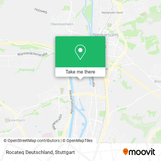
See Rocateq Deutschland, Heilbronn, on the map
Public Transit to Rocateq Deutschland in Heilbronn
Wondering how to get to Rocateq Deutschland in Heilbronn? Moovit helps you find the best way to get to Rocateq Deutschland with step-by-step directions from the nearest public transit station.
Moovit provides free maps and live directions to help you navigate through your city. View schedules, routes, timetables, and find out how long does it take to get to Rocateq Deutschland in real time.
Looking for the nearest stop or station to Rocateq Deutschland? Check out this list of stops closest to your destination: Heilbronn, Lichtenbergerstraße; Heilbronn Großkraftwerk Ost; Heilbronn Albertistraße; Heilbronn Kaufland; Neckarsulm Süd.
Bus: 31, 32, 682, 691, 692, 33, 695.Train: S41, S42, S4.
Want to see if there’s another route that gets you there at an earlier time? Moovit helps you find alternative routes or times. Get directions from and directions to Rocateq Deutschland easily from the Moovit App or Website.
We make riding to Rocateq Deutschland easy, which is why over 1.5 million users, including users in Heilbronn, trust Moovit as the best app for public transit. You don’t need to download an individual bus app or train app, Moovit is your all-in-one transit app that helps you find the best bus time or train time available.
For information on prices of bus, train and light rail, costs and ride fares to Rocateq Deutschland, please check the Moovit app.
Use the app to navigate to popular places including to the airport, hospital, stadium, grocery store, mall, coffee shop, school, college, and university.
Rocateq Deutschland Address: Lichtenbergerstraße 26 74076 Heilbronn street in Heilbronn
- Gfm Verwaltungs,
- Stoffstrom-Vermarktungs,
- Hts Heilbronner Truck Service,
- Ar Caddie Deutschland,
- Ruz Mineralik,
- Mehr Bewegen Shop,
- Achatz GmbH Zweigstelle Heilbronn,
- Kraftwerk Heilbronn,
- Aufbaugilde Heilbronn Gemeinnützige,
- Josef Blässinger GmbH&Co,
- Meinkurier Transport&Logistikgesellschaft,
- Amanj Autoservice,
- Gashi Gerüstbau,
- Aras Immobilien,
- Viborg,
- Skorupa Autoservice,
- Grupo Sese - van Eupen Logistik,
- Ccs Cosma Car Structure Heilbronn,
- Magna Ihv Gesellschaft,
- Outdoor-Climbing
Places Near Rocateq Deutschland (Heilbronn)
- Mercedes-Benz Museum, Bad Cannstatt,
- Schleyerhalle, Bad Cannstatt,
- Hauptbahnhof Stuttgart, Stuttgart-Mitte,
- Porsche Museum, Zuffenhausen,
- Hanns-Martin-Schleyer-Halle (Stuttgart Hans-Martin-Schleyerhalle), Bad Cannstatt,
- Marmorsaal Im Weissenburgpark, Stuttgart-Süd,
- Im Wizemann (Halle), Bad Cannstatt,
- Gasometer Pforzheim, Pforzheim,
- Waldfriedhof, Degerloch,
- Wilhelma (U-Bahn Wilhelma), Bad Cannstatt,
- Porsche-Arena, Bad Cannstatt,
- Mettingen Eros-Center Puff Laufhaus, Esslingen Am Neckar,
- Mercedes-Benz Museum (Mercedes Museum Stuttgart), Bad Cannstatt,
- Geilhaus Haus 33a, Reutlingen-Betzingen,
- SI-Centrum, Möhringen,
- Gleis 101/102 (tief), Stuttgart-Mitte,
- FlixBus Haltestelle, Stuttgart,
- Hanns-Martin-Schleyer-Halle, Bad Cannstatt,
- Pariser Platz Stuttgart, Stuttgart-Mitte,
- Klinikum Stuttgart - Katharinenhospital, Stuttgart-Mitte
How to get to popular places in Stuttgart with public transit
Get around Heilbronn by public transit!
Traveling around Heilbronn has never been so easy. See step by step directions as you travel to any attraction, street or major public transit station. View bus and train schedules, arrival times, service alerts and detailed routes on a map, so you know exactly how to get to anywhere in Heilbronn.
When traveling to any destination around Heilbronn use Moovit's Live Directions with Get Off Notifications to know exactly where and how far to walk, how long to wait for your line, and how many stops are left. Moovit will alert you when it's time to get off — no need to constantly re-check whether yours is the next stop.
Wondering how to use public transit in Heilbronn or how to pay for public transit in Heilbronn? Moovit public transit app can help you navigate your way with public transit easily, and at minimum cost. It includes public transit fees, ticket prices, and costs. Looking for a map of Heilbronn public transit lines? Moovit public transit app shows all public transit maps in Heilbronn with all Bus, Train, Subway, Light Rail, Ferry, S-Bahn and Funicular routes and stops on an interactive map.
Stuttgart has 7 transit type(s), including: Bus, Train, Subway, Light Rail, Ferry, S-Bahn and Funicular, operated by several transit agencies, including SSB - Stadtbahn, SSB, SSB - Seilbahn / Zacke, S-Bahn Stuttgart, Rhein-Neckar-Verkehr GmbH (rnv), Karlsruher Verkehrsverbund, DB AG, DB Regiobus BW, Arverio Baden-Württemberg GmbH, DB RegioNetz Verkehrs GmbH Westfrankenbahn, DB Regio AG Baden-Württemberg, Südwestdeutsche Verkehrs-AG, DB Regio AG Mitte Region Hessen, DB and Bodensee-Oberschwaben-Bahn