How to get to Olive Rock by bus?
Click on the bus route to see step by step directions with maps, line arrival times and updated time schedules.
From Montespertoli, Montespertoli
235 minFrom Antinori in Chianti Classico, San Casciano In Val Di Pesa
183 minFrom Colle Di Val D'Elsa, Colle Di Val D'Elsa
120 minFrom New Maltraverso Sports Center, Colle Di Val D'Elsa
123 minFrom Siena Eye Laser, Poggibonsi
103 minFrom Greve In Chianti, Greve In Chianti
284 minFrom Alta Val d'Elsa River Park, Colle Di Val D'Elsa
129 min
Bus stops near Olive Rock in San Gimignano
Bus lines to Olive Rock in San Gimignano
What are the closest stations to Olive Rock?
The closest stations to Olive Rock are:
- SP1 - Il Cotone Location is 130 meters away, 3 min walk.
- San Gimignano - Road is 1478 meters away, 19 min walk.
- Don Carrara Street 82 is 1619 meters away, 21 min walk.
Which bus lines stop near Olive Rock?
These bus lines stop near Olive Rock: 130, SG1.
What’s the nearest bus station to Olive Rock in San Gimignano?
The nearest bus station to Olive Rock in San Gimignano is SP1 - Il Cotone Location. It’s a 3 min walk away.
What time is the first bus to Olive Rock in San Gimignano?
The SG1 is the first bus that goes to Olive Rock in San Gimignano. It stops nearby at 8:25 AM.
What time is the last bus to Olive Rock in San Gimignano?
The SG1 is the last bus that goes to Olive Rock in San Gimignano. It stops nearby at 8:20 PM.
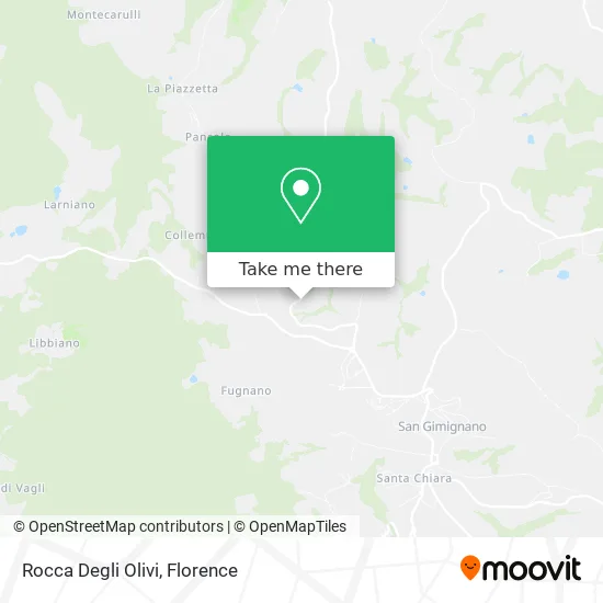
See Olive Rock, San Gimignano, on the map
Public Transit to Olive Rock in San Gimignano
Wondering how to get to Olive Rock in San Gimignano? Moovit helps you find the best way to get to Olive Rock with step-by-step directions from the nearest public transit station.
Moovit provides free maps and live directions to help you navigate through your city. View schedules, routes, timetables, and find out how long does it take to get to Olive Rock in real time.
Looking for the nearest stop or station to Olive Rock? Check out this list of stops closest to your destination: SP1 - Il Cotone Location; San Gimignano - Road; Don Carrara Street 82.
Bus: 130, SG1, 128, 133, SGN.
Want to see if there’s another route that gets you there at an earlier time? Moovit helps you find alternative routes or times. Get directions from and directions to Olive Rock easily from the Moovit App or Website.
We make riding to Olive Rock easy, which is why over 1.5 million users, including users in San Gimignano, trust Moovit as the best app for public transit. You don’t need to download an individual bus app or train app, Moovit is your all-in-one transit app that helps you find the best bus time or train time available.
For information on prices of bus and train, costs and ride fares to Olive Rock, please check the Moovit app.
Use the app to navigate to popular places including to the airport, hospital, stadium, grocery store, mall, coffee shop, school, college, and university.
Olive Rock Address: Provincial Road of San Gimignano street in San Gimignano
- Cotton Farm - San Gimignano, Tuscany,
- Sunshine Villa,
- San Biagio Real Estate,
- La Cappuccina Restaurant,
- Torre la Cappuccina,
- Pancole Pietra Focaia Street,
- Cappuccina Relais,
- Hotel Relais La Cappuccina,
- La Collegiata Hotel,
- Torre Luce Restaurant,
- Farm,
- Villa Pietre Focaie - San Gimignano,
- Villa del Sole San Gimignano,
- Corpus Domini Parish,
- Borgo il Bonagino,
- Castagnolino Agritourism,
- Poggetto di Montese by Bracali Marco,
- Loc. Pancole 49,
- Podere La Campagnola,
- Arcobaleno by Gamberucci Fiorenza
Places Near Olive Rock (San Gimignano)
- Artemio Franchi Municipal Stadium, Florence,
- Michelangelo Square, Florence,
- Campi Bisenzio, Campi Bisenzio,
- Santa Maria Nuova Hospital, Florence,
- IKEA Florence, Sesto Fiorentino,
- Mandela Forum (Nelson Mandela Forum), Florence,
- Santa Maria Novella Station, Florence,
- Verdi Theater, Florence,
- Cascine Park, Florence,
- Visarno Hippodrome, Florence,
- Torregalli Hospital Scandicci *, Scandicci,
- OOO, Florence,
- Field of Mars, Florence,
- Nelson Mandela Forum, Florence,
- Michelangelo Square, Florence,
- Visarno Arena, Florence,
- I Gigli, Campi Bisenzio,
- Asmana, Campi Bisenzio,
- Piero Palagi Hospital Facility-Florence, Florence,
- Tobacco Manufacture, Florence
How to get to popular places in Florence with public transit
Get around San Gimignano by public transit!
Traveling around San Gimignano has never been so easy. See step by step directions as you travel to any attraction, street or major public transit station. View bus and train schedules, arrival times, service alerts and detailed routes on a map, so you know exactly how to get to anywhere in San Gimignano.
When traveling to any destination around San Gimignano use Moovit's Live Directions with Get Off Notifications to know exactly where and how far to walk, how long to wait for your line, and how many stops are left. Moovit will alert you when it's time to get off — no need to constantly re-check whether yours is the next stop.
Wondering how to use public transit in San Gimignano or how to pay for public transit in San Gimignano? Moovit public transit app can help you navigate your way with public transit easily, and at minimum cost. It includes public transit fees, ticket prices, and costs. Looking for a map of San Gimignano public transit lines? Moovit public transit app shows all public transit maps in San Gimignano with all Bus, Train, Light Rail, Ferry and Funicular routes and stops on an interactive map.
Florence has 5 transit type(s), including: Bus, Train, Light Rail, Ferry and Funicular, operated by several transit agencies, including Florence Urban - Tuscan Bus Lines, GEST, Livorno and Province - Tuscan Bus Lines, Arezzo, Florence and Provinces - Tuscan Bus Lines, Prato and Province - Tuscan Bus Lines, Lucca and Province - Tuscan Bus Lines, Massa, Carrara and Province - Tuscan Bus Lines, Pisa and Province - Tuscan Bus Lines, Grosseto, Siena and Provinces - Tuscan Bus Lines, Arezzo, Siena and Provinces - Tuscan Bus Lines, Florence and Province - Tuscan Bus Lines, Pistoia and Province - Tuscan Bus Lines, Siena and Province - Tuscan Bus Lines, Arezzo and Province - Tuscan Bus Lines and Trenitalia