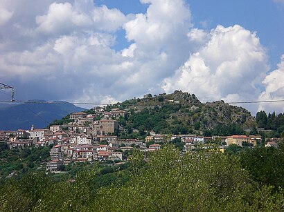
Directions to Roccagloriosa with public transportation
The following transit lines have routes that pass near Roccagloriosa
 Bus: CURCIO.
- Train: R.
How to get to Roccagloriosa by bus?
Click on the bus route to see step by step directions with maps, line arrival times and updated time schedules.
Bus stop near Roccagloriosa
- Roccagloriosa - St. Cataldo Junction, 1 min walk,
Train station near Roccagloriosa
- Celle Bulgheria Roccagloriosa, 26 min walk,
Bus lines to Roccagloriosa
- CURCIO, Centola Station,
What are the closest stations to Roccagloriosa?
The closest stations to Roccagloriosa are:
- Roccagloriosa - St. Cataldo Junction stop is 28 meters away, 1 min walk.
- Celle Bulgheria Roccagloriosa station is 2032 meters away, 26 min walk.
Which bus line stops near Roccagloriosa?
CURCIO (Sapri)
What’s the nearest train station to Roccagloriosa?
The nearest train station to Roccagloriosa is Celle Bulgheria Roccagloriosa. It’s a 26 min walk away.
What’s the nearest bus station to Roccagloriosa?
The nearest bus station to Roccagloriosa is Roccagloriosa - St. Cataldo Junction. It’s a 1 min walk away.
What time is the first train to Roccagloriosa?
The R is the first train that goes to Roccagloriosa. It stops nearby at 4:36 AM.
What time is the last train to Roccagloriosa?
The R is the last train that goes to Roccagloriosa. It stops nearby at 8:38 PM.
What time is the first bus to Roccagloriosa?
The CURCIO is the first bus that goes to Roccagloriosa. It stops nearby at 8:15 AM.
What time is the last bus to Roccagloriosa?
The CURCIO is the last bus that goes to Roccagloriosa. It stops nearby at 2:55 PM.
See Roccagloriosa on the map
Public Transportation to Roccagloriosa
Wondering how to get to Roccagloriosa? Moovit helps you find the best way to get to Roccagloriosa with step-by-step directions from the nearest public transit station.
Moovit provides free maps and live directions to help you navigate through your city. View schedules, routes, timetables, and find out how long does it take to get to Roccagloriosa in real time.
Looking for the nearest stop or station to Roccagloriosa? Check out this list of stops closest to your destination: Roccagloriosa - St. Cataldo Junction; Celle Bulgheria Roccagloriosa.
Bus: CURCIO.Train: R.
Want to see if there’s another route that gets you there at an earlier time? Moovit helps you find alternative routes or times. Get directions from and directions to Roccagloriosa easily from the Moovit App or Website.
We make riding to Roccagloriosa easy, which is why over 1.7 billion users, including users in Naples, trust Moovit as the best app for public transit. You don’t need to download an individual bus app or train app, Moovit is your all-in-one transit app that helps you find the best bus time or train time available.
For information on prices of bus and train, costs and ride fares to Roccagloriosa, please check the Moovit app.
Use the app to navigate to popular places including to the airport, hospital, stadium, grocery store, mall, coffee shop, school, college, and university.
Location: Naples
Popular routes to Roccagloriosa
Popular routes from Roccagloriosa
- Celle Di Bulgheria,
- Torre Orsaia,
- San Giovanni a Piro,
- Centola,
- Santa Marina,
- Montano Antilia,
- Ispani,
- Camerota,
- Cuccaro Vetere,
- San Mauro la Bruca,
- Futani,
- Vibonati,
- Tortorella,
- Sapri,
- Pisciotta,
- Torraca,
- Ceraso,
- Novi Velia,
- Cannalonga,
- Vallo Della Lucania
Places Near Roccagloriosa
- IKEA, Afragola,
- Naples/Beverello Pier, Naples,
- Sanità District, Naples,
- Agnano Hippodrome, Naples,
- Monaldi Hospital, Naples,
- Federico II Polyclinic, Naples,
- Palavesuvio, Naples,
- University Complex of Monte Sant'Angelo | University of Naples Federico II, Naples,
- Maximall, Pontecagnano Faiano,
- Oltremare Exhibition, Naples,
- Maximall Shopping Center, Pontecagnano Faiano,
- Naples Afragola Station, Afragola,
- Pascale Hospital, Naples,
- Vomero, Naples,
- Plebiscite Square, Naples,
- Poggioreale Market, Naples,
- Sea Hospital, Naples,
- Maximall Construction Pompeii, Torre Annunziata,
- Campania Shopping Center, Marcianise,
- Fuorigrotta, Naples
How to get to popular places in Naples with public transit
Get around Naples by public transit!
Traveling around Naples has never been so easy. See step by step directions as you travel to any attraction, street or major public transit station. View bus and train schedules, arrival times, service alerts and detailed routes on a map, so you know exactly how to get to anywhere in Naples.
When traveling to any destination around Naples use Moovit's Live Directions with Get Off Notifications to know exactly where and how far to walk, how long to wait for your line, and how many stops are left. Moovit will alert you when it's time to get off — no need to constantly re-check whether yours is the next stop.
Wondering how to use public transit in Naples or how to pay for public transit in Naples? Moovit public transit app can help you navigate your way with public transit easily, and at minimum cost. It includes public transit fees, ticket prices, and costs. Looking for a map of Naples public transit lines? Moovit public transit app shows all public transit maps in Naples with all Bus, Train, Metro, Light Rail, Ferry, Funicular and Gondola routes and stops on an interactive map.
Naples has 7 transit type(s), including: Bus, Train, Metro, Light Rail, Ferry, Funicular and Gondola, operated by several transit agencies, including ANM, EAV, EAV (operated by AirCampania), Curreri Travel, Busitalia Campania, SITA Sud, Trenitalia, Busitalia, AIR Campania (ex CTI-ATI), Shuttle, Tardugno, GepaTour Giugliano, Trotta Mobility Benevento, Alilauro and Caremar S.p.a.