Directions to Rocco Christoff Of United Real Estate (Spotsylvania County) with public transportation
The following transit lines have routes that pass near Rocco Christoff Of United Real Estate
 Bus: FLIXBUS 2605, GREYHOUND US0600, ROUTE 10, ROUTE 30, EX A/B.
How to get to Rocco Christoff Of United Real Estate by bus?
Click on the bus route to see step by step directions with maps, line arrival times and updated time schedules.
Bus stops near Rocco Christoff Of United Real Estate in Spotsylvania County
Bus lines to Rocco Christoff Of United Real Estate in Spotsylvania County
What are the closest stations to Rocco Christoff Of United Real Estate?
The closest stations to Rocco Christoff Of United Real Estate are:
- 219 - Taskforce Dr. | Shalaby Way is 127 yards away, 2 min walk.
- 214 - Central Park Blvd. | Commerce St. is 1036 yards away, 13 min walk.
Which bus lines stop near Rocco Christoff Of United Real Estate?
These bus lines stop near Rocco Christoff Of United Real Estate: FLIXBUS 2605, GREYHOUND US0600, ROUTE 10.
What’s the nearest bus station to Rocco Christoff Of United Real Estate in Spotsylvania County?
The nearest bus station to Rocco Christoff Of United Real Estate in Spotsylvania County is 219 - Taskforce Dr. | Shalaby Way. It’s a 2 min walk away.
What time is the first bus to Rocco Christoff Of United Real Estate in Spotsylvania County?
The ROUTE 10 is the first bus that goes to Rocco Christoff Of United Real Estate in Spotsylvania County. It stops nearby at 7:47 AM.
What time is the last bus to Rocco Christoff Of United Real Estate in Spotsylvania County?
The ROUTE 10 is the last bus that goes to Rocco Christoff Of United Real Estate in Spotsylvania County. It stops nearby at 8:02 PM.
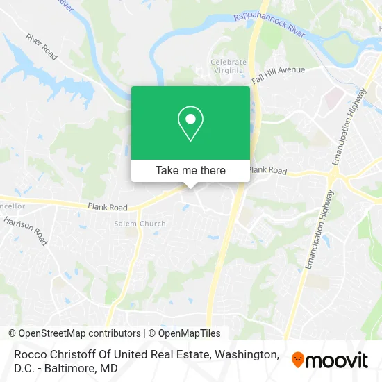
See Rocco Christoff Of United Real Estate, Spotsylvania County, on the map
Public Transit to Rocco Christoff Of United Real Estate in Spotsylvania County
Wondering how to get to Rocco Christoff Of United Real Estate in Spotsylvania County? Moovit helps you find the best way to get to Rocco Christoff Of United Real Estate with step-by-step directions from the nearest public transit station.
Moovit provides free maps and live directions to help you navigate through your city. View schedules, routes, timetables, and find out how long does it take to get to Rocco Christoff Of United Real Estate in real time.
Looking for the nearest stop or station to Rocco Christoff Of United Real Estate? Check out this list of stops closest to your destination: 219 - Taskforce Dr. | Shalaby Way; 214 - Central Park Blvd. | Commerce St..
Bus: FLIXBUS 2605, GREYHOUND US0600, ROUTE 10, ROUTE 30, EX A/B.
Want to see if there’s another route that gets you there at an earlier time? Moovit helps you find alternative routes or times. Get directions from and directions to Rocco Christoff Of United Real Estate easily from the Moovit App or Website.
We make riding to Rocco Christoff Of United Real Estate easy, which is why over 1.7 million users, including users in Spotsylvania County, trust Moovit as the best app for public transit. You don’t need to download an individual bus app or train app, Moovit is your all-in-one transit app that helps you find the best bus time or train time available.
For information on prices of bus and train, costs and ride fares to Rocco Christoff Of United Real Estate, please check the Moovit app.
Use the app to navigate to popular places including to the airport, hospital, stadium, grocery store, mall, coffee shop, school, college, and university.
Rocco Christoff Of United Real Estate Address: 12225 Amos Ln street in Spotsylvania County
- Dragonfly Club,
- Washington Academy,
- Sally Beauty Supply,
- Pearls Jade & Gems,
- Verizon Wireless,
- America's Home Place - Fredericksburg, VA,
- Route 3 Commuter Lot,
- Spotsylvania County Public School,
- Amazon Locker-Poi,
- Greyhound Bus,
- Fredericksburg Christian School,
- Walmart Fredericksburg Supercenter,
- BJ's,
- Amazon Counter-Experimax-Fredericksburg,
- Verizon Wireless,
- Chuck Moore, Realtor,
- William Huntington,
- Fredericksburg Expo & Conference Center,
- BNB Lawn Care,
- Dunrite Washing
Places Near Rocco Christoff Of United Real Estate (Spotsylvania County)
- National Zoo, Washington,
- National Museum of African American History and Culture, Washington,
- Marriott Marquis Washington, DC, Washington,
- Rock Creek Tennis Center, Washington,
- Washington DC VA Medical Center, Washington,
- National Theatre, Washington,
- Warner Theatre, Washington,
- PG Mall, Prince George's County,
- The Anthem, Washington,
- Sibley Memorial Hospital, Washington,
- Basilica of the National Shrine, Washington,
- Georgetown, Washington,
- Pennsylvania Ave NW (3rd st and pennsylvania), Washington,
- Camden Yards, Baltimore,
- Capital One Arena, Washington,
- Westfield Montgomery Mall, Montgomery County,
- Museum Of The Bible, Washington,
- Amazon Hq2, Arlington County,
- M&T Bank Stadium, Baltimore,
- Washington National Cathedral, Washington
How to get to popular places in Washington, D.C. - Baltimore, MD with public transit
Get around Spotsylvania County by public transit!
Traveling around Spotsylvania County has never been so easy. See step by step directions as you travel to any attraction, street or major public transit station. View bus and train schedules, arrival times, service alerts and detailed routes on a map, so you know exactly how to get to anywhere in Spotsylvania County.
When traveling to any destination around Spotsylvania County use Moovit's Live Directions with Get Off Notifications to know exactly where and how far to walk, how long to wait for your line, and how many stops are left. Moovit will alert you when it's time to get off — no need to constantly re-check whether yours is the next stop.
Wondering how to use public transit in Spotsylvania County or how to pay for public transit in Spotsylvania County? Moovit public transit app can help you navigate your way with public transit easily, and at minimum cost. It includes public transit fees, ticket prices, and costs. Looking for a map of Spotsylvania County public transit lines? Moovit public transit app shows all public transit maps in Spotsylvania County with all Bus, Train, Metro, Light Rail and Ferry routes and stops on an interactive map.
Washington, D.C. - Baltimore, MD has 5 transit type(s), including: Bus, Train, Metro, Light Rail and Ferry, operated by several transit agencies, including WMATA, Montgomery County Ride On, Fairfax Connector, TheBus, PRTC, DASH - Alexandria, Arlington Transit (ART), RTA of Central Maryland, MDOT MTA, MDOT MTA Light RailLink, MDOT MTA Commuter Bus, MDOT MTA Local Bus, FXBGO!, Virginia Railway Express (VRE) and MARC