Directions to Rocha Delli and Rocha Delli Ltda (Colombo) with public transportation
The following transit lines have routes that pass near Rocha Delli and Rocha Delli Ltda
How to get to Rocha Delli and Rocha Delli Ltda by bus?
Click on the bus route to see step by step directions with maps, line arrival times and updated time schedules.
From Hospital Pilar, São Francisco
58 minFrom Jardim Botânico, Jardim Botânico
56 minFrom Jockey Club do Paraná, Tarumã
68 minFrom Rua Doutor Faivre, Centro
46 minFrom Rua Barão do Serro Azul 134, Centro
42 minFrom São Francisco, São Francisco
67 minFrom Shopping Italia, Centro
46 minFrom Rua Candido De Abreu, Centro Cívico
62 minFrom Rua Itupava, Alto Da Rua XV
43 minFrom Jardim Botânico, Jardim Botânico
64 min
Bus stops near Rocha Delli and Rocha Delli Ltda in Colombo
Bus lines to Rocha Delli and Rocha Delli Ltda in Colombo
What are the closest stations to Rocha Delli and Rocha Delli Ltda?
The closest stations to Rocha Delli and Rocha Delli Ltda are:
- Rua André Nadolny, 1305 is 107 meters away, 2 min walk.
- Rua Ludovíco Kachel, 36 is 405 meters away, 6 min walk.
- R. Das Olarias, 373 is 723 meters away, 10 min walk.
Which bus lines stop near Rocha Delli and Rocha Delli Ltda?
These bus lines stop near Rocha Delli and Rocha Delli Ltda: B78 SÃO GABRIEL / GUADALUPE, S02 ROÇA GRANDE / ESTAÇÃO ATUBA.
What’s the nearest bus station to Rocha Delli and Rocha Delli Ltda in Colombo?
The nearest bus station to Rocha Delli and Rocha Delli Ltda in Colombo is Rua André Nadolny, 1305. It’s a 2 min walk away.
What time is the first bus to Rocha Delli and Rocha Delli Ltda in Colombo?
The B78 SÃO GABRIEL / GUADALUPE is the first bus that goes to Rocha Delli and Rocha Delli Ltda in Colombo. It stops nearby at 5:12 AM.
What time is the last bus to Rocha Delli and Rocha Delli Ltda in Colombo?
The S02 ROÇA GRANDE / ESTAÇÃO ATUBA is the last bus that goes to Rocha Delli and Rocha Delli Ltda in Colombo. It stops nearby at 12:05 AM.
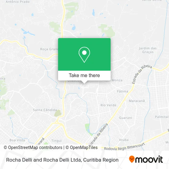
See Rocha Delli and Rocha Delli Ltda, Colombo, on the map
Public Transit to Rocha Delli and Rocha Delli Ltda in Colombo
Wondering how to get to Rocha Delli and Rocha Delli Ltda in Colombo? Moovit helps you find the best way to get to Rocha Delli and Rocha Delli Ltda with step-by-step directions from the nearest public transit station.
Moovit provides free maps and live directions to help you navigate through your city. View schedules, routes, timetables, and find out how long does it take to get to Rocha Delli and Rocha Delli Ltda in real time.
Looking for the nearest stop or station to Rocha Delli and Rocha Delli Ltda? Check out this list of stops closest to your destination: Rua André Nadolny; Rua Ludovíco Kachel; R. Das Olarias.
Bus: B78 SÃO GABRIEL / GUADALUPE, S02 ROÇA GRANDE / ESTAÇÃO ATUBA, I90 CACHOEIRA / MARACANÃ.
Want to see if there’s another route that gets you there at an earlier time? Moovit helps you find alternative routes or times. Get directions from and directions to Rocha Delli and Rocha Delli Ltda easily from the Moovit App or Website.
We make riding to Rocha Delli and Rocha Delli Ltda easy, which is why over 1.5 million users, including users in Colombo, trust Moovit as the best app for public transit. You don’t need to download an individual bus app or train app, Moovit is your all-in-one transit app that helps you find the best bus time or train time available.
For information on prices of bus, costs and ride fares to Rocha Delli and Rocha Delli Ltda, please check the Moovit app.
Use the app to navigate to popular places including to the airport, hospital, stadium, grocery store, mall, coffee shop, school, college, and university.
Rocha Delli and Rocha Delli Ltda Address: Travessa La Paz, 16 Campo Pequeno Colombo-PR 83404-530 street in Colombo
- Ação Marketing Direto - Planta C Colombo,
- Veliz Distribuidora,
- S. Móveis Planejados,
- W.S. Transporte,
- Vaz Instalacoes,
- Condomio Residencial Ilha do Sol,
- Adonai,
- Rua Santiago 660,
- Campo Pequeno,
- campo pequeno (Campo Pequeno),
- Residencial Deoville,
- Início,
- Lenys Cabeleireira,
- Residencial Spazio Roma,
- Rua André Nadolny 1560,
- Trevisol Serviços Administrativos,
- Cristinaaparecida,
- Edificio Luiz Gulin,
- Ovosborato,
- Condomínio Residencial Monterey
Places Near Rocha Delli and Rocha Delli Ltda (Colombo)
- Arena Da Baixada - Curitiba,
- Hospital Universitário Evangélico de Curitiba, Bigorrilho,
- Hospital do Rocio, Campo,
- Campo Largo, Campo,
- Hospital Da Cruz Vermelha, Batel,
- Shopping Palladium, Portão,
- Shopping Estação, Rebouças,
- Hospital Erasto Gaertner, Jardim Das Américas,
- Hospital Angelina Caron, Campina Grande Do Sul,
- Parque Barigui, Mercês,
- Hospital de Clínicas (HC - UFPR), Centro,
- Jardim Botânico de Curitiba PR, Centro,
- Hospital Madalena Sofia, Bairro Alto,
- Hospital Nossa Senhora Das Graças, Mercês,
- Hhhhh, Fazendinha,
- Park Shopping Barigüi, Mossunguê,
- Rua General Mário Tourinho, Campina Do Siqueira,
- Rua Martim Afonso 558, Mercês,
- Jockey Plaza Shopping Center, Tarumã,
- Pontifícia Universidade Católica do Paraná (PUCPR), Prado Velho
How to get to popular places in Curitiba Region with public transit
Get around Colombo by public transit!
Traveling around Colombo has never been so easy. See step by step directions as you travel to any attraction, street or major public transit station. View bus and train schedules, arrival times, service alerts and detailed routes on a map, so you know exactly how to get to anywhere in Colombo.
When traveling to any destination around Colombo use Moovit's Live Directions with Get Off Notifications to know exactly where and how far to walk, how long to wait for your line, and how many stops are left. Moovit will alert you when it's time to get off — no need to constantly re-check whether yours is the next stop.
Wondering how to use public transit in Colombo or how to pay for public transit in Colombo? Moovit public transit app can help you navigate your way with public transit easily, and at minimum cost. It includes public transit fees, ticket prices, and costs. Looking for a map of Colombo public transit lines? Moovit public transit app shows all public transit maps in Colombo with all Bus and Cable Car routes and stops on an interactive map.
Curitiba Region has 2 transit type(s), including: Bus and Cable Car, operated by several transit agencies, including Sistema Integrado de Mobilidade (URBS), Sistema Integrado de Mobilidade (AMEP), URBS (Cartões bancários e Dinheiro), URBS (Cartões bancários / Cartão URBS), AMEP (Cartões bancários / Cartão MetroCard), AMEP (Cartões bancários / Cartão MetroCard / Dinheiro), Viação Colombo (Dinheiro), TRIAR (Cartão TRIAR / Dinheiro), Empresa Curitiba Cerro Azul (Dinheiro), Expresso Nossa Senhora da Penha (Dinheiro), Empresa Campo Alto Tijucas (Dinheiro), Auto Viação São José (Cartão VEM / Dinheiro), BRT S/A (Cartão VEM / Dinheiro), TransPiedade (Cartão Cidadão / Dinheiro) and Oceânica Sul (Cartão Transporte / Dinheiro)