Directions to Rochester High School (Windsor) with public transportation
The following transit lines have routes that pass near Rochester High School
 Bus: 89ER SOUTH.
How to get to Rochester High School by bus?
Click on the bus route to see step by step directions with maps, line arrival times and updated time schedules.
Bus stop near Rochester High School in Windsor
- Barharbor Bank, Rochester, 4 min walk,VIEW
Bus lines to Rochester High School in Windsor
- 89ER SOUTH, Randolph Park And Ride Exit 4,VIEW
What are the closest stations to Rochester High School?
The closest stations to Rochester High School are:
- Barharbor Bank, Rochester is 250 yards away, 4 min walk.
Which bus line stops near Rochester High School?
89ER SOUTH (Tri-Valley Transit Depot – Randolph→Va Hospital Wrj)
What’s the nearest bus station to Rochester High School in Windsor?
The nearest bus station to Rochester High School in Windsor is Barharbor Bank, Rochester. It’s a 4 min walk away.
What time is the first bus to Rochester High School in Windsor?
The 89ER SOUTH is the first bus that goes to Rochester High School in Windsor. It stops nearby at 7:05 AM.
What time is the last bus to Rochester High School in Windsor?
The 89ER SOUTH is the last bus that goes to Rochester High School in Windsor. It stops nearby at 6:00 PM.
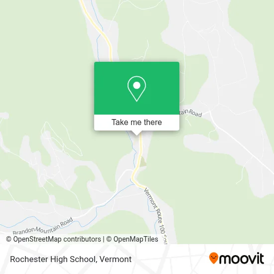
See Rochester High School, Windsor, on the map
Public Transit to Rochester High School in Windsor
Wondering how to get to Rochester High School in Windsor? Moovit helps you find the best way to get to Rochester High School with step-by-step directions from the nearest public transit station.
Moovit provides free maps and live directions to help you navigate through your city. View schedules, routes, timetables, and find out how long does it take to get to Rochester High School in real time.
Looking for the nearest stop or station to Rochester High School? Check out this list of stops closest to your destination: Barharbor Bank.
Bus: 89ER SOUTH.
Want to see if there’s another route that gets you there at an earlier time? Moovit helps you find alternative routes or times. Get directions from and directions to Rochester High School easily from the Moovit App or Website.
We make riding to Rochester High School easy, which is why over 1.5 million users, including users in Windsor, trust Moovit as the best app for public transit. You don’t need to download an individual bus app or train app, Moovit is your all-in-one transit app that helps you find the best bus time or train time available.
For information on prices of bus, costs and ride fares to Rochester High School, please check the Moovit app.
Use the app to navigate to popular places including to the airport, hospital, stadium, grocery store, mall, coffee shop, school, college, and university.
Rochester High School Address: 222 S Main St street in Windsor
- USPS Collection Box - Po Lobby,
- FLO,
- Macintosh Hill Rd,
- Mark R Pelletier,
- South End Auto,
- Bar Harbor Bank & Trust,
- Maricastle Enterprises,
- Rumorhasit,
- Butler Bill,
- Gifford Medical Center Auxiliary Thrift Shop,
- Greater Randolph Senior Center,
- Central VT Council on Aging,
- Hervieux-Woodb Bonnie - Gifford Medical Center,
- Town of Randolph Recreation,
- Jeremiah Parker Restoration & Construction,
- Randolph Park,
- Burstein Richard I,
- Barn Cat Books,
- Salisbury Flower Shop,
- Safe Haven
Places Near Rochester High School (Windsor)
- Missisquoi River Basin Association,
- Xxxxxxxxxxxxx, Chittenden,
- Richford Auto,
- Hannaford, Rutland,
- Ecco,
- Champlain Valley Exposition, Chittenden,
- Dartmouth-Hitchcock Medical Center, Clinical Systems, Grafton,
- GLOBALFOUNDRIES, Chittenden,
- Castleton University, Rutland,
- WXXX, Chittenden,
- University of Vermont Medical Center - Fanny Allen Campus, Chittenden,
- MVU,
- Derby Line Stanstead Border Crossing,
- Springfield, VT, Windsor,
- Castleton, VT, Rutland,
- Spring Step,
- Barre, VT,
- Waterbury, VT,
- Sugarbush Resort,
- Rutland, VT, Rutland
How to get to popular places in Vermont with public transit
Get around Windsor by public transit!
Traveling around Windsor has never been so easy. See step by step directions as you travel to any attraction, street or major public transit station. View bus and train schedules, arrival times, service alerts and detailed routes on a map, so you know exactly how to get to anywhere in Windsor.
When traveling to any destination around Windsor use Moovit's Live Directions with Get Off Notifications to know exactly where and how far to walk, how long to wait for your line, and how many stops are left. Moovit will alert you when it's time to get off — no need to constantly re-check whether yours is the next stop.
Wondering how to use public transit in Windsor or how to pay for public transit in Windsor? Moovit public transit app can help you navigate your way with public transit easily, and at minimum cost. It includes public transit fees, ticket prices, and costs. Looking for a map of Windsor public transit lines? Moovit public transit app shows all public transit maps in Windsor with all Bus, Train and Ferry routes and stops on an interactive map.
Vermont has 3 transit type(s), including: Bus, Train and Ferry, operated by several transit agencies, including Green Mountain Transit, Wilmington MOOver, Advance Transit, Vermont Translines, Rockingham MOOver, The Bus (Marble Valley Regional Transit District), Green Mountain Express, Rural Community Transportation, Addison County Transit Resources, Stagecoach Transportation Services, Amtrak, Greyhound-us, Dartmouth Campus Connector and Lake Champlain Ferries