
Directions to Rochester, NH with public transportation
The following transit lines have routes that pass near Rochester, NH
 Bus: 2, 6, 103.
How to get to Rochester, NH by bus?
Click on the bus route to see step-by-step directions with maps, line arrival times and updated time schedules.
Bus stop near Rochester, NH
- Wakefield St. (Rochester City Hall), 2 min walk,
Bus lines to Rochester, NH
- 2, Rochester / Somersworth / Dover / Portsmouth,
- 6, Farmington / Rochester,
- 103, Rochester / Kittery (PNSY Gate 1),
Questions & Answers
What are the closest stations to Rochester, NH?
The closest stations to Rochester, NH are:
- Wakefield St. (Rochester City Hall) stop is 138 yards away, 2 min walk.
Which bus lines stop near Rochester, NH?
These bus lines stop near Rochester, NH: 2, 6.
What’s the nearest bus station to Rochester, NH?
The nearest bus station to Rochester, NH is Wakefield St. (Rochester City Hall). It’s a 2 min walk away.
What time is the first bus to Rochester, NH?
The 2 is the first bus that goes to Rochester, NH. It stops nearby at 5:27 AM.
What time is the last bus to Rochester, NH?
The 2 is the last bus that goes to Rochester, NH. It stops nearby at 9:14 PM.
See Rochester, NH on the map
Jon Platek - Own work
CC BY-SA 3.0Rochester, NH
Rochester, NHRochester is a city in Strafford County, New Hampshire, United States. The population was 32,492 at the 2020 census, making it the 6th most populous city in New Hampshire. In addition to the downtown area, the city contains the villages of East Rochester, Gonic, and North Rochester. Rochester is home to Skyhaven Airport and part of Baxter Lake.
Rochester was one of New Hampshire's fastest growing cities between 2010 and 2020.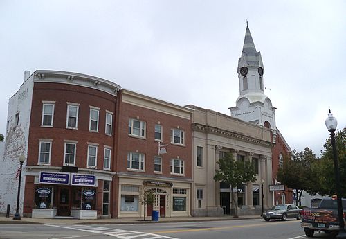 Image may be subject to copyright.Find out more on Wikipedia
Jon Platek - Own work
CC BY-SA 3.0- Rochester NH USA,
- New England Therapeutic Options,
- Fashion Nail Designs by Sueann,
- Frisbie Memorial Hospital,
- Park And Ride,
- Kohl's,
- Infinite Web Solutions (Myinfinitewebsolutions.Com),
- Carter's,
- Walmart Supercenter,
- Berwick ME USA,
- Strafford County Jail,
- Northeast Audiology,
- Berwick Maine,
- Strafford County Sheriff's Office,
- Paul J Dumont Youth Trails And Campground,
- Little Indonesia,
- Old Davidson Rubber Factory,
- Romeo J Messier Building,
- Sue Carney's Real Life Canine Academy,
- Walmart Grocery Pickup
Places Near Rochester, NH
- C & J Bus Lines, Portsmouth,
- Saja Inc,
- Exeter, NH, Exeter,
- Portsmouth International Airport at Pease, Portsmouth,
- Walmart Supercenter, Portsmouth,
- Pease International Airport, Portsmouth,
- Portsmouth International Airport at Pease (PSM) (Portsmouth International Airport at Pease), Portsmouth,
- Lonza Biologics Inc, Portsmouth,
- Phillips Exeter Academy, Exeter,
- Dandy Lion Food Services, Dover,
- Portsmouth Naval Prison, Kittery,
- Kittery Premium Outlets 1, Kittery,
- Dover, NH, Dover,
- Boulder Technologies LLC, Dover,
- Lonza 166 Corporate Drive, Portsmouth,
- Mighty Dog Roofing of Southern New Hampshire, Dover,
- Sandra Harris, Portsmouth,
- Salvation Army, Portsmouth,
- Exeter, New Hampshire, Exeter,
- Portsmouth Naval Shipyard Parking Garage, Kittery