How to get to Rocinha by bus?
Click on the bus route to see step by step directions with maps, line arrival times and updated time schedules.
From Posto 5 - Copacabana - Av. Atlantica
25 minFrom Policlínica Naval Nossa Senhora da Glória
48 minFrom Hospital Israelita Albert Sabin
42 minFrom Rua Ulysses Guimarães 16
34 minFrom Rua Afonso Cavalcanti 455
42 minFrom Vila Isabel
54 minFrom Flamengo
33 minFrom INSS - Posto Praça da Bandeira
32 minFrom Estrada do Bananal
68 minFrom Prefeitura Do Rio De Janeiro
42 min
How to get to Rocinha by metro?
Click on the metro route to see step by step directions with maps, line arrival times and updated time schedules.
From Posto 5 - Copacabana - Av. Atlantica
31 minFrom Policlínica Naval Nossa Senhora da Glória
55 minFrom Hospital Israelita Albert Sabin
59 minFrom Rua Ulysses Guimarães 16
50 minFrom Rua Afonso Cavalcanti 455
51 minFrom Flamengo
40 minFrom INSS - Posto Praça da Bandeira
59 minFrom Prefeitura Do Rio De Janeiro
51 min
Bus stops near Rocinha
Metro station near Rocinha
- São Conrado, 6 min walk,VIEW
Bus lines to Rocinha
- 104, São Conrado,VIEW
- 109, São Conrado (Reversível),VIEW
- LECD129, Central,VIEW
- LECD137, Central,VIEW
- 550, Gávea,VIEW
- SN 550, Cidade de Deus (Feira Livre),VIEW
- 552, Alvorada,VIEW
- 553, Recreio,VIEW
- 554, Piabas (Via Barata Ribeiro / Bartolomeu Mitre),VIEW
- 555, Rio das Pedras,VIEW
- 557, Rio das Pedras (via Floresta / Pinheiro),VIEW
- 558, Cidade De Deus,VIEW
- 565, Tanque (Feira Livre),VIEW
- SN 565, Gávea (Feira Livre),VIEW
- 785D, Charitas,VIEW
- 1785D (EXECUTIVO), Charitas,VIEW
- 2334, Campo Grande (Via Mato Alto),VIEW
- 2335, Santa Cruz (Reversível),VIEW
- 2338, Campo Grande (Reversível),VIEW
- 536, Leme,VIEW
What are the closest stations to Rocinha?
The closest stations to Rocinha are:
- Mercado Popular Da Rocinha is 241 meters away, 4 min walk.
- Estrada Da Gávea, 541 is 255 meters away, 4 min walk.
- Estrada Da Gávea, 474-482 is 257 meters away, 4 min walk.
- São Conrado is 404 meters away, 6 min walk.
- 11° Delegacia De Polícia Da Rocinha is 449 meters away, 6 min walk.
- Metrô São Conrado | Largo Da Macumba is 458 meters away, 6 min walk.
Which bus lines stop near Rocinha?
These bus lines stop near Rocinha: 104, 109, 550, 553, 565, LECD129, LECD137.
Which metro line stops near Rocinha?
L1, L4 (Uruguai)
What’s the nearest metro station to Rocinha?
The nearest metro station to Rocinha is São Conrado. It’s a 6 min walk away.
What’s the nearest bus station to Rocinha?
The nearest bus stations to Rocinha are Mercado Popular Da Rocinha, Estrada Da Gávea, 541 and Estrada Da Gávea, 474-482. The closest one is a 4 min walk away.
What time is the first metro to Rocinha?
The L1, L4 is the first metro that goes to Rocinha. It stops nearby at 5:04 AM.
What time is the last metro to Rocinha?
The L1, L4 is the last metro that goes to Rocinha. It stops nearby at 12:38 AM.
What time is the first bus to Rocinha?
The 539 is the first bus that goes to Rocinha. It stops nearby at 3:02 AM.
What time is the last bus to Rocinha?
The VAN 2101 is the last bus that goes to Rocinha. It stops nearby at 3:21 AM.
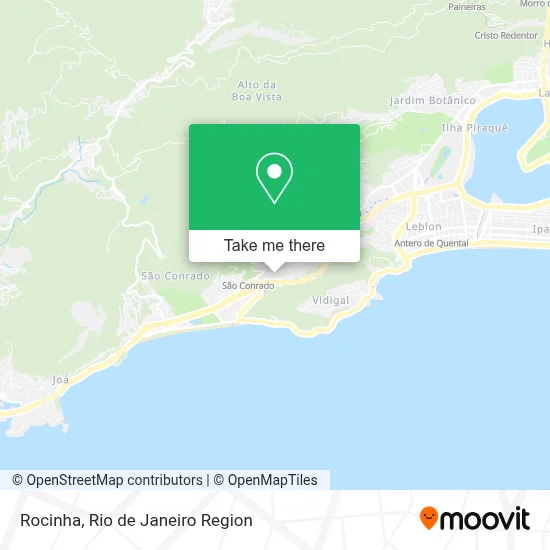
See Rocinha on the map
Public Transportation to Rocinha
Wondering how to get to Rocinha? Moovit helps you find the best way to get to Rocinha with step-by-step directions from the nearest public transit station.
Moovit provides free maps and live directions to help you navigate through your city. View schedules, routes, timetables, and find out how long does it take to get to Rocinha in real time.
Looking for the nearest stop or station to Rocinha? Check out this list of stops closest to your destination: Mercado Popular Da Rocinha; Estrada Da Gávea; Estrada Da Gávea; São Conrado; 11° Delegacia De Polícia Da Rocinha; Metrô São Conrado | Largo Da Macumba.
Bus: 104, 109, 550, 553, 565, LECD129, LECD137, 536, 539, VAN 2102, VAN 2101, SPB 550, 448, SPA 550, SN 554, 2337.Metro: L1, L4.
Want to see if there’s another route that gets you there at an earlier time? Moovit helps you find alternative routes or times. Get directions from and directions to Rocinha easily from the Moovit App or Website.
We make riding to Rocinha easy, which is why over 1.5 million users, including users in Rocinha, trust Moovit as the best app for public transit. You don’t need to download an individual bus app or train app, Moovit is your all-in-one transit app that helps you find the best bus time or train time available.
For information on prices of bus and metro, costs and ride fares to Rocinha, please check the Moovit app.
Use the app to navigate to popular places including to the airport, hospital, stadium, grocery store, mall, coffee shop, school, college, and university.
Location: Rocinha, Rio de Janeiro Region
- Academia Makoto,
- Academia the Best Gym,
- Rua do Boiadeiro s/n,
- Travessa Katia 29,
- Academia Xports Club Rocinha,
- Estrada da Gávea 4,
- Let's GO Bar - Rocinha RJ,
- Rancho das Colinas-Rio Bonito,
- Igreja Metodista da Rocinha,
- Pizzaria Toscana,
- Travessa Roma do Bairro Barcelos,
- Jc Pizzaria,
- Bar e Restaurante Social Trapiá,
- Travessa Roma 17-D,
- Praça Ailton Rosa,
- Quadra Da Roupa Suja,
- Largo do Boiadeiro,
- Gres Vila Isabel,
- Rua General Olímpio Mourão Filho 10,
- Rede Varejao Hortifruti
Places Near Rocinha
- Shopping Nova América, Del Castilho,
- Rodoviária Novo Rio (Rodoviária do Rio de Janeiro), Santo Cristo,
- Norte Shopping, Cachambi,
- Niterói, Niterói,
- Rua Ulysses Guimarães 16, Cidade Nova,
- Hospital Federal Do Andaraí, Andaraí,
- Avenida Rio Branco, Centro,
- Feirão De Malhas, Duque De Caxias,
- Rua Licínio Cardoso, São Francisco Xavier,
- Shopping Downtown, Barra Da Tijuca,
- Shopping RioSul, Botafogo,
- Hospital Federal Cardoso Fontes, Jacarepaguá,
- Avenida Venezuela 134, Saúde,
- Hospital Municipal Ronaldo Gazolla, Acari,
- Museu Do Amanhã, Centro,
- Rio De Janeiro,
- Praia do Arpoador, Ipanema,
- Feira Livre da Gloria, Glória,
- Shopping Rio Sul, Botafogo,
- Hospital Pedro Ernesto, Vila Isabel
How to get to popular places in Rio de Janeiro Region with public transit
Get around Rocinha by public transit!
Traveling around Rocinha has never been so easy. See step by step directions as you travel to any attraction, street or major public transit station. View bus and train schedules, arrival times, service alerts and detailed routes on a map, so you know exactly how to get to anywhere in Rocinha.
When traveling to any destination around Rocinha use Moovit's Live Directions with Get Off Notifications to know exactly where and how far to walk, how long to wait for your line, and how many stops are left. Moovit will alert you when it's time to get off — no need to constantly re-check whether yours is the next stop.
Wondering how to use public transit in Rocinha or how to pay for public transit in Rocinha? Moovit public transit app can help you navigate your way with public transit easily, and at minimum cost. It includes public transit fees, ticket prices, and costs. Looking for a map of Rocinha public transit lines? Moovit public transit app shows all public transit maps in Rocinha with all Bus, Train, Metro, Light Rail, Ferry, Cable Car, Gondola and Funicular routes and stops on an interactive map.
Rio de Janeiro Region has 8 transit type(s), including: Bus, Train, Metro, Light Rail, Ferry, Cable Car, Gondola and Funicular, operated by several transit agencies, including TrensRJ, Metrô Rio, VLT Carioca, Barcas Rio, BRT MOBI-Rio, Auto Viação Alpha, Auto Viação Tijuca, Gire Transportes, Transurb, Viação Nossa Senhora das Graças, Consórcio INTERSUL, Braso Lisboa (Municipal), Caprichosa Auto Ônibus, Auto Viação Três Amigos and Rodoviária Âncora Matias
Public transit lines with stations closest to Rocinha
Metro lines with stations closest to Rocinha
Bus lines with stations closest to Rocinha
Mercado Popular Da Rocinha
 104Terminal Gentileza - São Conrado (Brs 1 - Via Copacabana / Niemeyer)
- 109LECD131 - Terminal Gentileza - São Conrado (Via Santa Bárbara / Jardim Botânico)
- LECD129319 - Central - Terminal Alvorada (via Av. Américas / Túnel Santa Bárbara)
- LECD137SV319 - Terminal Alvorada - Central (via Av. Américas / Praia do Flamengo)
- 550Cidade de Deus - Gávea (via Rio das Pedras)