How to get to Rock For You by bus?
Click on the bus route to see step by step directions with maps, line arrival times and updated time schedules.
From Policlínica José Paranhos Fontenelle, Penha
38 minFrom Hospital Estadual Getúlio Vargas-PS, Penha
30 minFrom Passarela 9, Bonsucesso
25 minFrom Ilha do Governador, Galeão
39 minFrom Avenida Itaóca 2532, Inhaúma
37 minFrom Estação BRT Santa Luzia, Ramos
30 minFrom Rua Leopoldina Rego, Penha
33 minFrom Favela Nova Holanda, Maré
24 minFrom Vila Da Penha, Vila Da Penha
39 minFrom UFRJ - Ilha do Fundão, Cidade Universitária (Fundão)
21 min
How to get to Rock For You by train?
Click on the train route to see step by step directions with maps, line arrival times and updated time schedules.
Bus stops near Rock For You in Duque De Caxias
- Avenida Governador Leonel De Moura Brizola, 1670-1712, 1 min walk,VIEW
- Ponto Final - Caxias (Santo Antônio - Linhas 26, 27 E 449), 1 min walk,VIEW
- Ponto Final - Caxias (Trel), 2 min walk,VIEW
- Ponto Final - Caxias (Santo Antônio - Linhas 418 E 500), 2 min walk,VIEW
- Ponto Final - Caxias (Santo Antônio - Linhas 15i E 33), 2 min walk,VIEW
- Ponto Final - Caxias (União - Linhas 555i, 556i E 558i), 3 min walk,VIEW
- Terminal Plínio Casado, 4 min walk,VIEW
- Passarela Da Rodoviária Plínio Casado, 4 min walk,VIEW
- Estação Duque De Caxias (Linhas Via Rua Marechal Deodoro), 5 min walk,VIEW
- Avenida Duque De Caxias, 207 (Desativado Aos Domingos), 6 min walk,VIEW
- Rua General Câmara, 341 (Somente Domingos), 7 min walk,VIEW
Train station near Rock For You in Duque De Caxias
- Gramacho, 17 min walk,VIEW
Bus lines to Rock For You in Duque De Caxias
- 011, Bar dos Cavaleiros - Jardim Leal,VIEW
- 022, Centenário - Carrefour (Via 25 de Agosto / Corte 8),VIEW
- 26, Caxias - João Pessoa (Via Gramacho / Reduc),VIEW
- 112C, Caxias - Central,VIEW
- 415C, Jardim Leal - Central (Via Gramacho),VIEW
- 415M, Magé - Caxias (Integração Barra da Tijuca),VIEW
- 415M, Magé - Caxias (Integração Para Barra da Tijuca),VIEW
- 415T, Caxias - Barra da Tijuca (Via Linha Amarela),VIEW
- 415T, Caxias - Barra da Tijuca (Parador - via Linha Amarela),VIEW
- 416T, Caxias - Barra (Rápido - via Linha Amarela),VIEW
- 419C, Jardim Leal - Cidade Universitária,VIEW
- 502, Caxias - Vale do Ipê,VIEW
- 600C, Wona - Central (Brs I - Via Penha),VIEW
- 726, Sarapuí - Pedrinhas,VIEW
- 1415C (EXECUTIVO), Jardim Leal - Central,VIEW
- 2111C (EXECUTIVO), Caxias - Castelo (Brs I - Via Av. Pres. Vargas / Av. Passos),VIEW
- 2950C (EXECUTIVO), Caxias - Castelo (Via 25 de Agosto / Viaduto),VIEW
- 2951C (EXECUTIVO), Caxias - Castelo (Via 25 de Agosto / Itatiaia),VIEW
- 27, Caxias,VIEW
- 449, Amapá,VIEW
What are the closest stations to Rock For You?
The closest stations to Rock For You are:
- Avenida Governador Leonel De Moura Brizola, 1670-1712 is 69 meters away, 1 min walk.
- Ponto Final - Caxias (Santo Antônio - Linhas 26, 27 E 449) is 73 meters away, 1 min walk.
- Ponto Final - Caxias (Trel) is 141 meters away, 2 min walk.
- Ponto Final - Caxias (Santo Antônio - Linhas 418 E 500) is 142 meters away, 2 min walk.
- Ponto Final - Caxias (Santo Antônio - Linhas 15i E 33) is 145 meters away, 2 min walk.
- Ponto Final - Caxias (União - Linhas 555i, 556i E 558i) is 171 meters away, 3 min walk.
- Terminal Plínio Casado is 241 meters away, 4 min walk.
- Passarela Da Rodoviária Plínio Casado is 271 meters away, 4 min walk.
- Estação Duque De Caxias (Linhas Via Rua Marechal Deodoro) is 386 meters away, 5 min walk.
- Avenida Duque De Caxias, 207 (Desativado Aos Domingos) is 447 meters away, 6 min walk.
- Rua General Câmara, 341 (Somente Domingos) is 476 meters away, 7 min walk.
- Gramacho is 1287 meters away, 17 min walk.
Which bus lines stop near Rock For You?
These bus lines stop near Rock For You: 112C, 415T, 431C, 564.
Which train line stops near Rock For You?
RAMAL SARACURUNA (Gramacho)
What’s the nearest train station to Rock For You in Duque De Caxias?
The nearest train station to Rock For You in Duque De Caxias is Gramacho. It’s a 17 min walk away.
What’s the nearest bus station to Rock For You in Duque De Caxias?
The nearest bus stations to Rock For You in Duque De Caxias are Avenida Governador Leonel De Moura Brizola, 1670-1712 and Ponto Final - Caxias (Santo Antônio - Linhas 26, 27 E 449). The closest one is a 1 min walk away.
What time is the first train to Rock For You in Duque De Caxias?
The RAMAL SARACURUNA is the first train that goes to Rock For You in Duque De Caxias. It stops nearby at 4:22 AM.
What time is the last train to Rock For You in Duque De Caxias?
The RAMAL SARACURUNA is the last train that goes to Rock For You in Duque De Caxias. It stops nearby at 11:24 PM.
What time is the first bus to Rock For You in Duque De Caxias?
The 499 is the first bus that goes to Rock For You in Duque De Caxias. It stops nearby at 3:00 AM.
What time is the last bus to Rock For You in Duque De Caxias?
The 415C is the last bus that goes to Rock For You in Duque De Caxias. It stops nearby at 3:27 AM.
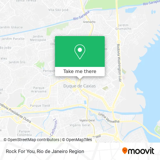
See Rock For You, Duque De Caxias, on the map
Public Transit to Rock For You in Duque De Caxias
Wondering how to get to Rock For You in Duque De Caxias? Moovit helps you find the best way to get to Rock For You with step-by-step directions from the nearest public transit station.
Moovit provides free maps and live directions to help you navigate through your city. View schedules, routes, timetables, and find out how long does it take to get to Rock For You in real time.
Looking for the nearest stop or station to Rock For You? Check out this list of stops closest to your destination: Avenida Governador Leonel De Moura Brizola; Ponto Final - Caxias (Santo Antônio - Linhas 26; Ponto Final - Caxias (Trel); Ponto Final - Caxias (Santo Antônio - Linhas 418 E 500); Ponto Final - Caxias (Santo Antônio - Linhas 15i E 33); Ponto Final - Caxias (União - Linhas 555i; Terminal Plínio Casado; Passarela Da Rodoviária Plínio Casado; Estação Duque De Caxias (Linhas Via Rua Marechal Deodoro); Avenida Duque De Caxias; Rua General Câmara; Gramacho.
Bus: 112C, 415T, 431C, 564, 011, 022, 26, 415C, 27, 449, 505, 506, 511, 513, 15I, 33, 418, 500.Train: RAMAL SARACURUNA.
Want to see if there’s another route that gets you there at an earlier time? Moovit helps you find alternative routes or times. Get directions from and directions to Rock For You easily from the Moovit App or Website.
We make riding to Rock For You easy, which is why over 1.5 million users, including users in Duque De Caxias, trust Moovit as the best app for public transit. You don’t need to download an individual bus app or train app, Moovit is your all-in-one transit app that helps you find the best bus time or train time available.
For information on prices of bus and train, costs and ride fares to Rock For You, please check the Moovit app.
Use the app to navigate to popular places including to the airport, hospital, stadium, grocery store, mall, coffee shop, school, college, and university.
Rock For You Address: Av. Pres. Kennedy, 1910 street in Duque De Caxias
- Rua Estevam Di Giacomo,
- South & Co,
- Micro Quality,
- Casa das Bombas Juiriz,
- Cetep - FAETEC,
- Teciplast,
- Galeria Estação Fashion - Caxias,
- 116 - Nova Iguaçu X Caxias (Via Paulínea),
- Grill Churrascaria e Pizzaria,
- Lupi,
- Cachorro Quente do Russo,
- 201,
- Long Life Clinica Médica,
- Rua Belisário Pena / RJ-101,
- Ponto De Ônibus - Caxias-Bairro Wona,
- Avenida Governador Leonel de Moura Brizola 2018,
- Clínica Médica Long Life,
- Monique Morelli Comercio De Roupas E Acessorios,
- Odonto Quality,
- Consultorio Dr Enio Clapp
Places Near Rock For You (Duque De Caxias)
- Museu Do Amanhã, Centro,
- Shopping Downtown, Barra Da Tijuca,
- Rio De Janeiro,
- Hospital Pedro Ernesto, Vila Isabel,
- Hospital Municipal Ronaldo Gazolla, Acari,
- Norte Shopping, Cachambi,
- Hospital Federal Cardoso Fontes, Jacarepaguá,
- Feira Livre da Gloria, Glória,
- Niterói, Niterói,
- Praia do Arpoador, Ipanema,
- Hospital Federal Do Andaraí, Andaraí,
- Feirão De Malhas, Duque De Caxias,
- Avenida Venezuela 134, Saúde,
- Shopping Rio Sul, Botafogo,
- Avenida Rio Branco, Centro,
- Rua Licínio Cardoso, São Francisco Xavier,
- Rua Ulysses Guimarães 16, Cidade Nova,
- Shopping RioSul, Botafogo,
- Rodoviária Novo Rio (Rodoviária do Rio de Janeiro), Santo Cristo,
- Shopping Nova América, Del Castilho
How to get to popular places in Rio de Janeiro Region with public transit
Get around Duque De Caxias by public transit!
Traveling around Duque De Caxias has never been so easy. See step by step directions as you travel to any attraction, street or major public transit station. View bus and train schedules, arrival times, service alerts and detailed routes on a map, so you know exactly how to get to anywhere in Duque De Caxias.
When traveling to any destination around Duque De Caxias use Moovit's Live Directions with Get Off Notifications to know exactly where and how far to walk, how long to wait for your line, and how many stops are left. Moovit will alert you when it's time to get off — no need to constantly re-check whether yours is the next stop.
Wondering how to use public transit in Duque De Caxias or how to pay for public transit in Duque De Caxias? Moovit public transit app can help you navigate your way with public transit easily, and at minimum cost. It includes public transit fees, ticket prices, and costs. Looking for a map of Duque De Caxias public transit lines? Moovit public transit app shows all public transit maps in Duque De Caxias with all Bus, Train, Metro, Light Rail, Ferry, Cable Car, Gondola and Funicular routes and stops on an interactive map.
Rio de Janeiro Region has 8 transit type(s), including: Bus, Train, Metro, Light Rail, Ferry, Cable Car, Gondola and Funicular, operated by several transit agencies, including TrensRJ, Metrô Rio, VLT Carioca, Barcas Rio, BRT MOBI-Rio, Auto Viação Alpha, Auto Viação Tijuca, Gire Transportes, Transurb, Viação Nossa Senhora das Graças, Consórcio INTERSUL, Braso Lisboa (Municipal), Caprichosa Auto Ônibus, Auto Viação Três Amigos and Rodoviária Âncora Matias