How to get to Rockbridge Insurance by bus?
Click on the bus route to see step by step directions with maps, line arrival times and updated time schedules.
From Saint Barnabas Medical Center, Livingston
64 minFrom Orange, NJ, City Of Orange
26 minFrom Parsippany, NJ, Parsippany-Troy Hills
103 minFrom Mountainside Hospital, Glen Ridge
80 minFrom MMNJ, Parsippany-Troy Hills
122 minFrom Lakeland Bus Stop, Parsippany-Troy Hills
91 minFrom West Orange, NJ, West Orange
58 minFrom Clara Maass Medical Center, Belleville
94 minFrom Bloomfield, NJ, Bloomfield
84 min
Bus stop near Rockbridge Insurance in Livingston
- Eisenhower Parkway at Dorsa Ave, 3 min walk,VIEW
Bus lines to Rockbridge Insurance in Livingston
- 73, I-280 Express Livingston Ml I-280 Express Via Florham Pk,VIEW
What are the closest stations to Rockbridge Insurance?
The closest stations to Rockbridge Insurance are:
- Eisenhower Parkway at Dorsa Ave is 149 yards away, 3 min walk.
Which bus lines stop near Rockbridge Insurance?
These bus lines stop near Rockbridge Insurance: 71, 73.
What’s the nearest bus station to Rockbridge Insurance in Livingston?
The nearest bus station to Rockbridge Insurance in Livingston is Eisenhower Parkway at Dorsa Ave. It’s a 3 min walk away.
What time is the first bus to Rockbridge Insurance in Livingston?
The 73 is the first bus that goes to Rockbridge Insurance in Livingston. It stops nearby at 6:56 AM.
What time is the last bus to Rockbridge Insurance in Livingston?
The 73 is the last bus that goes to Rockbridge Insurance in Livingston. It stops nearby at 5:25 PM.
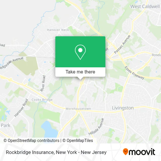
See Rockbridge Insurance, Livingston, on the map
Public Transit to Rockbridge Insurance in Livingston
Wondering how to get to Rockbridge Insurance in Livingston? Moovit helps you find the best way to get to Rockbridge Insurance with step-by-step directions from the nearest public transit station.
Moovit provides free maps and live directions to help you navigate through your city. View schedules, routes, timetables, and find out how long does it take to get to Rockbridge Insurance in real time.
Looking for the nearest stop or station to Rockbridge Insurance? Check out this list of stops closest to your destination: Eisenhower Parkway at Dorsa Ave.
Bus: 71, 73.
Want to see if there’s another route that gets you there at an earlier time? Moovit helps you find alternative routes or times. Get directions from and directions to Rockbridge Insurance easily from the Moovit App or Website.
We make riding to Rockbridge Insurance easy, which is why over 1.5 million users, including users in Livingston, trust Moovit as the best app for public transit. You don’t need to download an individual bus app or train app, Moovit is your all-in-one transit app that helps you find the best bus time or train time available.
For information on prices of bus, costs and ride fares to Rockbridge Insurance, please check the Moovit app.
Use the app to navigate to popular places including to the airport, hospital, stadium, grocery store, mall, coffee shop, school, college, and university.
Rockbridge Insurance Address: 355 Eisenhower Pkwy street in Livingston
- Unified Marketing,
- The Barker Lounge,
- Detailsbyg,
- Jones & Jones Trucking Llc,
- South Orange Limo,
- Ultrafooty Llc,
- Pure Energy Entertainment,
- SIGNARAMA,
- Ethereal Media,
- Bluerun- Indoor Ski and Snowboard Training Club,
- Lincare Inc.,
- Pc Franzblau Dratch,
- Elvira Chaush, Financial Advisor - Eagle Strategies,
- Santander Bank Atm,
- Santander Bank Branch,
- Koala Insulation of North Central NJ,
- Levine Jacobs & Company,
- David M Feder CPA,
- Greenway Landscapes & Construction,
- Stull Stull & Brody
Places Near Rockbridge Insurance (Livingston)
- Katz's Deli, Manhattan,
- 911 Memorial, Manhattan,
- 66 John Street, Manhattan,
- Queens Center Mall, Queens,
- Hudson Yards, Manhattan,
- Mountainside Hospital, Glen Ridge,
- 3 Stone St, Manhattan,
- Rockefeller Center, Manhattan,
- 376 Hudson Street, Manhattan,
- Pier 83, Manhattan,
- Chinatown, Manhattan,
- Bellevue Hospital, Manhattan,
- 26 Federal Plaza, Manhattan,
- qqqq, Manhattan,
- San Gennaro Feast, Manhattan,
- 111 Centre New York City Supreme Court, Manhattan,
- 1 Police Plaza, Manhattan,
- Times Square, Manhattan,
- SoHo, Manhattan,
- Wall Street, Manhattan
How to get to popular places in New York - New Jersey with public transit
Get around Livingston by public transit!
Traveling around Livingston has never been so easy. See step by step directions as you travel to any attraction, street or major public transit station. View bus and train schedules, arrival times, service alerts and detailed routes on a map, so you know exactly how to get to anywhere in Livingston.
When traveling to any destination around Livingston use Moovit's Live Directions with Get Off Notifications to know exactly where and how far to walk, how long to wait for your line, and how many stops are left. Moovit will alert you when it's time to get off — no need to constantly re-check whether yours is the next stop.
Wondering how to use public transit in Livingston or how to pay for public transit in Livingston? Moovit public transit app can help you navigate your way with public transit easily, and at minimum cost. It includes public transit fees, ticket prices, and costs. Looking for a map of Livingston public transit lines? Moovit public transit app shows all public transit maps in Livingston with all Bus, Train, Subway, Light Rail, Ferry and Cable Car routes and stops on an interactive map.
New York - New Jersey has 6 transit type(s), including: Bus, Train, Subway, Light Rail, Ferry and Cable Car, operated by several transit agencies, including MTA Subway, Metro-North Railroad, LIRR, PATH, MTA New York City Transit - Express routes, MTA Bus, NJ Transit, NYC Ferry, NICE bus, Bee-Line Bus, NJ Transit Rail, Norwalk Transit District, Hartford Line, River Valley Transit and HART